
Winter weather advisory for northeast Minnesota
Wintry mix of rain, sleet, snow in northern Minnesota into Wednesday

Go Deeper.
Create an account or log in to save stories.
Like this?
Thanks for liking this story! We have added it to a list of your favorite stories.


Time to dust off the winter weather terminology.
A winter weather advisory is posted overnight until 9 a.m. Wednesday for much of northeastern Minnesota, including the North Shore.
The National Oceanic and Atmospheric Administration’s High-Resolution Rapid Refresh model shows the system producing snow across northeastern Minnesota overnight. The forecast model loop below runs between 8 p.m. Tuesday and 7 a.m. Wednesday.
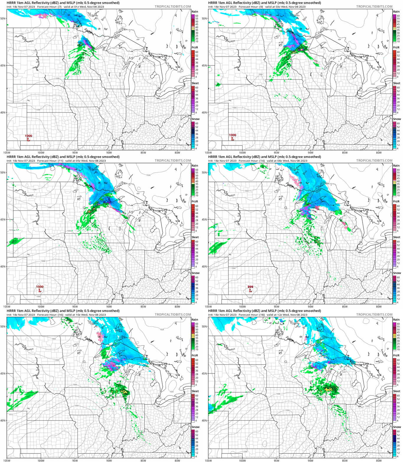
A few inches of wet sloppy snow will fall overnight, especially in the higher terrain above the North Shore.
Turn Up Your Support
MPR News helps you turn down the noise and build shared understanding. Turn up your support for this public resource and keep trusted journalism accessible to all.
Here is the wording on the advisories for northeastern Minnesota:
URGENT - WINTER WEATHER MESSAGE
National Weather Service Duluth MN
206 PM CST Tue Nov 7 2023
Northern Cook and Lake-
Including the city of Isabella
206 PM CST Tue Nov 7 2023
...WINTER WEATHER ADVISORY IN EFFECT UNTIL 9 AM CST WEDNESDAY...
* WHAT...Mixed precipitation expected. Total snow accumulations of
2 to 5 inches and ice accumulations of a light glaze.
* WHERE...Northern Cook and Lake County.
* WHEN...Until 9 AM CST Wednesday.
* IMPACTS...Plan on slippery road conditions. The hazardous
conditions could impact the morning or evening commute.
* ADDITIONAL DETAILS...Snow accumulations of 3 to 5 inches will be
most likely along and east of the Gunflint Trail.
PRECAUTIONARY/PREPAREDNESS ACTIONS...
Slow down and use caution while traveling.
The latest road conditions can be obtained by calling 5 1 1.
Road conditions can also be found at 511mn.org for Minnesota or
511wi.gov for Wisconsin.
Southern Lake-Southern Cook-
Including the cities of Two Harbors, Silver Bay, and Grand Marais
206 PM CST Tue Nov 7 2023
...WINTER WEATHER ADVISORY REMAINS IN EFFECT UNTIL 9 AM CST
WEDNESDAY...
* WHAT...Snow expected. Total snow accumulations of up to 6
inches, mainly in the higher elevations along the North Shore.
* WHERE...Southern Lake and Southern Cook Counties. This
includes the Tribal Lands of the Grand Portage Reservation.
* WHEN...Until 9 AM CST Wednesday.
* IMPACTS...Plan on slippery road conditions. The hazardous
conditions could impact the morning or evening commute.
* ADDITIONAL DETAILS...Areas immediately near Lake Superior will
see periods of rain mixing in with snow. Expect lesser snow
accumulations near Lake Superior of 3 inches or less. Some
light ice accumulation will be possible as well tonight.
Temperatures overnight will hover a few degrees on either side of freezing in the north. Expect roads to range from just wet to icy in spots.

High temperatures Wednesday afternoon will return to the 50s south and 40s north. Check out the warmth still lingering south of Minnesota:

It’s a preview of coming attractions next week. I’m not making any judgments on whether that’s good or bad for us mid-November. It’s just unseasonably warm.
Stay tuned.

