
50s and 60s still look likely next week across Minnesota
Temps likely to run 10-20 degrees warmer than average
Go Deeper.
Create an account or log in to save stories.
Like this?
Thanks for liking this story! We have added it to a list of your favorite stories.


The weather maps continue to show an unseasonably mild air mass heading for Minnesota next week.
Persistent southerly winds will blow across Minnesota as we head into next week. The warming trend begins in earnest on Sunday, and the warmth looks likely to persist through most of next week.
Upper warm dome
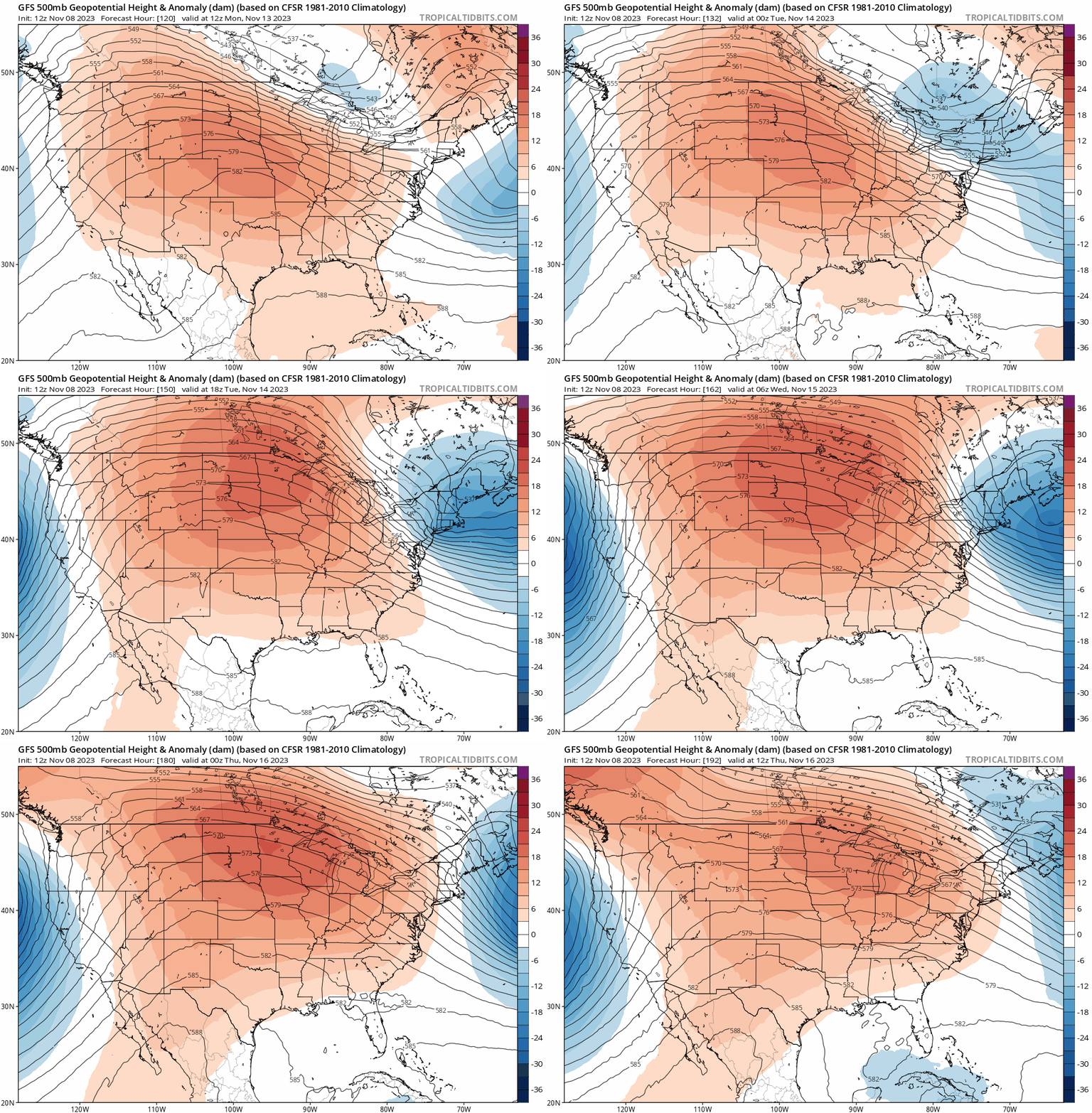
Large-scale upper air patterns drive temperature trends. You can see how the National Oceanic and Atmospheric Administration’s Global Forecast System model (and others) build a massive ridge of warmer-than-average air across the central United States next week.
The forecast model loop at the top of this post runs between Monday and Thursday mornings.
Turn Up Your Support
MPR News helps you turn down the noise and build shared understanding. Turn up your support for this public resource and keep trusted journalism accessible to all.
The warmer air should push highs into the 50s north with 60s in the Twin Cities and southern Minnesota as early as Tuesday of next week.

That persistent warm zone aloft will produce persistent southerly winds here on the ground where we live next week. This pattern looks likely to produce several days with highs in the 50s across most of Minnesota, with at least a couple of days in the 60s across southern Minnesota.
NOAA’s Global Forecast System model temperature loop below runs between Tuesday and Thursday afternoons:
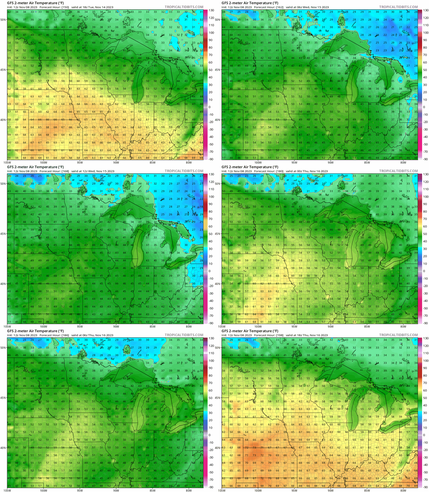
The average high and low for the Twin Cities next Wednesday are 42 and 28 degrees. Temperatures next week will run about 10 to 20 degrees warmer than average.
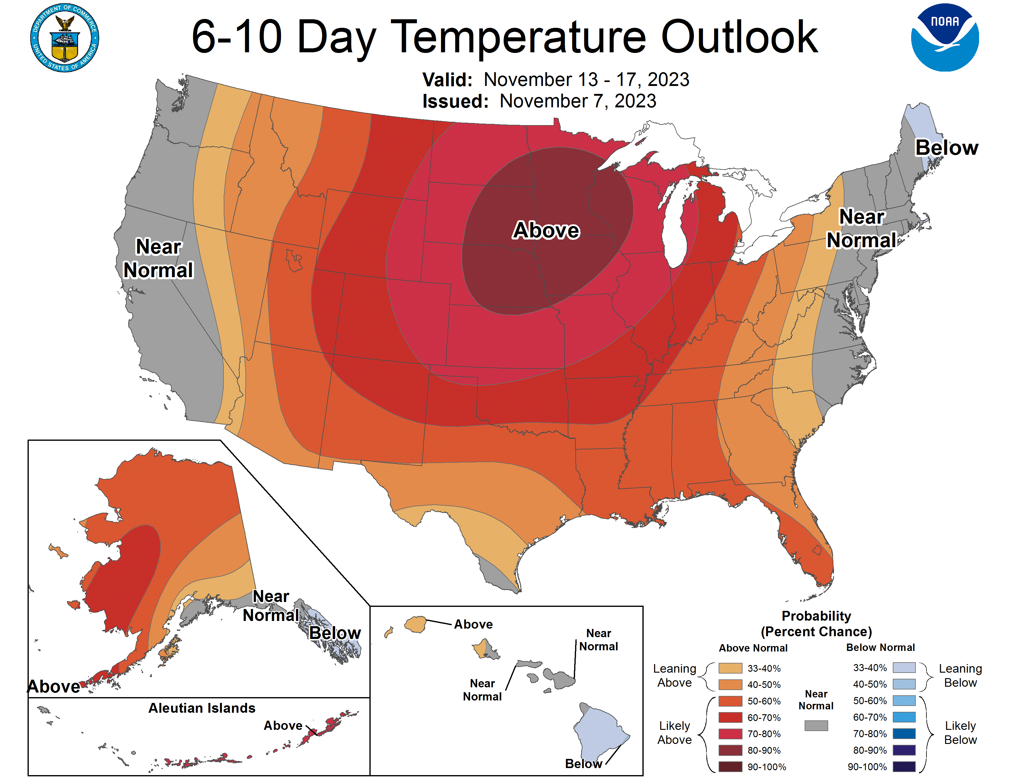
NOAA’s six to 10-day temperature outlook stamps the highest probability of warmer-than-average air right across Minnesota next week.
It remains to be seen if this is an early fingerprint of the strengthening El Niño in the tropical Pacific Ocean, but the overall trend for milder-than-average winters in Minnesota during El Niño winters is strong.

Stay tuned.

