
Return to October: Unseasonably warm air arrives starting Sunday
Temps 10-20 degrees warmer than average around Minnesota next week
Go Deeper.
Create an account or log in to save stories.
Like this?
Thanks for liking this story! We have added it to a list of your favorite stories.


Another bike ride, another boat ride, another chance to get those last few leaves cleaned up. An unseasonably mild air mass blows into Minnesota next week.
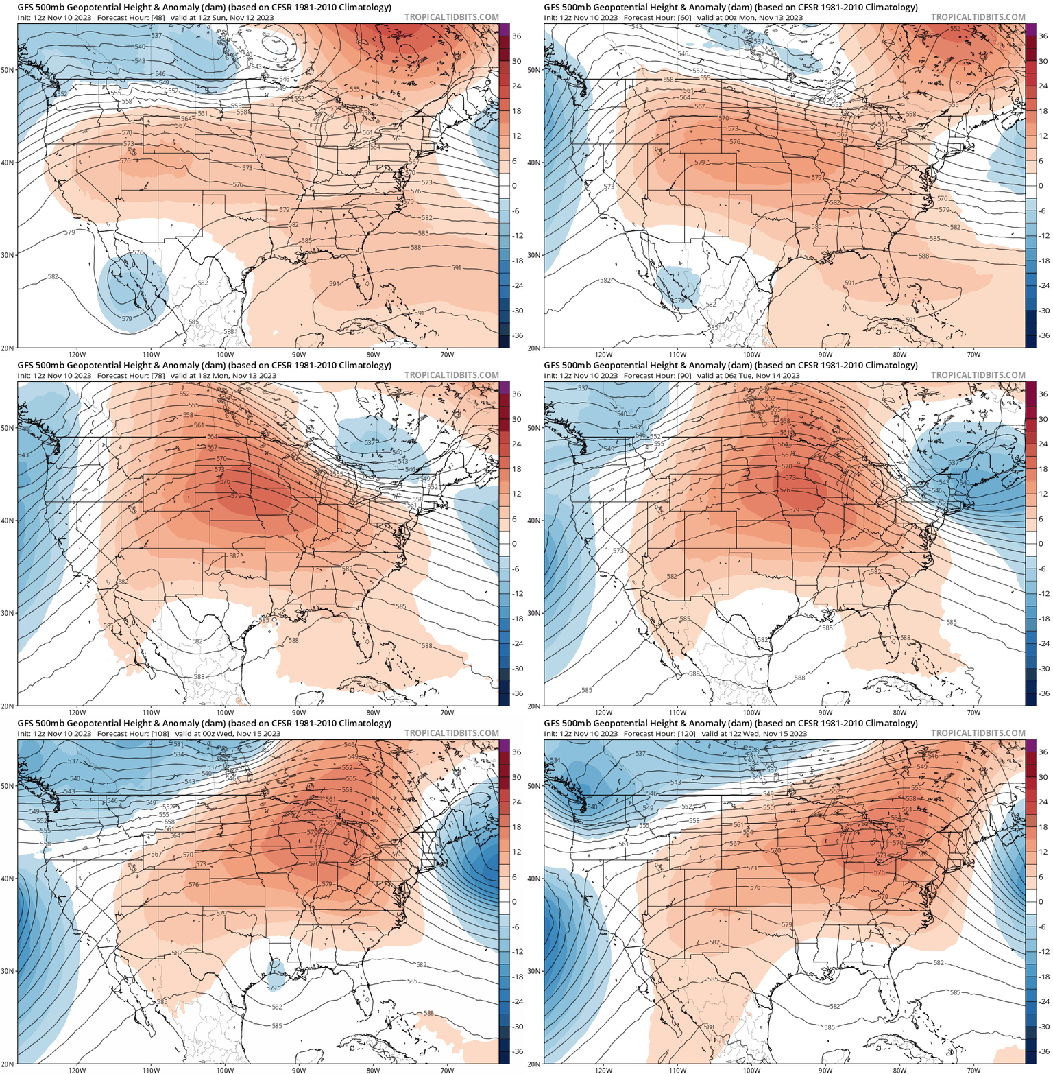
The National Oceanic and Atmospheric Administration’s Global Forecast System and other forecast models have been tracking the warmup for about a week now. You can watch the warm colors bathe the Upper Midwest next week in the upper-air forecast model loop above.
Here on the ground where we live, the warmup begins in earnest Sunday afternoon. Saturday brings chilly air in the 30s north and 40s south. Sunday is the sunnier, milder day this weekend. Highs will push well into the 50s across southern Minnesota with mostly 40s north.

Abundant sunshine will last from Sunday through most of next week. That means we’ll squeeze out every degree that our fading November sun can muster. By Tuesday, highs in the 60s will be common in the Twin Cities and southern Minnesota.
Turn Up Your Support
MPR News helps you turn down the noise and build shared understanding. Turn up your support for this public resource and keep trusted journalism accessible to all.

Wednesday looks like the warmest day next week. Highs will push into the mid-60s as far north as the Twin Cities, with 50 degrees all the way north toward the Canadian border.
I think the map below could be a few degrees too conservative. I won’t be shocked to see parts of the Twin Cities hit 65 degrees or warmer on Wednesday afternoon.

Far above average
The average high and low temperatures for the Twin Cities next Wednesday are 42 and 28 degrees. So next week’s temperatures will run a good 10 to 20 degrees warmer than our mid-November averages.
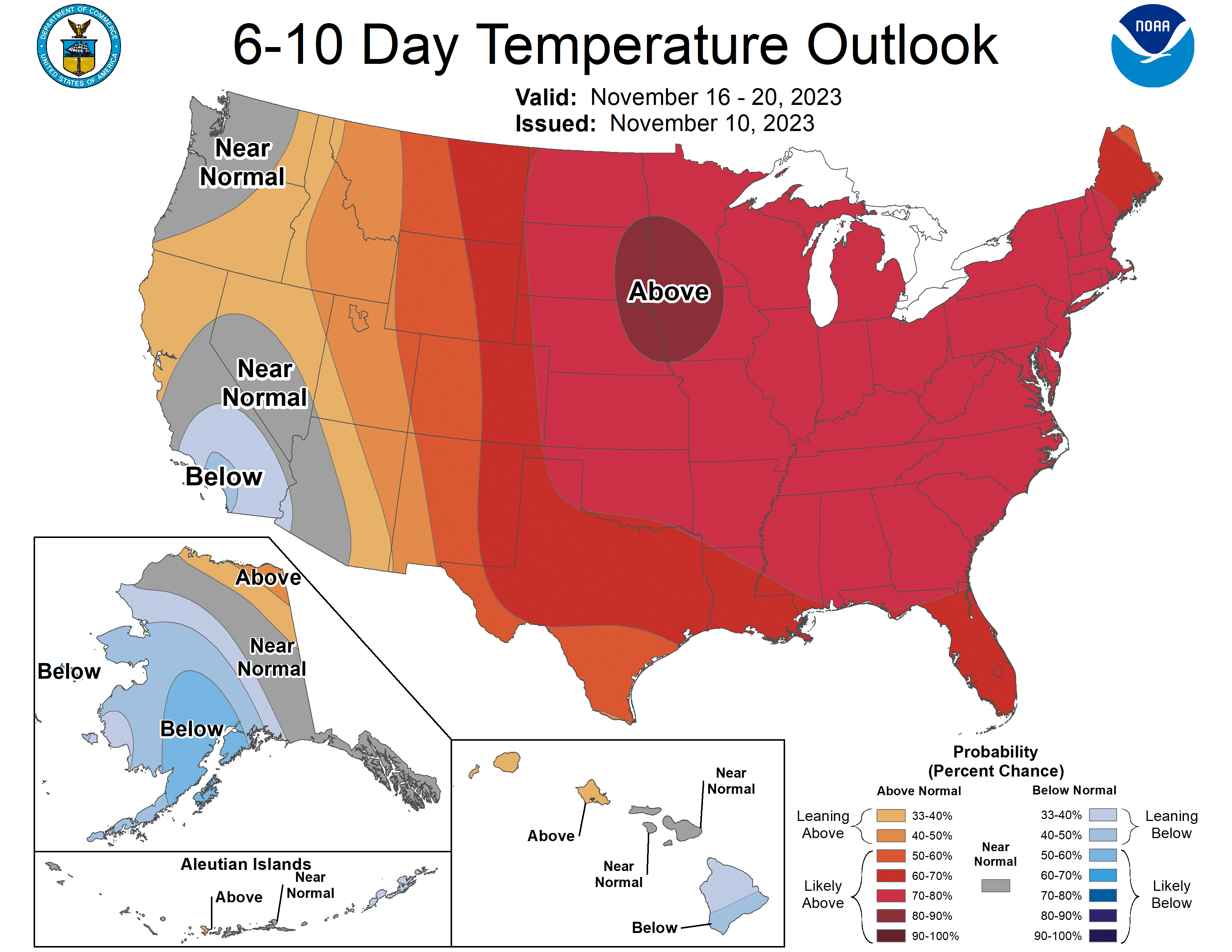
Record highs for the Twin Cities next week are in the upper 60s and low 70s. We probably won’t break any maximum temperature records next week, but we might challenge some of the record “high minimum” (overnight minimum) temperatures around 50 degrees later next week.
7th straight warmer-than-average month?
We’ve already recorded six straight warmer-than-average months in Minnesota. November is already running 1.5 degrees warmer than average. Next week’s warm spell will push our cumulative monthly temperature departure significantly higher than average.
The outlooks for the rest of November strongly favor warmer-than-average temperatures overall.
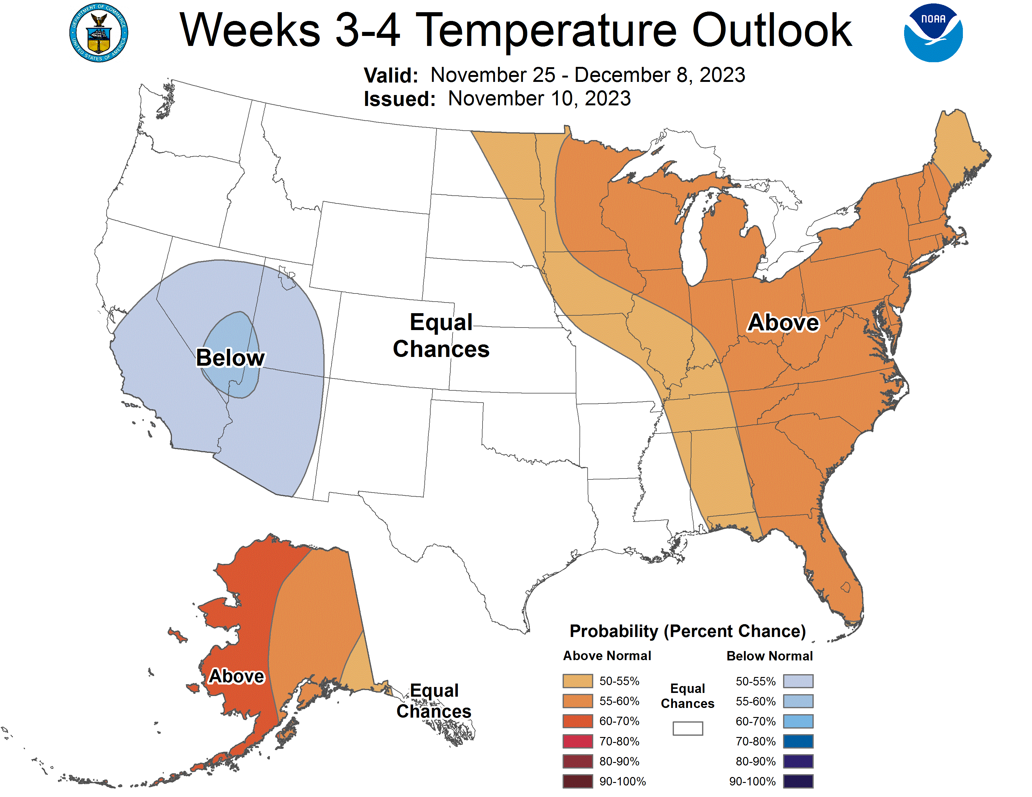
If December continues the trend of warmer-than-average temperatures, it’s possible 2023 could challenge for a spot in the 10 warmest years on record in the Twin Cities and much of Minnesota.
Stay tuned.

