
Balmy November temperatures about to crash to near average levels
November is the 3rd fastest warming month in Minnesota

Go Deeper.
Create an account or log in to save stories.
Like this?
Thanks for liking this story! We have added it to a list of your favorite stories.


The latest set of 30-year climate normals for Minnesota shows what we are feeling this month.
November is the third fastest-warming month in Minnesota and the Twin Cities in the past 30 years. The average temperature in the Twin Cities for November (1991-2020) is 1.1 degrees warmer than in the last set of 30-year averages. (1981-2010)
You can see from the graph at the top of this post that December (+2.3F) and January (+1.4F) are the first and second fastest-warming months in the Twin Cities.
So as you think about our warm November so far, keep this in mind. Even though temperatures are running 4.2 degrees warmer than average so far this November, they’re actually 5.2 degrees warmer than the 1981-2010 averages.
Turn Up Your Support
MPR News helps you turn down the noise and build shared understanding. Turn up your support for this public resource and keep trusted journalism accessible to all.
That’s one reason I like to emphasize longer-term averages for comparison. It gives us a better metric for assessing current weather patterns in light of climate changes through the last century.
Shifting 30-year averages dilute the impact of climate change when compared to longer-term averages.
Near-record warmth Thursday
Central and southern Minnesota will squeeze out one more balmy day Thursday.
Highs will run well into the 60s across southern Minnesota including the Twin Cities area. Highs reached the 70s across much of South Dakota and Nebraska Wednesday afternoon. That air mass will squeeze across southern Minnesota ahead of the advancing cold front Thursday.
I still think the numbers on the map below are a few degrees too conservative for Thursday.

I think it’s quite possible we’ll see 70 degrees Thursday afternoon in parts of southern Minnesota. The record high for the Twin Cities on Thursday is 68 degrees. We may come close.
Temps crash Friday
Northwest winds will howl across Minnesota Thursday night. The colder air mass will bring highs in the 30s and 40s on Friday.

The weekend looks seasonable with highs in the 40s to 50s south and 40s north.

Much colder next week
The coldest air mass of the season so far looks likely by Thanksgiving Day. Highs should fall from the 30s early next week, to the 20s by Thanksgiving Day.
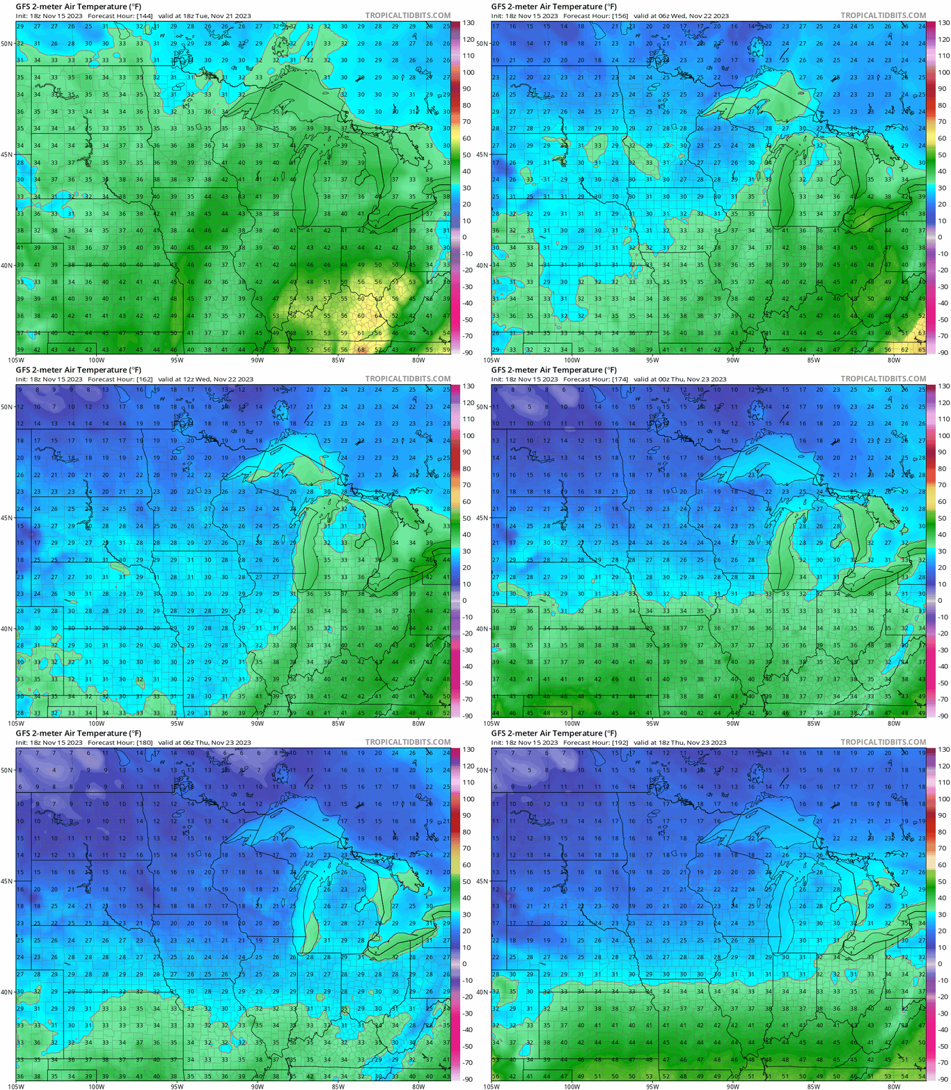
The good news? You’ll be able to keep those holiday beverages plenty cold out on the porch or deck on Thanksgiving Day.

