
50 degrees again Thursday for much of southern Minnesota
Another unusual December warm front ahead Thursday

Go Deeper.
Create an account or log in to save stories.
Like this?
Thanks for liking this story! We have added it to a list of your favorite stories.


The warm weather hits just keep on comin’. Another unseasonably warm front blows into Minnesota Thursday.
Temperatures already exceeded model forecasts Wednesday afternoon. The thermometer hit 50 degrees in Madison in southwestern Minnesota and 43 in the Twin Cities. That’s 14 degrees above the normal high of 29 degrees.
Highs Thursday (see the map above) will reach well into the 50s in southwestern Minnesota. Highs should reach 50 degrees in the Twin Cities Thursday.
Milder-than-normal weather remains in place through the weekend. Highs remain in the 40s across southern Minnesota into the weekend.
Turn Up Your Support
MPR News helps you turn down the noise and build shared understanding. Turn up your support for this public resource and keep trusted journalism accessible to all.

Rain and snow Friday, Saturday
Forecast models suggest a rain-snow mix across Minnesota Friday into Saturday. The National Oceanic and Atmospheric Administration’s Global Forecast System model brings mostly rain Friday, but transitions to a mix of snow into Saturday.
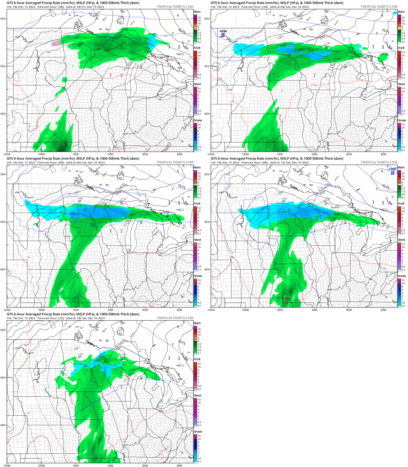
Some accumulations are possible especially in central and northern Minnesota by Saturday. Forecast models differ on accumulation potential as usual. Here’s NOAA’s Global Forecast System model snowfall output through Saturday:

The week leading up to Christmas looks mild again with highs in the 40s, but forecast models continue to suggest a possible rain or snow system just before Christmas.
The notion of a white Christmas hangs by a thread. But it’s still hanging on.
Stay tuned.

