
Severe weather risk Thursday for much of Minnesota
Storms could produce large hail, wind damage, tornadoes

Go Deeper.
Create an account or log in to save stories.
Like this?
Thanks for liking this story! We have added it to a list of your favorite stories.


Keep an eye to the sky Thursday around much of Minnesota. A storm system will spawn thunderstorms that may produce severe weather.
This system is particularly well-suited to produce violent updrafts within storms that can produce large hail from golf ball-sized up to 3 inches in diameter.
The National Oceanic and Atmospheric Administration’s Storm Prediction Center lays out a slight to enhanced risk zone Thursday across eastern Minnesota into Wisconsin that includes the Twin Cities area. (See the image above.)
Check out the discussion in the convective outlook for storm potential in our region Thursday:
Turn Up Your Support
MPR News helps you turn down the noise and build shared understanding. Turn up your support for this public resource and keep trusted journalism accessible to all.
...Upper Midwest/Great Lakes vicinity...
Convection will likely be ongoing Thursday morning near the surface low and beneath the upper low. Cold temperatures aloft will support steepened midlevel lapse rates within modest boundary layer moisture across the eastern Dakotas. Hail will be possible with this activity. Supercell wind profiles are also expected into late morning, and additional low-topped convection may develop from late morning into early afternoon, posing a risk of hail, gusty winds and a tornado or two across the eastern Dakotas.
By afternoon, mid-60s F dewpoints are expected within a somewhat narrow warm sector from central MN southeast into WI and northern IL. As large-scale ascent increases, thunderstorms are expected to develop in an arc from east-central MN into southeast WI on the nose of a 40-50 kt low-level jet and midlevel dry slot. Vertically veering winds will produce supercell wind profiles. Low-level hodographs will become enlarged, in part due to the increasing low-level jet, but also within the warm front zone. Additionally, steep midlevel lapse rates and MLCAPE greater than 2500 J/kg are possible. This should support robust updrafts and rapidly increasing storm intensity once initiation occurs. Large to very large hail (up to 3 inch diameter) and tornadoes (a couple may be strong) appear possible within the moisture-rich, favorably sheared warm sector. Given strong 850-700 mb flow and steepening low-level lapse rates where strong heating occurs, severe gust potential is also expected. Current thinking is that given the orthogonal nature of low-level flow to the surface boundaries, supercell storm mode may be favored, with perhaps a trend toward bowing segment during the evening. A gust to 80 mph cannot be ruled out, but given uncertainty in storm mode transitioning to or favoring linear segments have held off on adding a sig-wind delineation.
Multiple storm waves
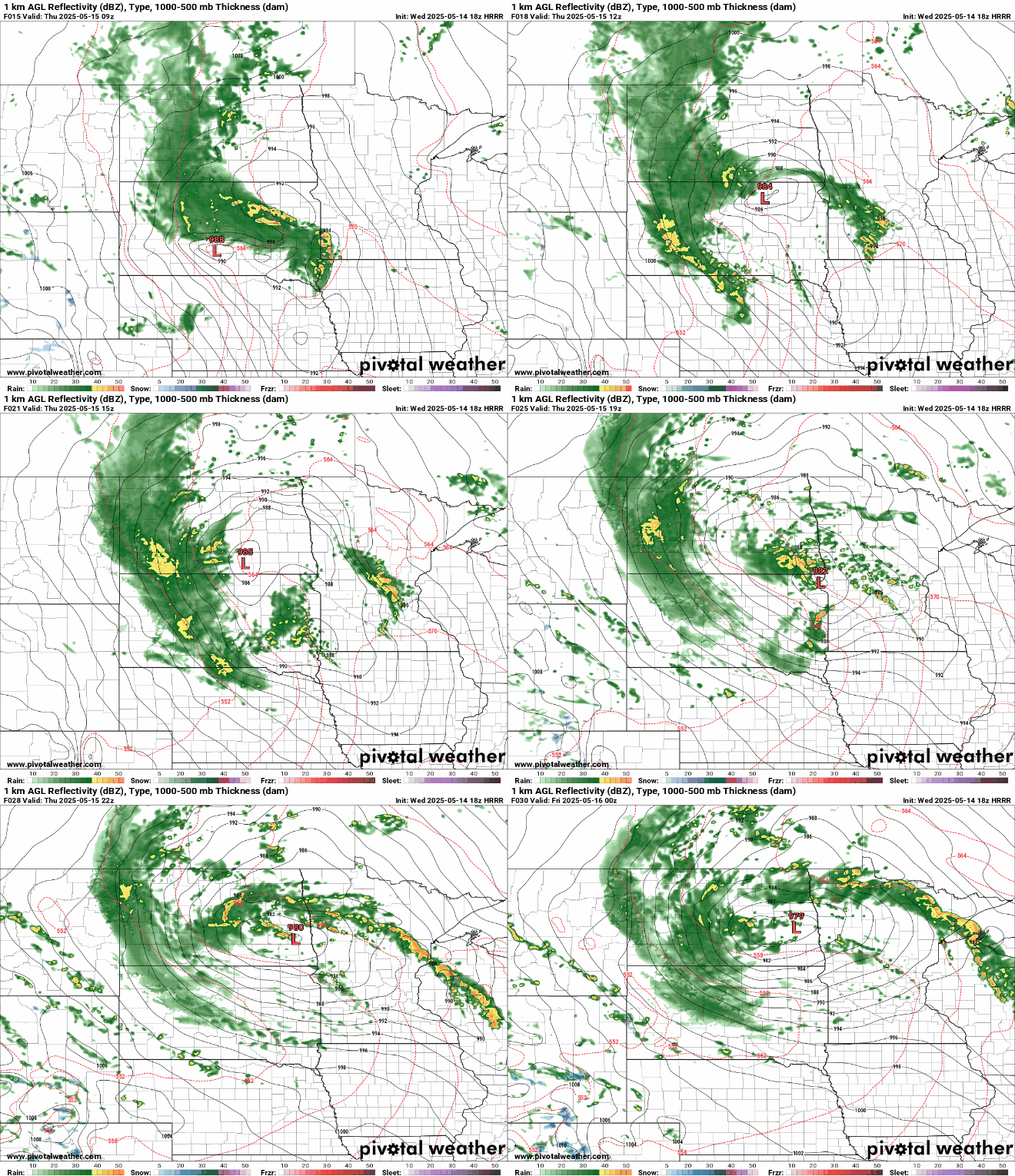
We may see a couple rounds of storms Thursday. The first wave looks likely during the morning hours. Then a second wave may fire into the afternoon hours.
NOAA’s High-Resolution Rapid Refresh model suggests a storm wave in southwestern Minnesota early Thursday morning that later tracks through central Minnesota, clipping the Twin Cities during morning rush hours.
A second wave fires near the Twin Cities in the early afternoon and moves northeast. The forecast model loop below runs between 4 a.m. and 7 p.m. Thursday.
Large hail risk
This system has the potential to drop some large hailstones across Minnesota Thursday. On the map below, NOAA’s Storm Prediction Center highlights the risk of hail the size of golf balls to baseballs across eastern Minnesota and Wisconsin Thursday.

Tornado risk
Some storms that develop Thursday will have violent updrafts capable of producing tornadoes. There is a growing risk for a few strong (EF-2 to EF-5) tornadoes Thursday, especially in Wisconsin.

Rainfall potential
Aside from any severe weather, these storms may produce beneficial rainfall across much of Minnesota.
Most forecast models produce between one-half and 1 inch of rainfall into Friday. NOAA’s latest (18Z) High-Resolution Rapid Refresh model paints a swath of 1-inch rainfall from southwestern Minnesota through central and northeastern Minnesota, clipping the western Twin Cities.

Your results may vary.
Stay tuned Thursday!

