
Smoke storm: Highest smoke level ever recorded for Minnesota
Grand Portage set a record for highest wildfire smoke air quality index

Go Deeper.
Create an account or log in to save stories.
Like this?
Thanks for liking this story! We have added it to a list of your favorite stories.


May you live in interesting times.
Tuesday’s smoke front produced the highest air quality index reading for wildfire smoke on record in the state of Minnesota.
I checked with meteorologists at the Minnesota Pollution Control Agency and they told me Tuesday that the air quality index in Grand Portage at the state’s northeastern tip hit 800 at 2 a.m. Tuesday. That breaks the previous smoke-induced record of 692 in St. Cloud on July 29, 2021.
The AQI of 274 in Blaine Tuesday morning was very high, but not the highest on record for the Twin Cities.
Turn Up Your Support
MPR News helps you turn down the noise and build shared understanding. Turn up your support for this public resource and keep trusted journalism accessible to all.
Here’s some of my communication with David Brown at MPCA:
Hi Paul,
The highest hourly PM2.5 concentration measured today in the Twin Cities was 199 ug/m^3 (274 AQI), recorded at the Blaine monitor at 6 AM.
The highest recorded hourly concentration in Minnesota is 657 ug/m^3 on 7/4/2020 in Minneapolis. This was the result of smoke from fireworks in the late evening hours. This was the first Independence Day during the COVID19 pandemic when municipal fireworks displays were cancelled and personal fireworks usage was very high. This combined with poor dispersion that evening due to light winds produced some very high fine particle concentrations.
The highest hourly concentration recorded in Minnesota due to wildfire smoke was 422 ug/m^3 (692 AQI) on 7/29/2021 in St. Cloud, and for the Twin Cities was 353 ug/m^3 (555 AQI) recorded on 5/7/2016.
The highest daily-average PM2.5 concentration recorded in the Twin Cities was 111 ug/m^3 (190 AQI) on 6/14/2023.
With air quality expected to steadily improve for the Twin Cities during the rest of the day I think we’ll fall a little short of the daily record. My back-of-the-envelope calculation puts today’s highest daily concentration for the Twin Cities between 95-105 ug/m^3.
As an aside, the Grand Portage monitor in northeast Minnesota recorded an hourly concentration of 476 ug/m^3 at 2 AM this morning, which is the highest recorded hourly concentration in Minnesota due to wildfire smoke. That would be an AQI of 800. It would be the 2nd highest all-time hourly concentration in all of Minnesota if you include the July 4th, 2020 fireworks smoke event, but highest all-time statewide for wildfire smoke (or any other event type for that matter).
Thanks, David
David Brown
Risk Evaluation & Air Modeling Unit
Minnesota Pollution Control Agency
Our air quality improves dramatically Wednesday and Thursday the smoke plume pushes east of Minnesota.
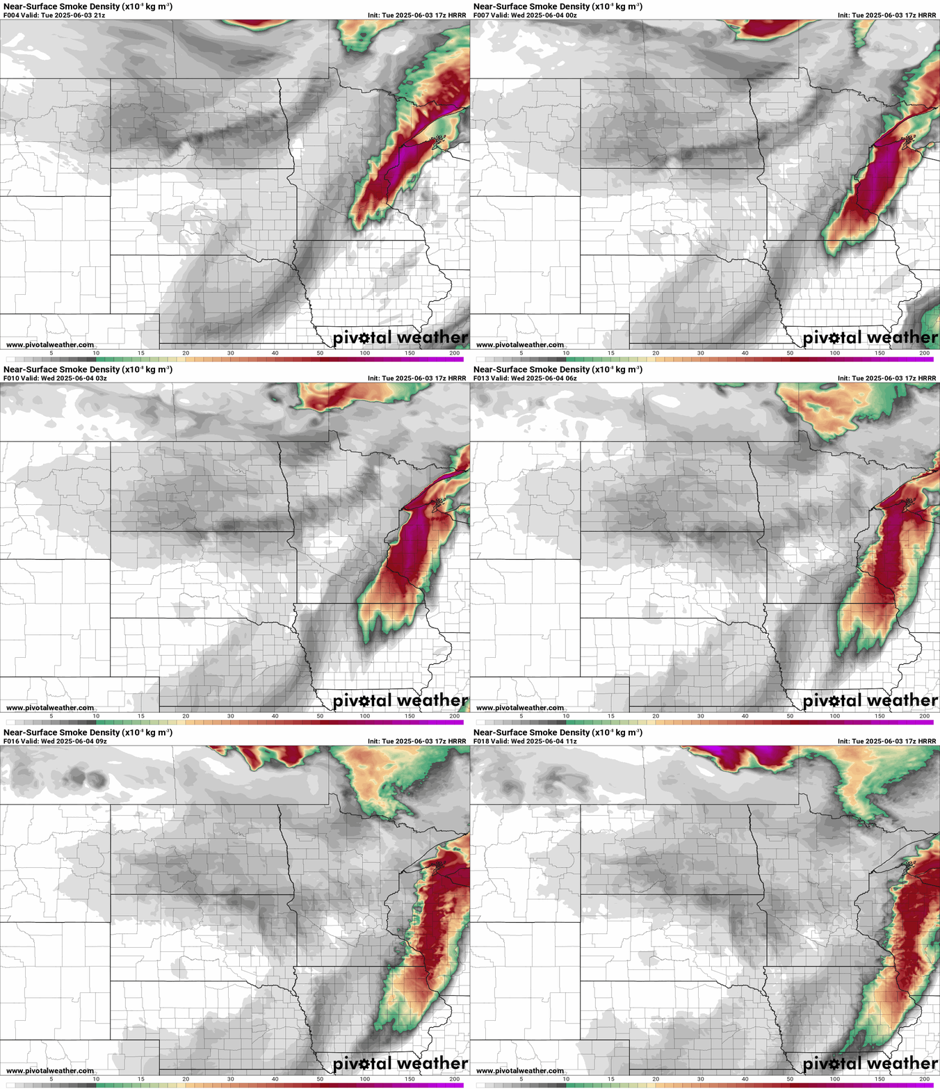
Good to moderate air quality will favor more of Minnesota Wednesday.

Milder through the weekend
Wednesday’s blue skies and milder temperatures will be a welcome sight.

Temperatures will run in the 70s through the upcoming weekend. Slight rain chances favor Thursday and Saturday nights. There are hints of more wildfire smoke by around Sunday.
Stay tuned.

