
Lukewarm weekend ahead; smoke chance Sunday
Pretty decent weekend overall; some Canadian wildfire smoke possible Sunday

Go Deeper.
Create an account or log in to save stories.
Like this?
Thanks for liking this story! We have added it to a list of your favorite stories.


Welcome to the first full weekend in June Minnesota.
These summer weekends are precious this far north. Many of us live in a state of partial hibernations for a few months each winter. Then it seems like a race to pack in all those great summer activities and celebrations in just a few weeks between now and September.

I’d give this upcoming weekend’s weather forecast 6 or 7 Weather Lab stars depending on how much wildfire smoke filters down from Canada Sunday.
The good news?
Turn Up Your Support
MPR News helps you turn down the noise and build shared understanding. Turn up your support for this public resource and keep trusted journalism accessible to all.
I’ve been watching clouds and rain hit some of the fire zones in Canada Friday. There’s not nearly as much smoke belching out of central Canada compared to earlier this week. So it looks like whatever smoke we get this weekend may not be nearly as bad as what we choked on this week.
The National Oceanic and Atmospheric Administration’s High-Resolution Rapid Refresh model smoke output shows the trends between 1 p.m. Saturday and 1 p.m. Sunday:
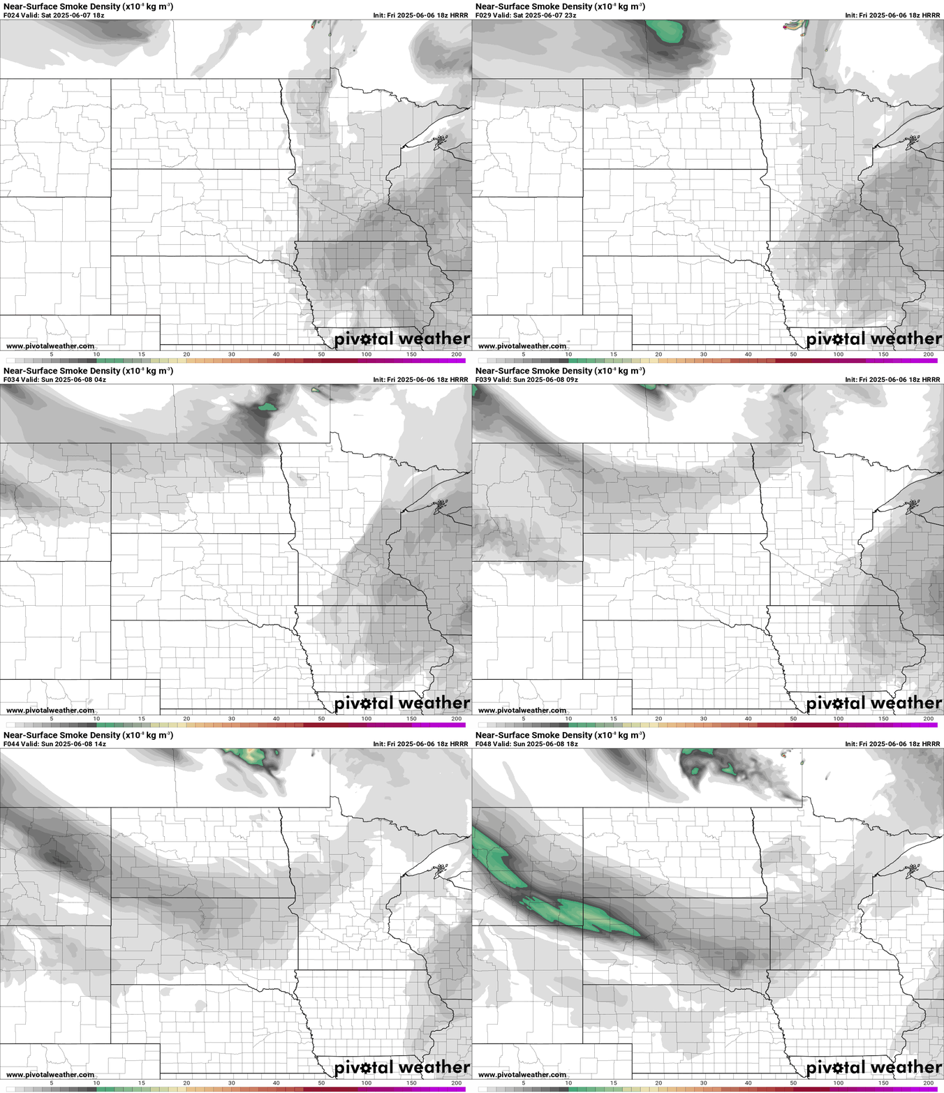
The air quality forecast for Sunday shows smoke levels that are unhealthy for sensitive groups. (See the map at the top of the post)
So we may be spared the ugly and hazardous purple shades on the map this weekend, although I do expect the Minnesota Pollution Control Agency to issue an air quality alert for Sunday.
Spotty showers
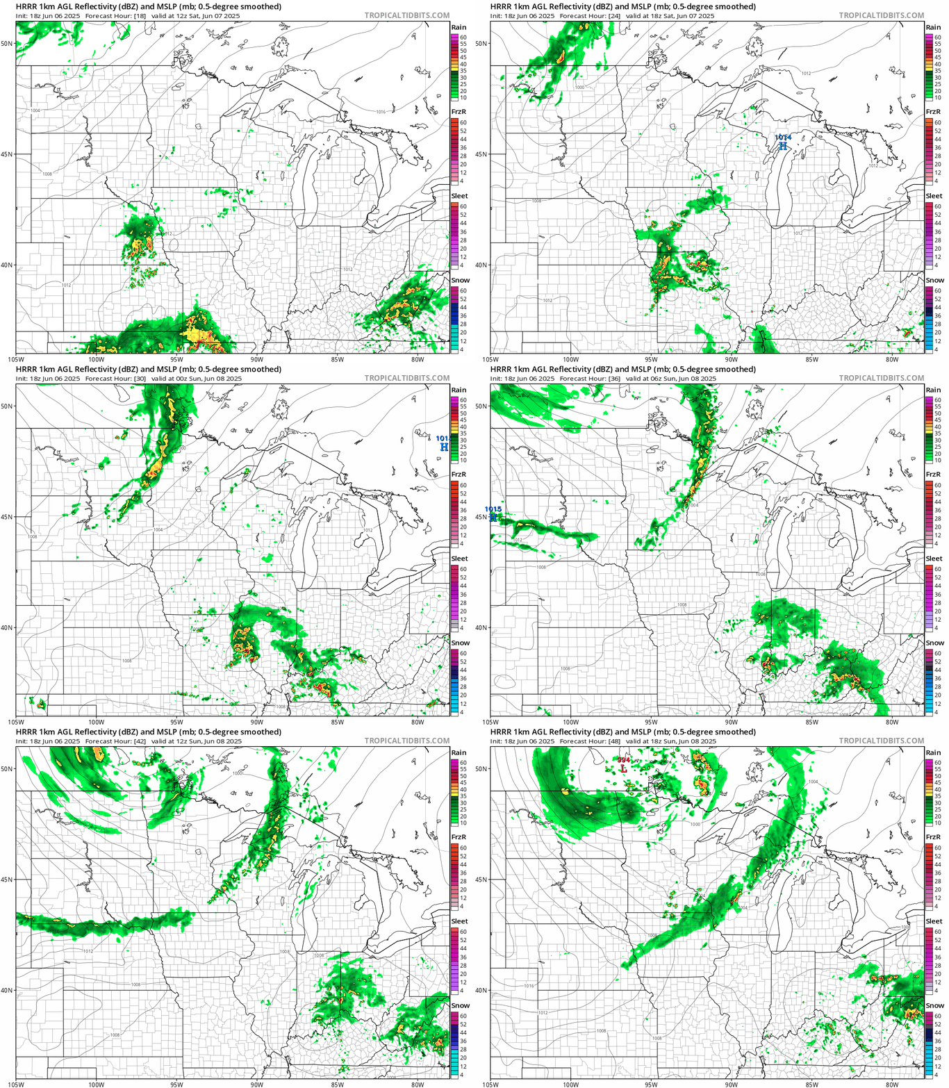
It looks like shower coverage will be limited this weekend across Minnesota. We’ll enjoy mostly dry hours this weekend with just a couple hours of showers possible at any one point.
NOAA’s HRRR model shows isolated showers Saturday with a more concentrated shower line with the cold front Saturday night into early Sunday. The forecast model loop below run between 7 a.m. Saturday and 1 p.m. Sunday.
Highs this weekend will be in the lukewarm 70s across most of Minnesota.

Next week looks warmer with highs back into the 80s by Tuesday and for most of next week.
A major heat dome will develop in the western U.S. next week.
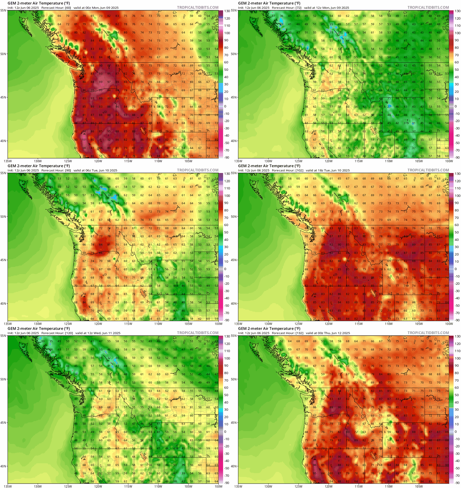
That heat dome looks likely to spill into Minnesota in the next one to two weeks. I think we’ll start seeing more 90s in the forecast.
Most of our wildfire smoke has come from Canada this year, but with as the heat dome builds in the Pacific Northwest next week I expect we’ll see increased wildfire activity in the western U.S.
Watching smoke plumes will be a week-to-week adventure this summer, depending on wildfire activity in Canada and the western U.S.
Enjoy the weekend!

