
Here comes the rain: Waves of soaking rainfall through Friday
Multi-inch rainfall totals likely across parts of central, southern Minnesota

Go Deeper.
Create an account or log in to save stories.
Like this?
Thanks for liking this story! We have added it to a list of your favorite stories.


June looks ready to remind us it’s the wettest month of the year on average in Minnesota. A slowly moving weather system will drop a few waves of rain across our region through Friday.
The first wave is working through western Minnesota this Wednesday afternoon. Severe cells near the Iowa border have produced winds of 60 mph with trees down in northern Iowa.
More docile showers will spread showers into the Twin Cities and eastern Minnesota through this evening.
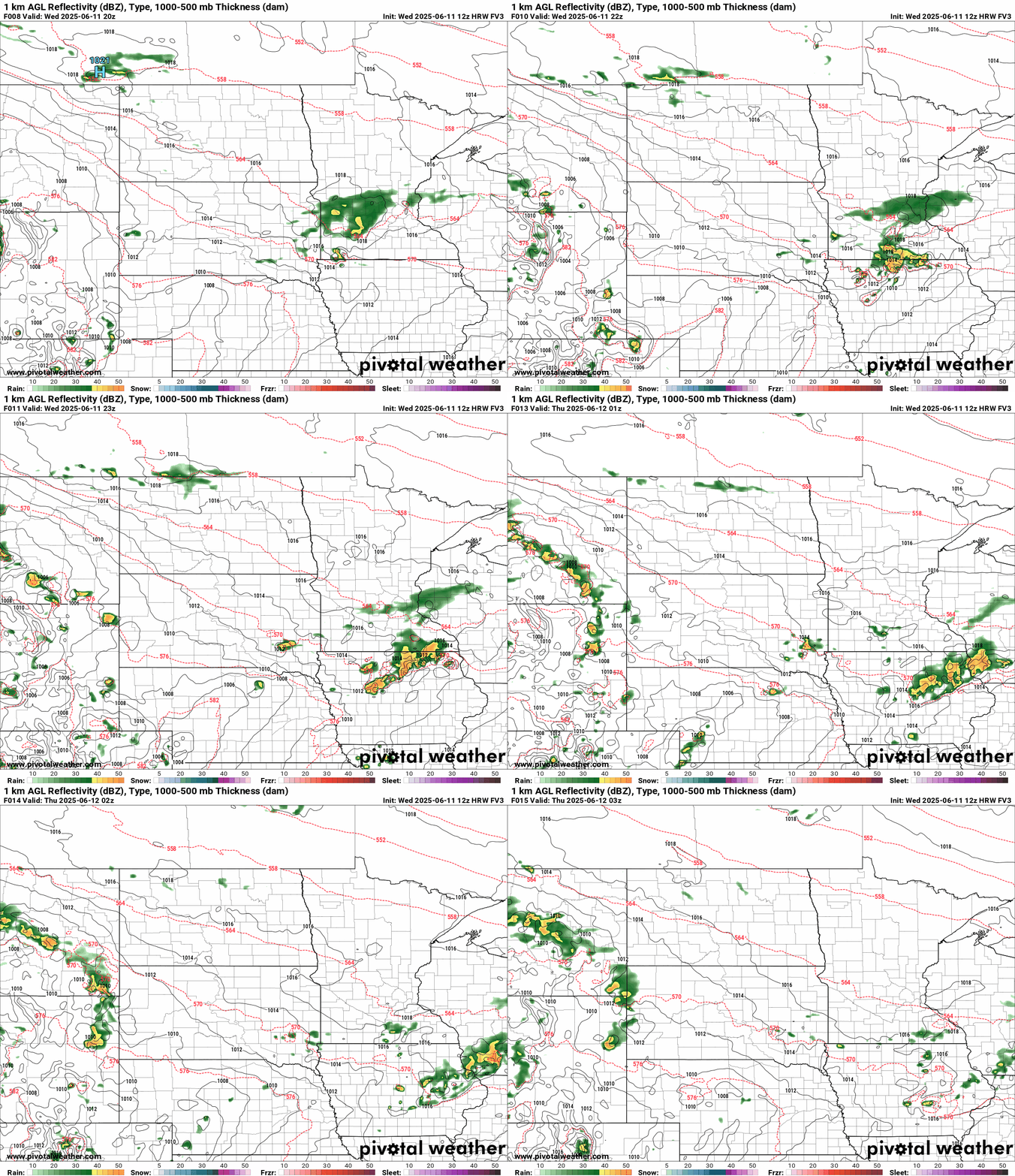
On the map below, the National Oceanic and Atmospheric Administration’s FV3 model tracks the lead rain wave through southern Minnesota through 10 p.m. Wednesday. Cells near the Iowa border could be severe.
Turn Up Your Support
MPR News helps you turn down the noise and build shared understanding. Turn up your support for this public resource and keep trusted journalism accessible to all.
Main event Thursday night
The bigger rainfall event with this system will cross central and southern Minnesota Thursday night into Friday morning. A cluster of thunderstorms with locally heavy rainfall looks likely.
NOAA’s FV3 model is typical of many that bring the heaviest cells through Minnesota Thursday night into early Friday morning. For the Twin Cities, it appears the heaviest rains could favor the wee hours of Friday morning into the morning rush hours.
The forecast model loop below runs between 1 p.m. Thursday and 1 p.m. Friday.
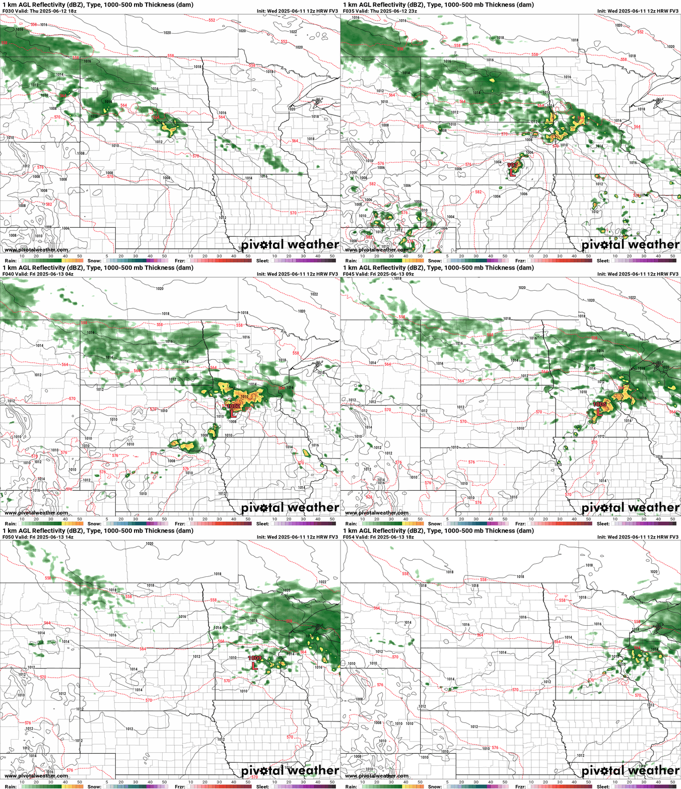
There’s still large forecast model variation in precisely where the heaviest rain zone will set up. It’s typical to see multiple spatial solutions for these summertime mesoscale systems.
NOAA’s High-Resolution Rapid Refresh model lays a multi-inch band of rainfall right through the greater Twin Cities area by late Friday:

Models from the European Centre for Medium-Range Weather Forecasts and NOAA’s Global Forecast System lay the heaviest rain zone north of the Twin Cities through central Minnesota.

On the map below, NOAA’s FV3 model splits the solution, with the heaviest rain core from the northern Twin Cities into central Minnesota. Could this be the sweet spot?

Stay tuned as we tweak the path of the heaviest rainfall through Thursday night.
Father’s Day weekend looks sunnier and drier with highs warming through the 70s.


