
Spotty shower and storm chances through Friday; highest severe risk south
Friday evening storm chances for the Twin Cities

Go Deeper.
Create an account or log in to save stories.
Like this?
Thanks for liking this story! We have added it to a list of your favorite stories.


We’re watching a couple of weak-low pressure waves passing through the Upper Midwest through Friday.
The first brought a few spotty showers Thursday morning. That wave may trigger some stronger thunderstorms across Iowa and far southern Minnesota later Thursday.
The National Oceanic and Atmospheric Administration’s Storm Prediction Center is watching the risk zone in Iowa and far southern Minnesota for possible weather watch Thursday afternoon. But NOAA doesn’t expect to post a watch at this time.
The highest severe risk Thursday favors Iowa with an enhanced risk zone.
Turn Up Your Support
MPR News helps you turn down the noise and build shared understanding. Turn up your support for this public resource and keep trusted journalism accessible to all.
Most forecast models favor greater thunderstorm coverage moving across Minnesota from west to east on Friday.
NOAA’s FV3 model is typical of many that suggest a broken line of storms moving across Minnesota Thursday afternoon with a (fading?) storm line favoring arrival in the Twin Cities sometime Friday evening.
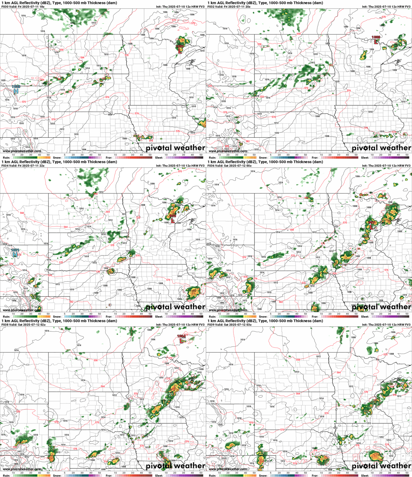
Thankfully, the overall setup doesn’t look great for severe weather Friday with a marginal (low) risk zone across Minnesota.

Highs will run mostly in the 80s Friday afternoon.

Great July weekend ahead
The latest model runs favor a beautiful July weekend ahead for Minnesota. This should be a great time up at the lake or at your favorite chill spot. Look for plenty of sunshine both days. Highs favor the 70s Saturday, with more widespread 80s by Sunday afternoon.

Get out there Minnesota!

