Updraft® - Minnesota Weather News

Scattered Friday storms possible, but a pretty nice weekend ahead

Highs in the 70s to 80 again by the weekend
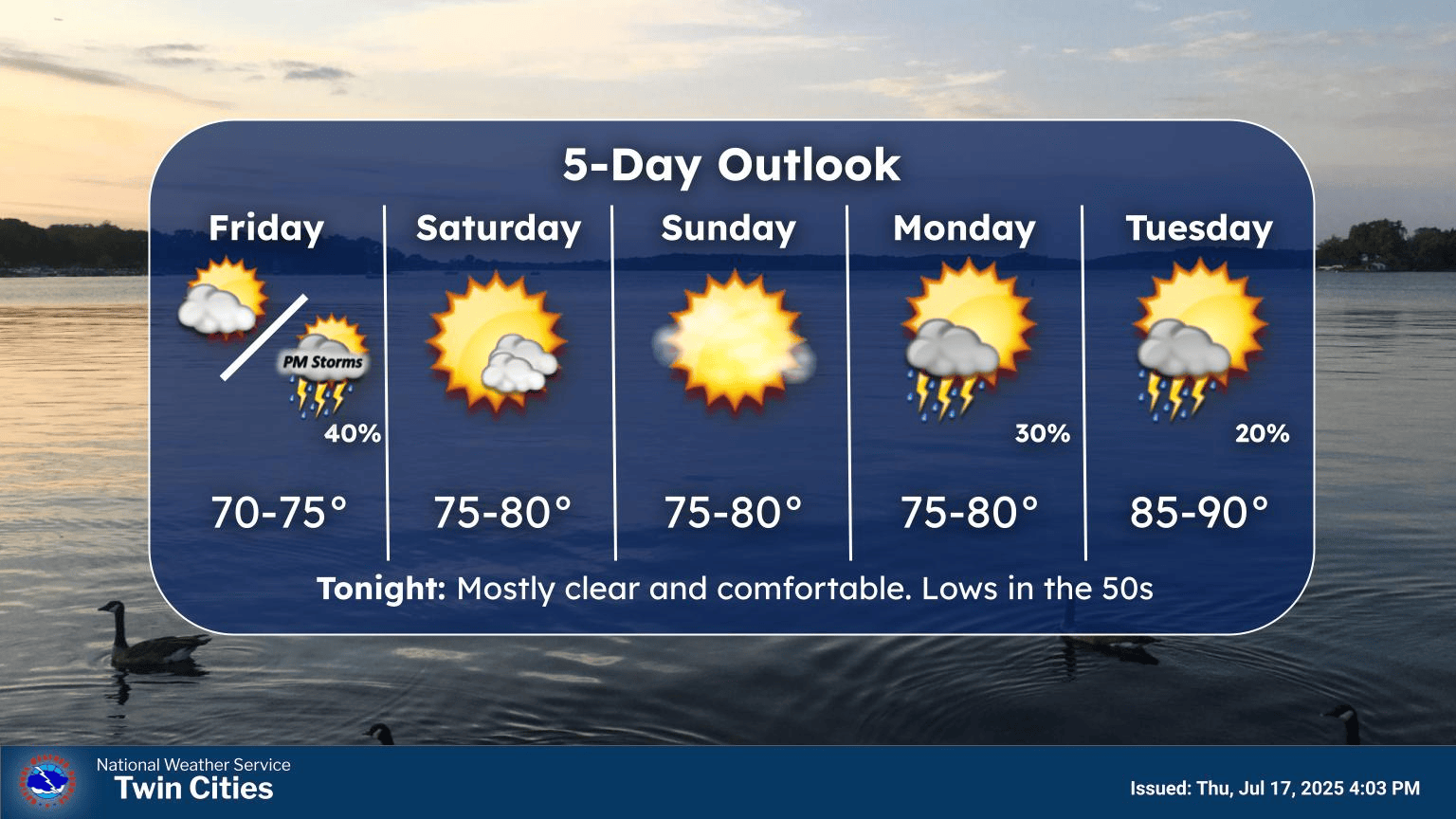
Twin Cities forecast at a glance
Twin Cities forecast at a glance.
Twin Cities National Weather Service office

It’s been a stunning Thursday across Minnesota with comfortable temperatures and blue skies with a few decorative cumulus clouds.

But it looks like we’re back in the spotty thunderstorm business around Minnesota on Friday.

A weak weather wave will cross Minnesota Friday. Spotty showers and thunderstorms will cross Minnesota from west to east. It looks like timing favors scattered storms in western Minnesota in the morning, spreading into eastern Minnesota later in the afternoon into evening.

The National Oceanic and Atmospheric Administration’s FV3 model seems to have a good handle on coverage and timing trends. Check out the map below.

NOAA FV3 model
Finite­-Volume Cubed-Sphere Dynamical Core model between 6 a.m. and 10 p.m. Friday
NOAA, via Tropical Tidbits

NOAA’s Storm Prediction Center lays out a marginal (low) risk for a few severe storms favoring southern Minnesota:

Severe weather risk areas
Severe weather risk areas Friday.
NOAA, via Iowa Environmental Mesonet / Iowa State University.

Highs Friday will run in the 60s north and 70s south.

Forecast high temperatures Friday
NOAA

Nice weekend ahead

The upcoming weekend looks pretty good across Minnesota. A mix of sun and a few clouds will make for a pleasant weekend with highs in the 70s to around 80 degrees by Sunday afternoon.

Forecast high temperatures Sunday
NOAA

A few forecast models show a chance of thunderstorms overnight into Monday morning. Next week looks warm again with highs in the upper 80s by Tuesday!

Volume Button
Volume
Now Listening To Livestream
MPR News logo
On Air
Left, Right and Center with David Greene