
Strongest storms north overnight; isolated storms possible in Twin Cities
Heat advisory returns Wednesday. Slight severe storm risk includes the Twin Cities Wednesday.

Go Deeper.
Create an account or log in to save stories.
Like this?
Thanks for liking this story! We have added it to a list of your favorite stories.


Welcome to peak summer heat and thunderstorm season.
Our steamy deep tropical air mass is fuel for scattered storms that will pop up through Wednesday. Forecast models and stability indices still keep the heaviest storms risk across central and northern Minnesota through the overnight hours.
But a couple of the short range afternoon forecast model runs suggest few isolated thundershowers are possible near the Twin Cities anytime after 9 p.m. to 10 p.m. Tuesday evening.
A flood watch continues for northeast Minnesota until Thursday.
Turn Up Your Support
MPR News helps you turn down the noise and build shared understanding. Turn up your support for this public resource and keep trusted journalism accessible to all.
Including the cities of Duluth and Aitkin
131 PM CDT Tue Jul 22 2025
...FLOOD WATCH NOW IN EFFECT FROM MIDNIGHT CDT TONIGHT THROUGH THURSDAY MORNING...
* WHAT...Flash flooding caused by excessive rainfall is possible.
* WHERE...In Minnesota, southern Aitkin, Carlton and southern St. Louis Counties. This includes the Tribal Lands of the Mille Lacs Band, East Lake area and the Fond du Lac Band.
* WHEN...From Midnight Tuesday night through Thursday morning.
* IMPACTS...Excessive runoff may result in flooding of rivers, creeks, streams, and other low-lying and flood-prone locations.
* ADDITIONAL DETAILS... - Multiple rounds of heavy rainfall are forecast tonight through Thursday morning. This heavy rainfall may fall on top of already saturated soils from other recent heavy rainfall and lead to excessive runoff. Flash flooding is possible.
Hot and stormy Wednesday
Heat index values will reach 100 degrees again in southeast Minnesota Wednesday. Cooler weather filters in from the north.

The heat advisory has been posted again for Wednesday for all of southern Minnesota.
Including the cities of Stillwater, Fairmont, Shakopee, Blaine, Chanhassen, New Ulm, Faribault, Waseca, Gaylord, Minneapolis, Le Sueur, Hastings, St Peter, St James, St Paul, Mankato, Chaska, and Victoria
322 PM CDT Tue Jul 22 2025
...HEAT ADVISORY REMAINS IN EFFECT FROM NOON TO 8 PM CDT WEDNESDAY...
* WHAT...Heat index values in the upper 90s to 105 expected.
* WHERE...Portions of central, east central, and south central Minnesota.
* WHEN...For the first Heat Advisory, until 8 PM CDT this evening. For the second Heat Advisory, from noon to 8 PM CDT Wednesday.
* IMPACTS...Hot temperatures and high humidity may cause heat illnesses.
Scattered storms will continue across much of Minnesota Wednesday. There’s considerable spread in model solutions on timing and coverage for thunderstorms Wednesday. That’s pretty typical with weaker summer synoptic weather patterns like the one we have now.
NOAA’s Storm Prediction Center lays out a slight risk zone further southward including the Twin Cities Wednesday. (map at top of post)
NOAA’s NAM 3 km model seems to have a reasonable idea of a couple of waves of thunderstorms forming Wednesday. It favors one morning and multiple afternoon storms waves possible. The forecast model loop below runs between 4 a.m. and 7 p.m. Wednesday.
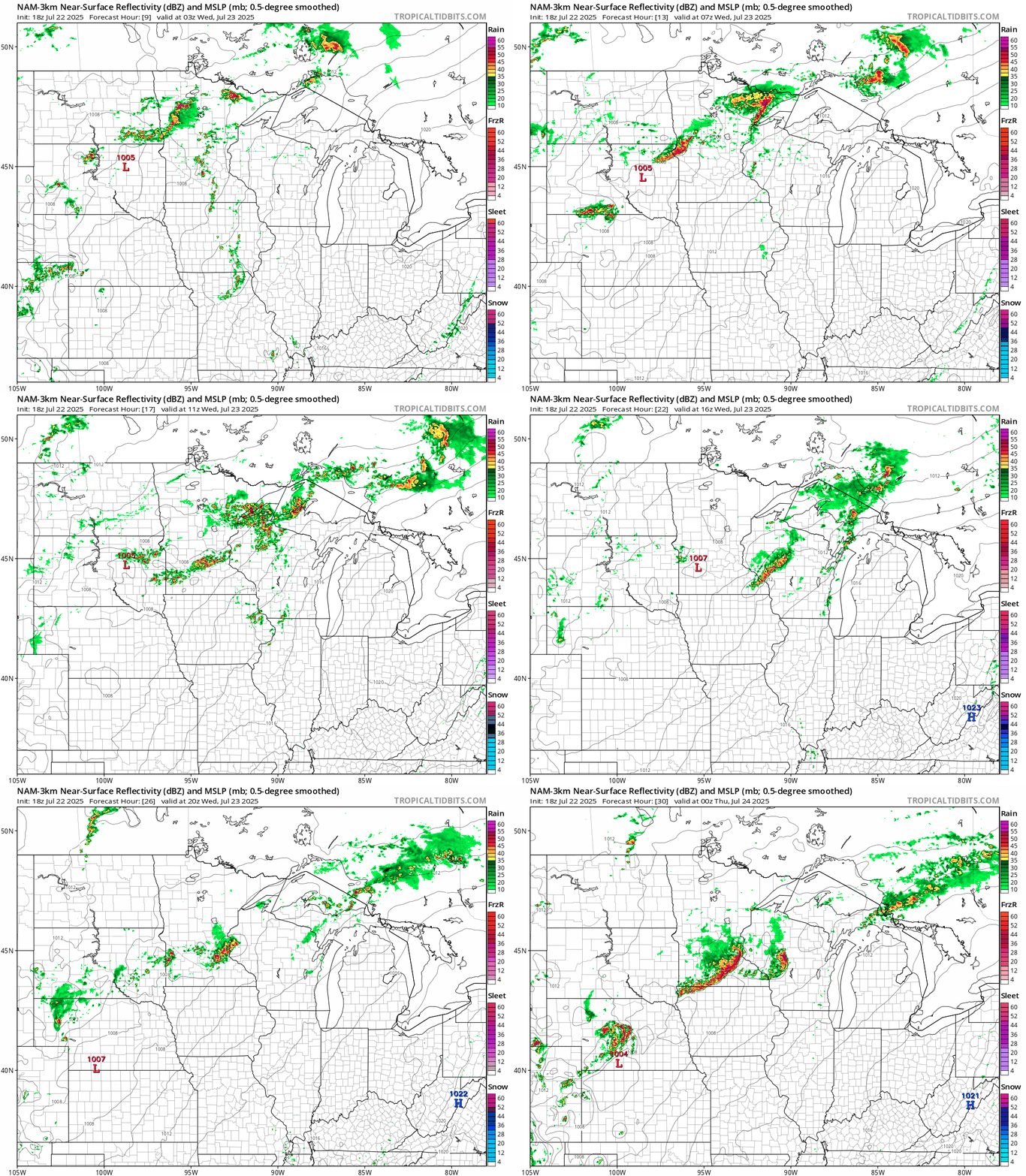
The best chance for severe storms around the Twin Cities seems to favor the late afternoon early evening time period.
Stay tuned for possible watches and warnings Wednesday!

