
Summery weekend ahead; refreshingly cooler next week
Classic summer weather through Monday; cooler, less humid next week
Go Deeper.
Create an account or log in to save stories.
Like this?
Thanks for liking this story! We have added it to a list of your favorite stories.


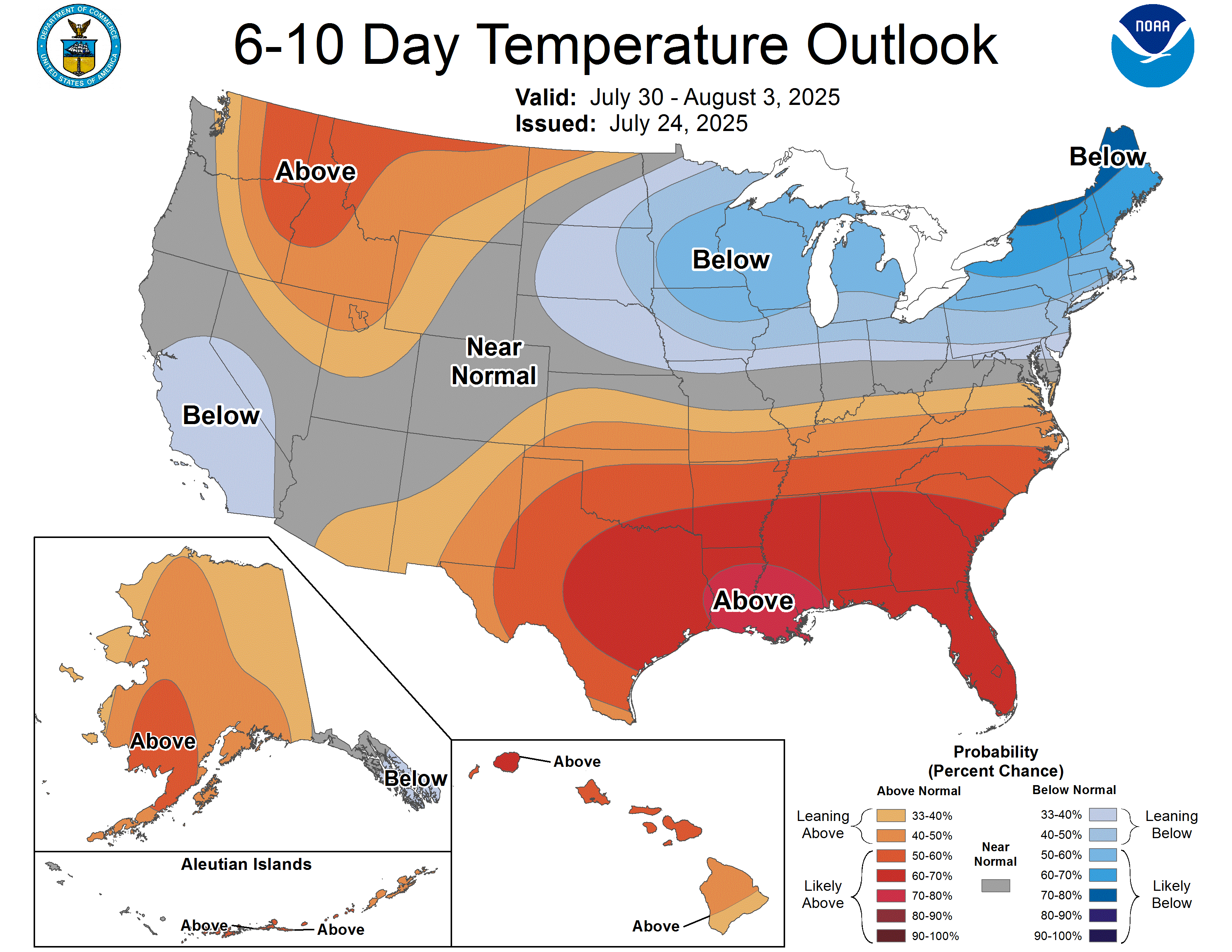
It’s a classic summer weather pattern for Minnesota into the upcoming weekend, but changes are starting to show up on the weather maps next week. A much cooler and less humid air mass will blow in from the north starting next Tuesday.
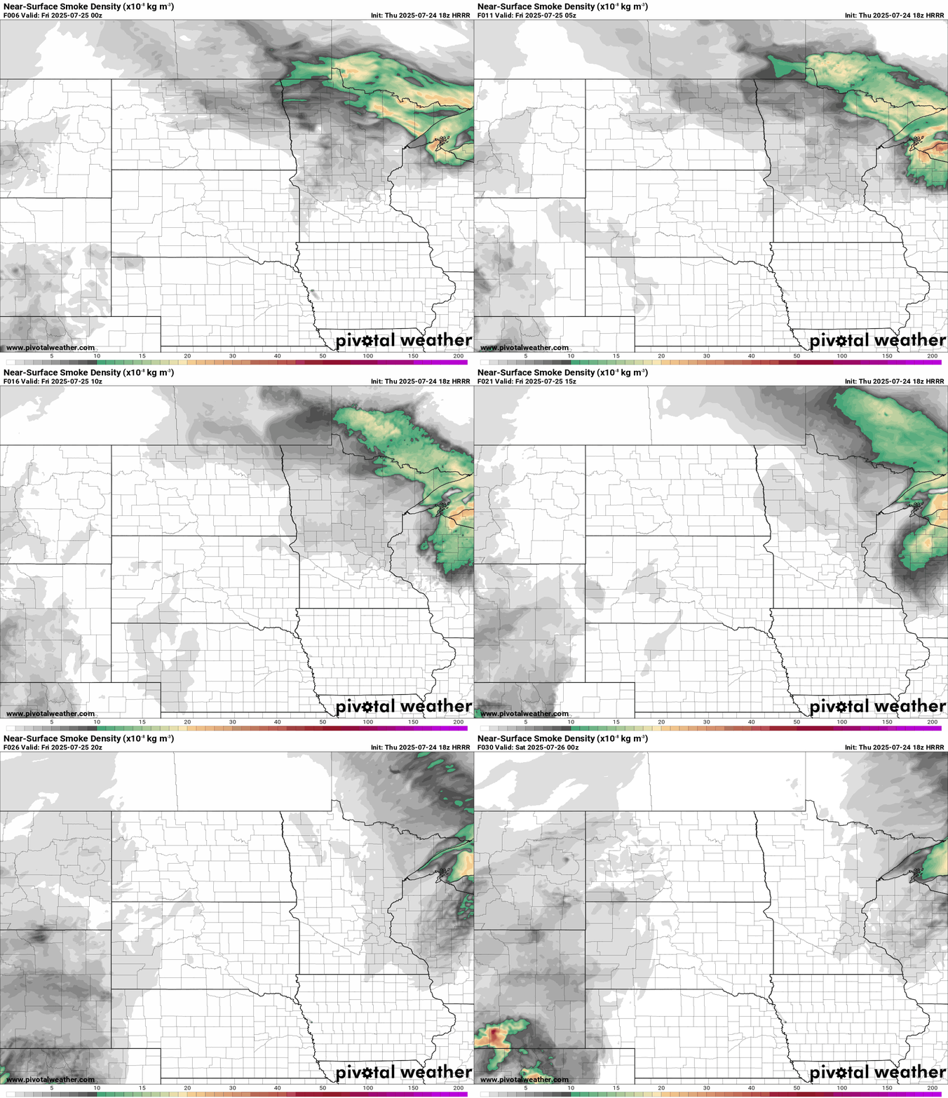
In the meantime, we’re still dealing with some wildfire smoke in the northern half of Minnesota.

An air quality alert continues for Friday in Minnesota.

Here are the details from the Minnesota Pollution Control Agency:
Turn Up Your Support
MPR News helps you turn down the noise and build shared understanding. Turn up your support for this public resource and keep trusted journalism accessible to all.
Air quality is expected to reach the red AQI category in northern and central Minnesota, which is unhealthy for everyone
The Minnesota Pollution Control Agency (MPCA) has expanded the air quality alert to include southeast Minnesota. The alert runs until 11 p.m. on Friday, July 25. The affected area includes the Twin Cities metro area, Brainerd, Alexandria, Albert Lea, Marshall, Worthington, Hinckley, St. Cloud, Ortonville, Mankato, Bemidji, East Grand Forks, Moorhead, International Falls, Two Harbors, Hibbing, Ely, Duluth, Roseau, and the Tribal Nations of Upper Sioux, Mille Lacs, Prairie Island, Leech Lake, White Earth, Red Lake, Grand Portage, and Fond du Lac.
A band of heavy smoke from wildfires in Saskatchewan and Manitoba is moving south across central and northern Minnesota on Thursday. Smoke will reach southern Minnesota Thursday afternoon. Thursday's smoke model forecasts suggest smoke is likely to reach southeast Minnesota by Thursday evening. Therefore, the alert has been expanded to cover southeast Minnesota. Smoke will linger across the state until Friday afternoon, and then southerly winds are expected to push the smoke back to the north. Air quality should improve gradually from south to north beginning Friday afternoon, with improvement in fine particle levels below the alert threshold expected by the end of Friday.
Fine particle levels are expected to reach the red air quality index (AQI) category, a level considered unhealthy for everyone, across northern and central Minnesota. This area includes Brainerd, Alexandria, Hinckley, Ortonville, Bemidji, East Grand Forks, Moorhead, International Falls, Two Harbors, Hibbing, Ely, Duluth, Roseau, and the Tribal Nations of Mille Lacs, Leech Lake, White Earth, Red Lake, Grand Portage, and Fond du Lac. In the red area, sensitive groups should avoid prolonged or heavy exertion and limit time spent outdoors. Everyone should limit prolonged or heavy exertion and time spent outdoors.
Fine particle levels are expected to reach the orange AQI category, a level considered unhealthy for sensitive groups, across southern Minnesota. This area includes the Twin Cities metro area, Albert Lea, Marshall, Worthington, St. Cloud, Mankato, and the Tribal Nations of Upper Sioux and Prairie Island. In the orange area, sensitive groups should limit prolonged or heavy exertion and time spent outdoors.
Our winds will shift into the south Friday and air quality should improve from south to the north. I won’t be surprised if the air quality alert is dropped early, especially for southern Minnesota Friday.
Summery weekend
Skies will be mostly sunny to partly cloudy through the upcoming weekend. Temperatures will warm through the 80s and will push 90 degrees again in the south by Sunday and Monday.

A cool front sagging southward Sunday looks likely to trigger some thunderstorms moving from north to south Sunday afternoon and evening.
Free AC next week
Forecast models drive a stronger cool front southward next week into Minnesota.
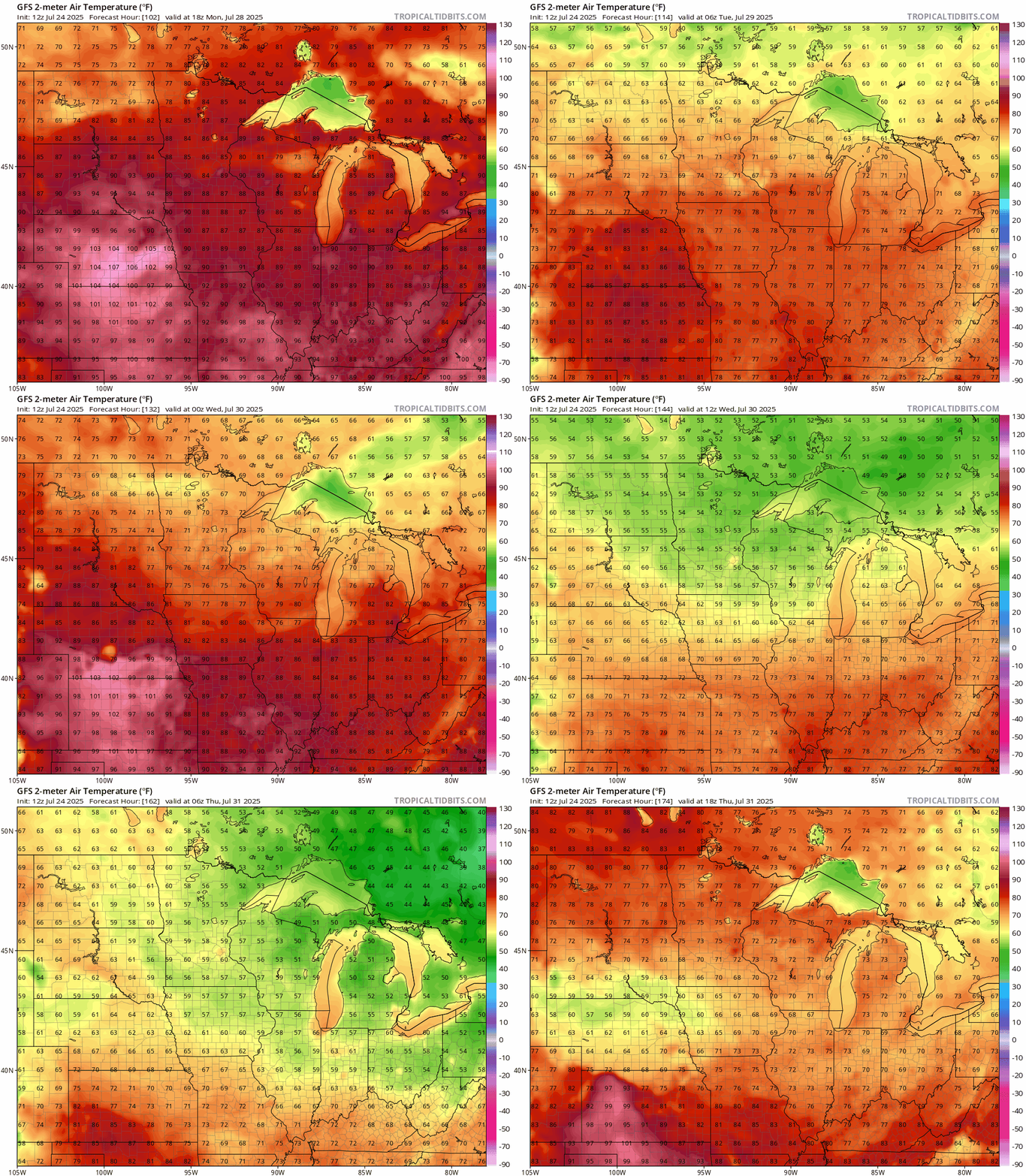
The National Oceanic and Atmospheric Administration’s Global Forecast System model is typical of many that drop highs from near 90 Monday into the 70s by the middle of next week! Check out the map below.
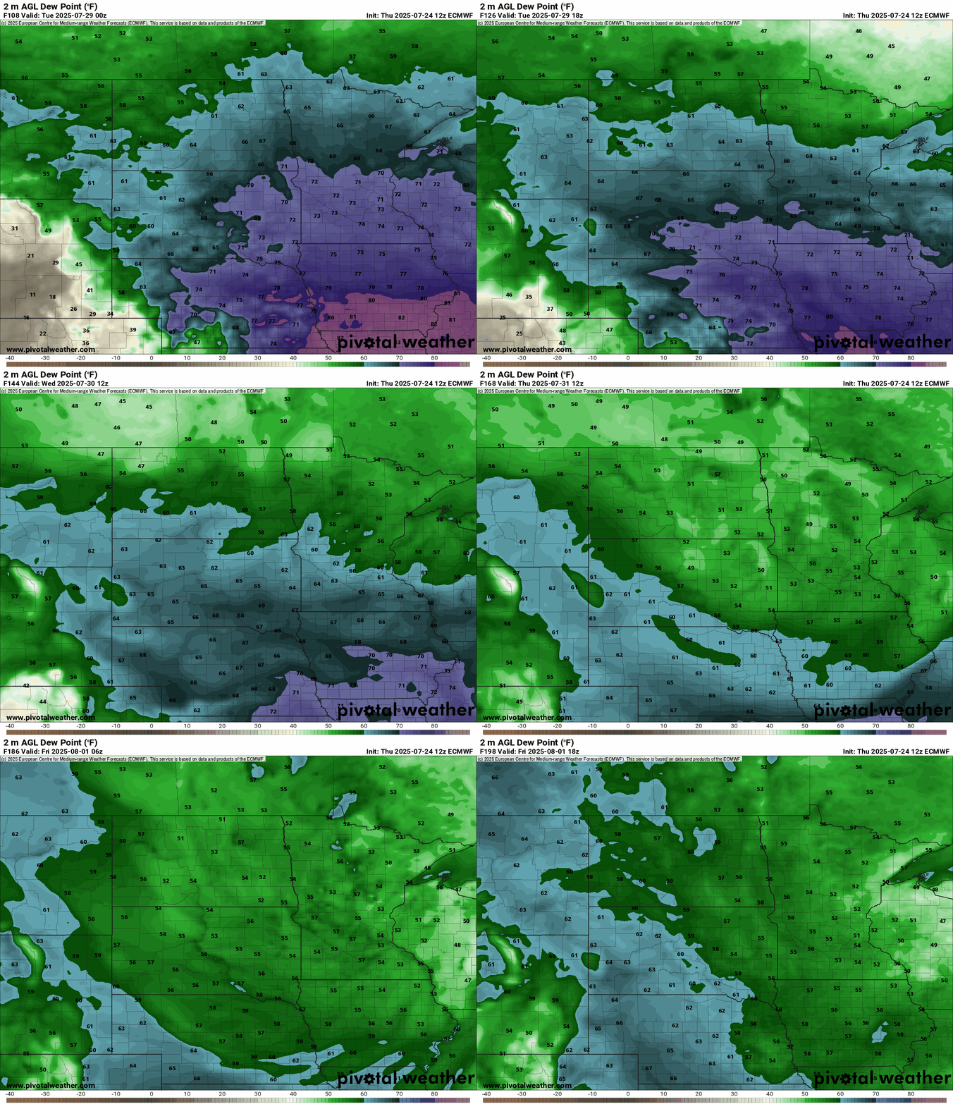
The inbound air mass looks like some of the driest air we’ve seen in weeks around here. Dew points in the comfy 50s look likely.
We’ll have to watch for more possible Canadian wildfire smoke intrusion with a northerly flow next week.
Stay tuned!

