
Steamy weekend ahead; much cooler and less humid next week
Air quality improving; scattered storms north Saturday, possibly Twin Cities late Sunday

Go Deeper.
Create an account or log in to save stories.
Like this?
Thanks for liking this story! We have added it to a list of your favorite stories.


Welcome to the last weekend of July in Minnesota. How did that happen exactly?
Our partly steamy summers at 45 degrees north latitude can be fleeting. And next week’s forecast maps bring a reminder that September is just about five weeks away.
Smoky skies east
First, we deal with the latest batch of Canadian wildfire smoke in eastern Minnesota.
Air quality at ground level has been in the unhealthy range Friday for most of eastern Minnesota. Western Minnesota features good to moderate air quality and the region’s air quality alert has been dropped.
Turn Up Your Support
MPR News helps you turn down the noise and build shared understanding. Turn up your support for this public resource and keep trusted journalism accessible to all.

Air quality this weekend is expected to be in the good to moderate range across Minnesota as southerly winds blow smoke northward into Canada.

Steamy weekend ahead
An increasing hot and humid late July air mass returns to Minnesota this weekend. Highs Saturday will climb toward the 90-degree mark once again. Sunday and Monday will feature 90s in the south. You may want to evacuate to the nearest beach this weekend.
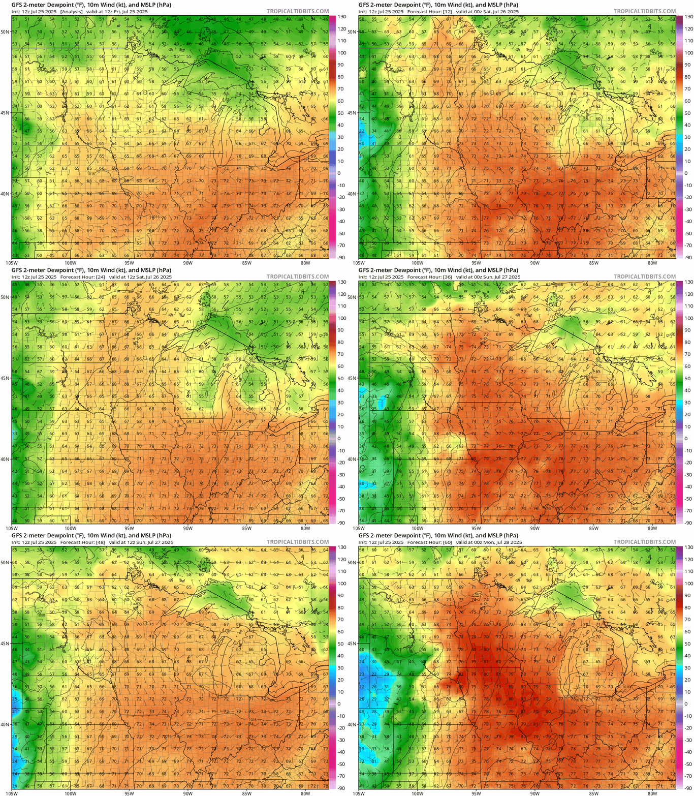
An increasingly steamy air mass with dew points in the 70s to around 80 degrees returns to Minnesota this weekend.
On the map below, the National Oceanic and Atmospheric Administration’s Global Forecast System model shows dew points in the 70s pumping back into our region. Dew points will approach Amazon Jungle levels of 80 degrees by Sunday in the south.
Scattered storms will rumble across the far north overnight through Saturday. NOAA’s FV3 model shows the trend:
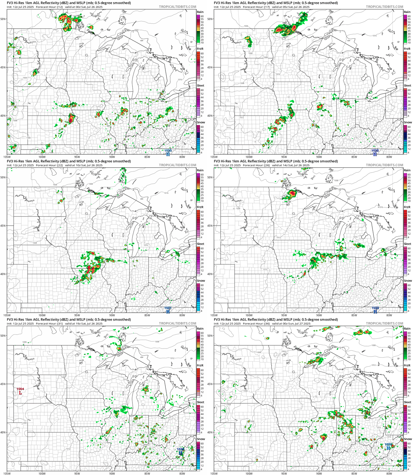
By Sunday, storms will work from north to south and may reach the Twin Cities by late Sunday evening. A marginal risk for severe storms covers all of Minnesota Sunday.
Much cooler next week
Monday still looks steamy with highs in the 90s. A much cooler air mass will begin to filter south Tuesday and highs by Wednesday through Friday in the 70s look likely with comfy dew points in the 50s!

With the northerly flow next week we’ll have to watch for additional wildfire smoke episodes.
Stay tuned.

