
Severe weather risk favors southern Minnesota overnight
Storms may pack damaging winds, large hail, heavy rain

Go Deeper.
Create an account or log in to save stories.
Like this?
Thanks for liking this story! We have added it to a list of your favorite stories.


It’s another severe weather risk night across much of southern Minnesota.
The National Oceanic and Atmospheric Administration’s Storm Prediction Center used the whole color palette to paint the severe risk zone overnight through 7 a.m. Tuesday (check out the map above).
The latest forecast model trends as we approach Monday evening favor a later and more southerly track for the most severe storms.
NOAA’s High-Resolution Rapid Refresh model is among those solutions that bring a possible bowing line of storms across southern Minnesota favoring the Interstate 90 corridor and areas south of the Twin Cities.
Turn Up Your Support
MPR News helps you turn down the noise and build shared understanding. Turn up your support for this public resource and keep trusted journalism accessible to all.
The forecast model loop below runs between 10 p.m. Monday and 3 a.m. Tuesday.
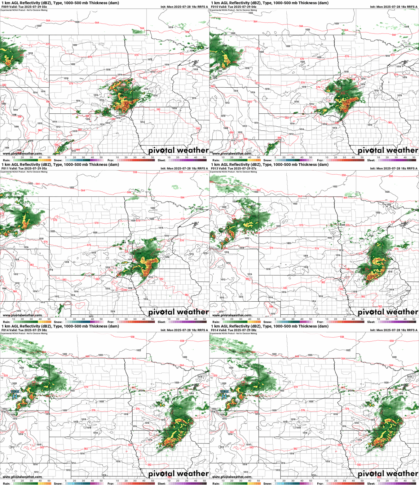
If these model trends verify, that would mean later storms probably after midnight for the Twin Cities with the most severe storms south of the greater Twin Cities area. Stay alert for possible watches and warnings Monday night.
Cooler days ahead this week
A few spotty showers are possible behind a cool front Tuesday. But the main weather change this week features a much cooler and less humid air mass blowing in from the north. Highs starting Wednesday through Friday will be in the refreshing 70s across Minnesota!

Dew points will be in the comfy 50s so you can give the AC a rest later this week.
Air quality alert
The northerly wind flow later this week will unfortunately bring another wave of smoke southward into Minnesota. Our latest air quality alert includes the northern half of Minnesota.

The alert may be expanded to cover all of Minnesota this week.
Here’s the latest forecast discussion from the Minnesota Pollution Control Agency:
KEY MESSAGES: 1) Heavy surface smoke is expected to impact northern and central Minnesota Tuesday, and an Air Quality Alert has been issued. 2.) Heavy surface smoke may spread to southern Minnesota Tuesday night and Wednesday. 3.) Smoke may produce poor air quality statewide through Friday. DETAILED DISCUSSION: Upper level winds will steer wildfire smoke from central Saskatchewan and Manitoba southeast towards and/or into Minnesota through Tuesday, and surface high pressure will help keep the smoke at the surface. As of this Monday afternoon, light to moderate surface smoke is already affecting the Arrowhead region, however, heavier smoke is expected to move into the Arrowhead and across the rest of northern and central Minnesota on Tuesday. Smoke will continue to drift south Tuesday night into Wednesday, and the air quality alert may need to be expanded to include southern Minnesota on Wednesday. Surface high pressure will blanket the region through Friday, and result in light winds and poor dispersion. Therefore, smoke may remain over the state until Friday when winds finally switch from the south. Ground-level ozone production may increase due to the presence of wildfire smoke in a drier, albeit cooler, environment Wednesday through Friday as well.
Stay tuned.

