
Air quality alert extended for all of Minnesota until noon Monday
Wildfire smoke will linger but gradually improve this weekend.

Go Deeper.
Create an account or log in to save stories.
Like this?
Thanks for liking this story! We have added it to a list of your favorite stories.


The smoky summer of ‘25 rolls on.
The MPCA has extended the air quality alert for all of Minnesota until noon Monday. Air quality is expected to remain unhealthy for everyone through Saturday.
Our winds will turn southerly this weekend,. But the smoke plume has penetrated into the central U.S. Friday as far south as Missouri and Kansas.

That means we’ll recycle some of the smoke that has already pushed south of Minnesota this weekend before we start to pull cleaner air in here. NOAA’s HRRR near surface smoke output shows smoke levels of varying intensity washing over the Upper Midwest this weekend.
Turn Up Your Support
MPR News helps you turn down the noise and build shared understanding. Turn up your support for this public resource and keep trusted journalism accessible to all.
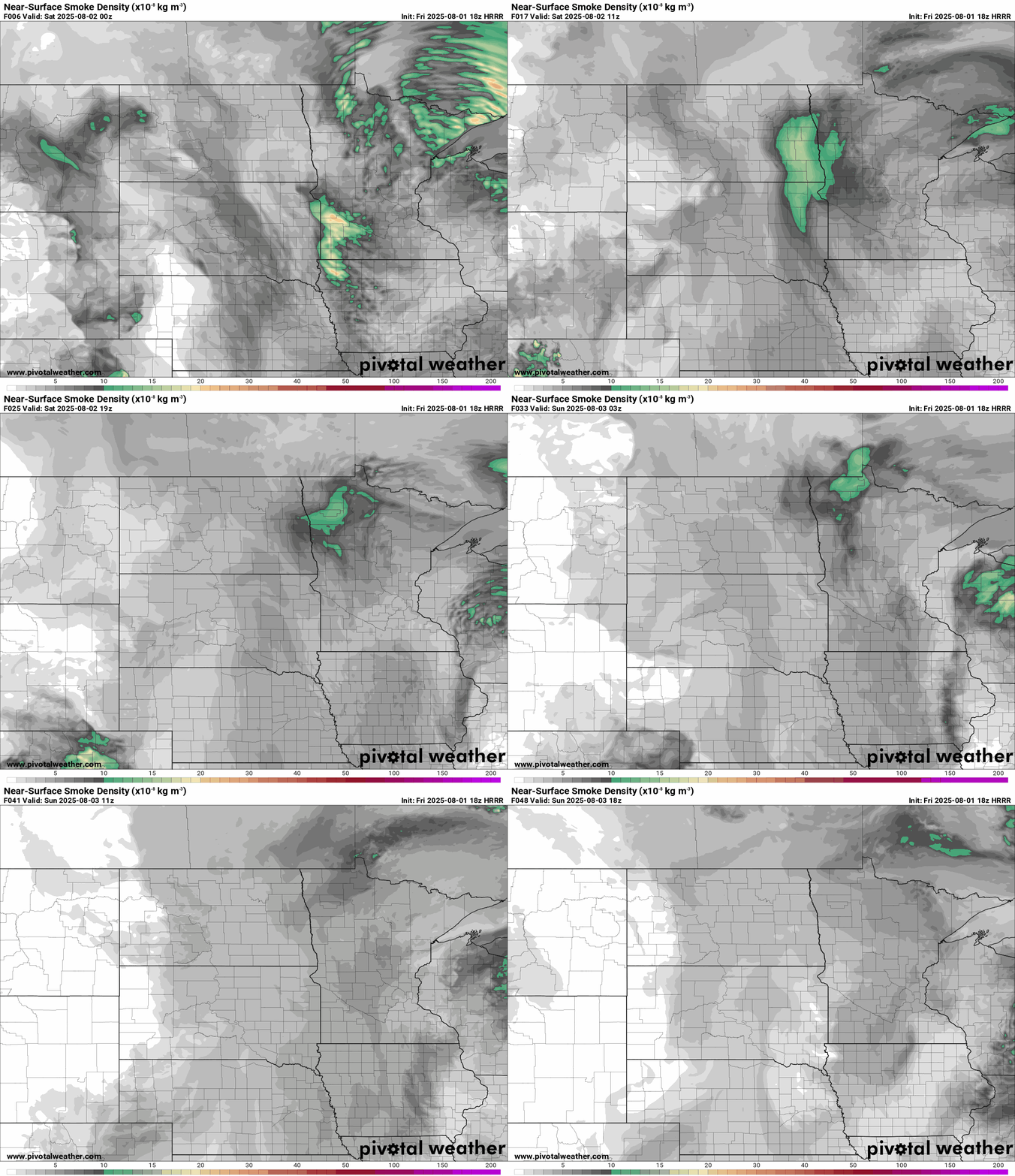
We may see more improvement in air quality Sunday.
Once again Friday the Twin Cities (and most of Minnesota) are breathing some of the worst air quality in the world.

Here’s the latest MPCA air quality forecast discussion updated Friday afternoon.
Forecast discussion
Updated Fri, Aug 1, 2025
KEY MESSAGES: 1) Air Quality Alert in effect for all of Minnesota. 2.) Periods of heavy surface smoke to impact Minnesota through at least Sunday. DETAILED DISCUSSION: Surface high pressure will camp out over the region through Friday evening, and will result in light winds and poor dispersion. Smoke with widespread Red/Unhealthy AQI concentrations will likely remain over most of the state through tonight and into the day Saturday when winds finally switch from the south. Winds will increase out of the south over the weekend as high pressure drifts east of the area. Smoke concentrations should gradually decline starting Saturday, but with smoke spreading as far south as Tennessee and Missouri the clearing of the smoke may be slow. Orange AQIs could hang on through Sunday and even into Monday. By later Monday most of the alert-level smoke should push north back onto Canada. For ozone, thick smoke will hold back ground-level ozone production for today. For Friday and over the weekend, the combination of thinning smoke and stronger sunlight reaching the ground may cause ozone to increase due to the presence of ozone precursors in the wildfire smoke.
Pleasant weekend temperatures and humidity
Temperatures and humidity this weekend will be very pleasant across Minnesota Dew points will stay in the comfortable 50s this weekend. Highs will run in the 70s to near 80 across Minnesota this weekend.

Next week looks increasingly summery across Minnesota. Southerly winds should keep smoke levels tolerable. Highs will warm back into the 80s.

We’ll runs a low-grade (30 percent) chance of scattered showers and thunderstorms next week, but many of us will get an extended chance to dry out.
Enjoy the weekend as much as you are able!

