
Dog Days of summer: Increasingly steamy with spotty storm chances ahead
Highs in the 90s by Friday afternoon in the south.

Go Deeper.
Create an account or log in to save stories.
Like this?
Thanks for liking this story! We have added it to a list of your favorite stories.


Welcome to the Dog Days of summer Minnesota.
The ancient Greeks and Romans noticed the so called Dog Star Sirius risking in the late summer sky near the sun in the morning. They believed the bright star added extra heat to the atmosphere during July into August.
The Dog Days of summer are loosely defined as the period between July 3 to around August 11 in the Northern Hemisphere. These weeks are typically the warmest and most humid weeks of the year in most of the northern hemisphere.
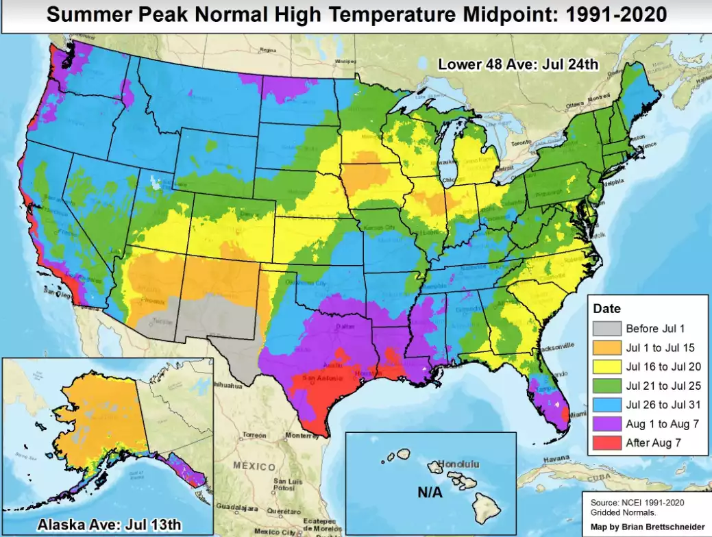
Increasingly steamy
Turn Up Your Support
MPR News helps you turn down the noise and build shared understanding. Turn up your support for this public resource and keep trusted journalism accessible to all.
Our forecast features southerly winds and a gradual warming trend the rest of this week. High will reach the mid to upper 80s across much of Minnesota Thursday.

By Friday lower 90s will cover parts of the south. (map at top)
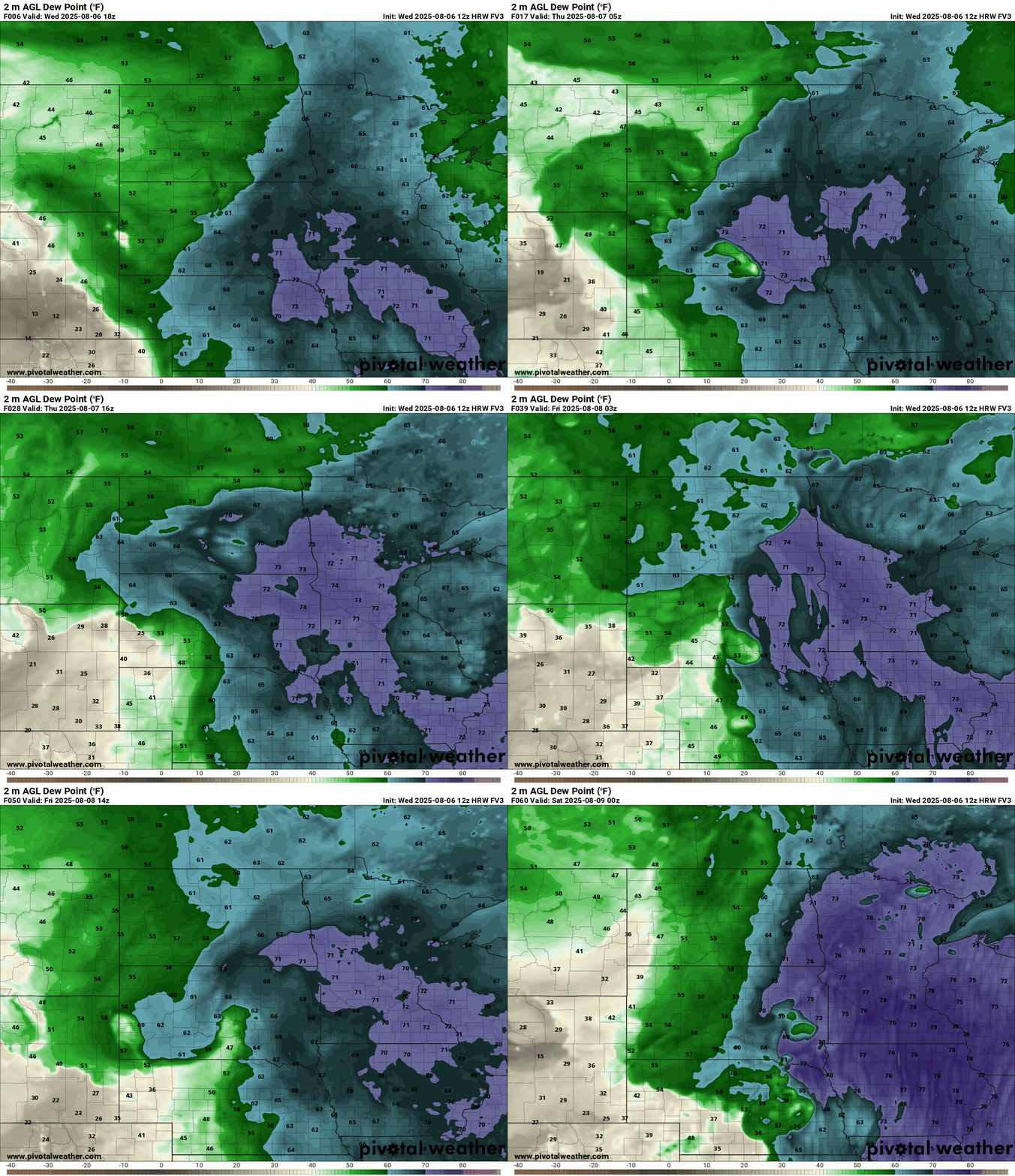
Dew points will also rise across Minnesota the rest of this week.
A combination of Gulf moisture and corn sweat will push dew points into the tropical upper 60s to 70s through Friday. Note how dew points tend to rise during the day as sunshine boosts evaporation from soils and corn sweat pulls additional moisture from corn and other plants into the lower atmosphere.
Spotty storms
Thunderstorm coverage looks fairly spotty the next few days across Minnesota. NOAA’s NAM 3 km model is typical of models like the European that develop a storms complex in the Dakotas Thursday evening and track it into Minnesota overnight. The forecast model loop below runs between 7 p.m. Thursday and 7 a.m. Friday.
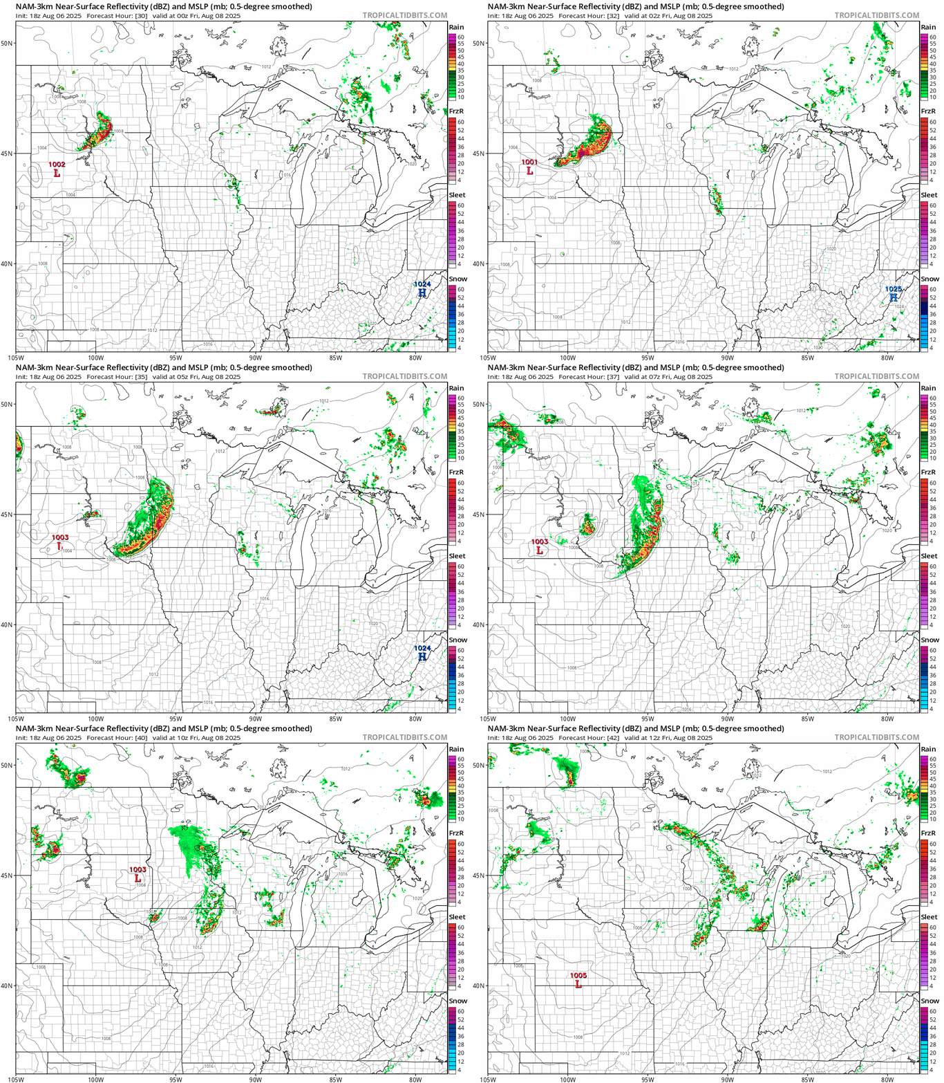
The highest risk for any severe storms favors the Dakotas into western Minnesota.
A cool front this weekend brings a chance of scattered storms. We may see some more wildfire smoke drift south this weekend across Minnesota once again.
Stay tuned.

