
Steamy: Heat advisories and spotty storm chances ahead
Heat index values will approach 100 degrees Friday afternoon.

Go Deeper.
Create an account or log in to save stories.
Like this?
Thanks for liking this story! We have added it to a list of your favorite stories.


Welcome to another steamy summer air mass Minnesota.
Our latest air mass features temperatures near 90 degrees and dew points in the tropical 70s. That will yield heat index values in the 90s to around 100 degrees especially Friday afternoon.
Heat advisories are up for much of central and northeast Minnesota until 8 p.m. Thursday. And a heat advisory kicks in for the greater Twin Cities area at noon Friday and runs through 10 p.m.
Hennepin-Anoka-Ramsey-Washington-Carver-Scott-Dakota- Including the cities of Hastings, Chanhassen, Victoria, Blaine, Shakopee, St Paul, Stillwater, Minneapolis, and Chaska
126 PM CDT Thu Aug 7 2025
...HEAT ADVISORY IN EFFECT FROM NOON TO 10 PM CDT FRIDAY...
* WHAT...Heat index values up to 100 degrees expected.
* WHERE...Anoka, Carver, Dakota, Hennepin, Ramsey, Scott, and Washington Counties.
* WHEN...From noon to 10 PM CDT Friday.
* IMPACTS...Hot temperatures and high humidity may cause heat illnesses.
PRECAUTIONARY/PREPAREDNESS ACTIONS... Drink plenty of fluids, stay in an air-conditioned room, stay out of the sun, and check up on relatives and neighbors. If you do not have air conditioning in your home or lack shelter, you can call 211 or visit weather.gov/mpx/coolingcenters for assistance locating appropriate shelter from the heat.
Highs Friday afternoon will push 90 degrees in southern Minnesota.
Turn Up Your Support
MPR News helps you turn down the noise and build shared understanding. Turn up your support for this public resource and keep trusted journalism accessible to all.

And dew points with our tropical air mass are in the steamy zone. Look at how dew points in the 70s slosh around much of Minnesota through Friday.
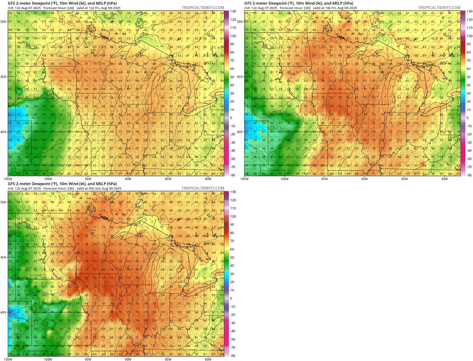
Obviously we’re used to this kind of heat in a Minnesota summer. But just use common weather sense and take it easy out there especially Friday afternoon.
Spotty storms
Our heat dome features warm air aloft that is capping our atmosphere and limiting storms coverage overall. But a couple of waves of storms may brew at night from the Dakotas and blow into Minnesota. The first looks likely overnight into Friday morning and may approaches eastern Minnesota and the Twin Cities around 5-7 a.m. Friday.
The second wave looks likely Friday night into early Saturday and could be more robust in the east. NOAA’s NAM 3 km model shows this possible solution but keep in mind summer storm coverage details are notoriously localized.
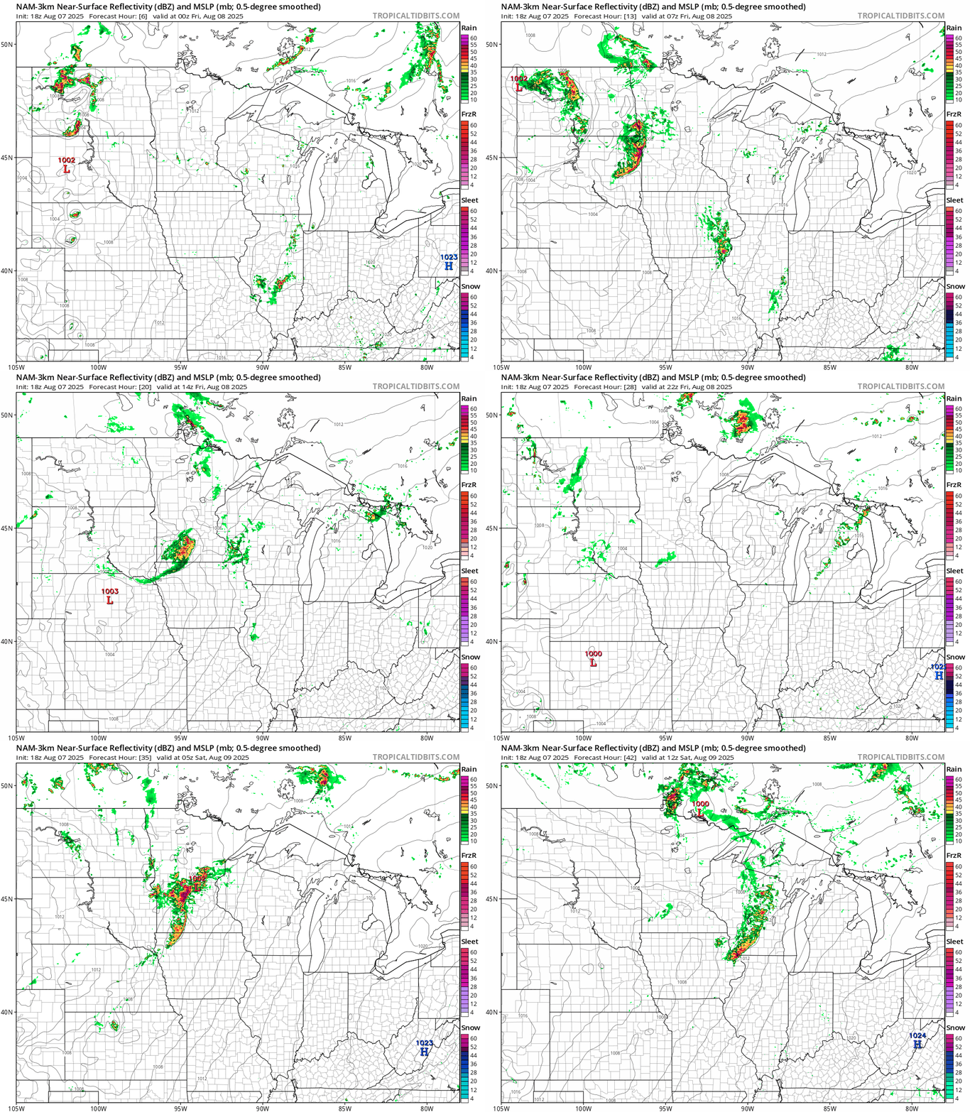
The highest severe weather risk zone favors northwest Minnesota into Friday morning.
Weekend cool front
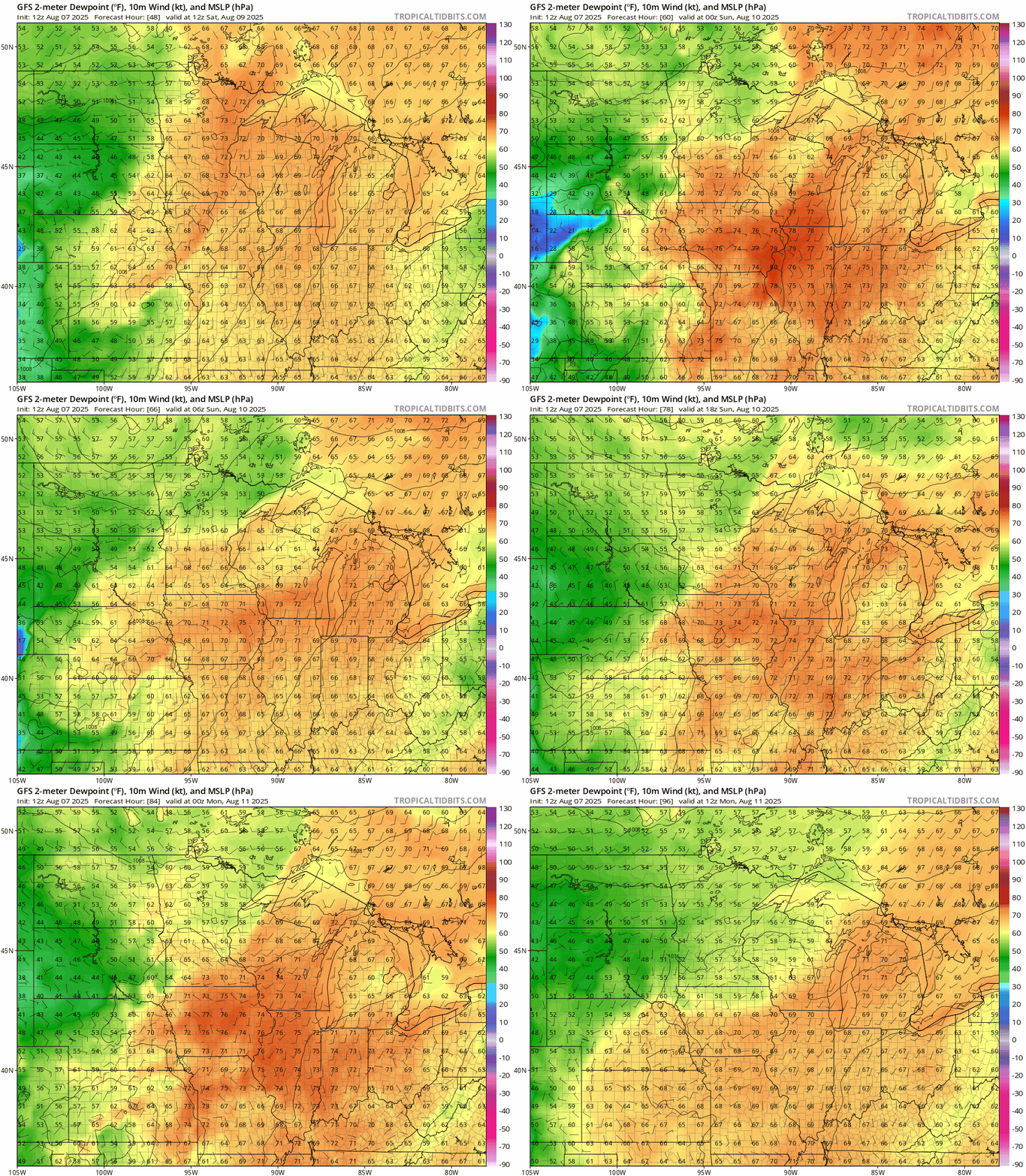
A cool front will cross Minnesota by Saturday. The air mass behind the front will be slightly cooler and much less humid especially by Sunday.
Highs this weekend will cool into the 80s south and even comfy 70s north.

And our inbound air mass transfusion will push dew points in the delightful 50s into Minnesota by Monday!
Take it easy out there Minnesota!

