
Comfortable humidity for now; steamy again by Friday
Scattered storms in parts of Minnesota, especially later this week

Go Deeper.
Create an account or log in to save stories.
Like this?
Thanks for liking this story! We have added it to a list of your favorite stories.


We’re breathing easier across most of Minnesota. Smoke has mostly cleared the southern parts of the state, but the newest air quality alert covers the north through Wednesday.
Dew points have fallen into the comfy 50s across most of Minnesota. We’ll enjoy this more comfortable weather through Thursday.

Highs Wednesday will run mostly in the 70s across most of Minnesota to around 80 degrees in the south.

Steamy again by Friday
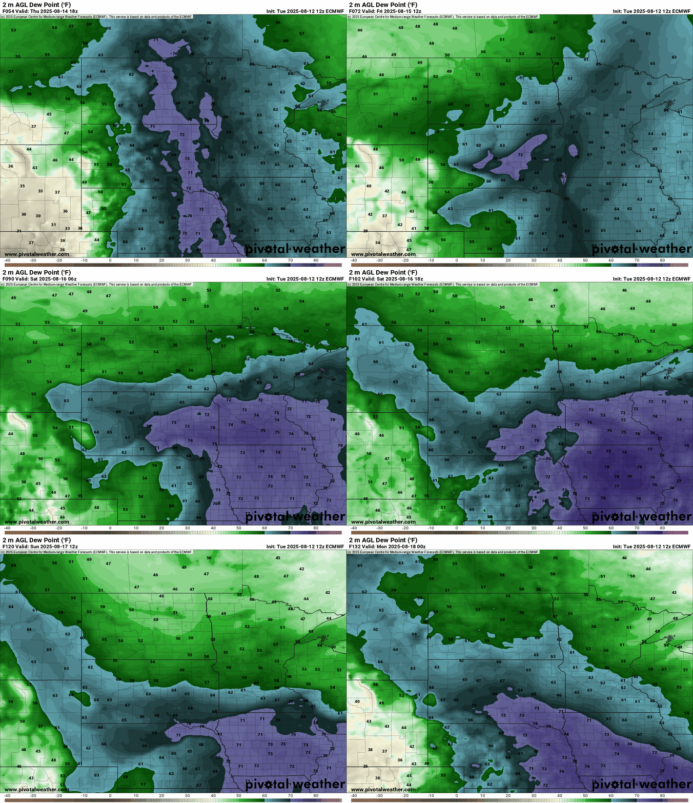
Our wind flow turns southerly again later this week. That will pump another batch of tropical air into Minnesota and boost dew points back into the sultry 70s.
On the map below, the European Centre for Medium-Range Weather Forecasts model shows the deeper tropical moisture coming north once again. Watch the soupy dew points slosh around Friday and Saturday with drier air pushing back south by Sunday.
Friday looks like the warmest day with highs will into the upper 80s south but cooler 70s north.

Isolated thunderstorms look likely to roam Minnesota Thursday and especially late Friday night. Stay tuned as we refine potential storm coverage and timing in the next 48 hours.
Turn Up Your Support
MPR News helps you turn down the noise and build shared understanding. Turn up your support for this public resource and keep trusted journalism accessible to all.

