
Tracking heavy rainfall potential through the upcoming weekend
Storms packing torrential downpours possible especially at night this weekend.

Go Deeper.
Create an account or log in to save stories.
Like this?
Thanks for liking this story! We have added it to a list of your favorite stories.


We’re enjoying a beautiful late summer air mass over Minnesota now.
But changes are already brewing on the weather maps that will blow in a steamy tropical air mass capable of storms with torrential rainfall rates through the upcoming weekend.
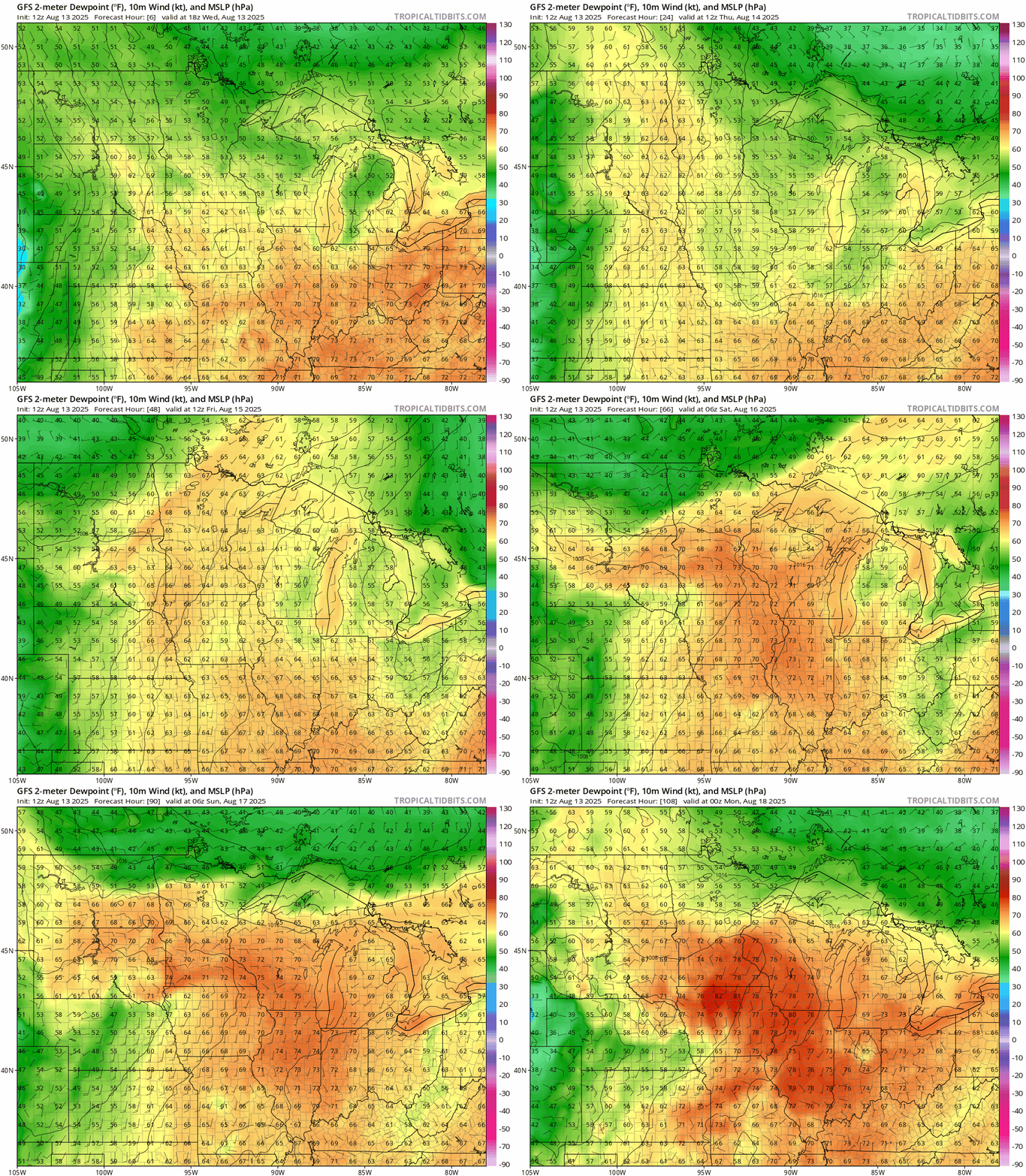
Watch as NOAA’s GFS model pumps an oppressively tropical air mass north with dew points in the 70s by Thursday rising to near 80 degrees by Sunday evening.
All forecast models generate occasional heavy storms for parts of Minnesota between Thursday night and Monday. Details of specific geography and timing will vary over the next few days. Here’s the European model solution.
Turn Up Your Support
MPR News helps you turn down the noise and build shared understanding. Turn up your support for this public resource and keep trusted journalism accessible to all.
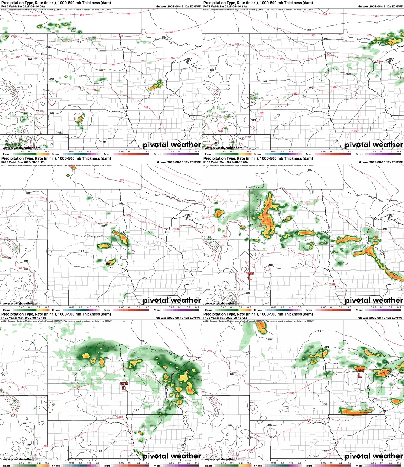
It won’t rain all the time through the upcoming weekend. But when it does, torrential rainfall rates of 1 to 3 inches per hour are possible locally. That may produce flash flooding in local areas. And heavy storms may favor the nighttime and early morning hours when it’s hard to see flash flooding.
Be ready for possible flood watches and warnings across parts of Minnesota this upcoming weekend. With this setup, we can’t rule out locally heavy rainfall totals of more than 6 inches this weekend in some areas.
Late summer heavy rainfall events
Late summer is climatologically ripe for heavy rainfall events in Minnesota. Steamy tropical air provides the fuel. Slow moving fronts can trigger heavy rain cells that crawl along slowly in weak steering current this time of year.
The biggest rain event in the Twin Cities occurred in late July 1987. The Twin Cities Superstorm dumped 6 to 12 inches of rain in the southern Twin Cities that night.
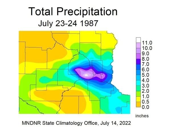 Twin Cities Superstorm rainfall totals.Minnesota DNR

The mega-rain event of August 10-11, 2016 dumped over 6 inches of rain in tow separate areas.
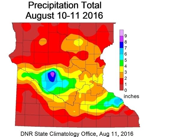 August 10-11, 2016 mega-rain event.Minnesota DNR

And the heaviest rainfall event ever recorded at the Minnesota State Fair occurred on August 30, 1977. Here’s a description of that event from the Minnesota State Climatology Office.
The largest rain event in the State Fair's history was August 30, 1977. At 8:20pm heavy rains hit the State Fairgrounds. The U of M St. Paul Campus climate observatory one mile north of the Fairgrounds reported 4.06 inches of rain. This caused some of the worst street flooding seen at the Fairgrounds. The bulk of the rain fell in a 3 1/2 hour period from 8:15pm to 11:45pm. The grandstand show was canceled, and people had great difficulty trying to leave the Fair. The Twin Cities International Airport saw 7.28 inches from this event, second all-time only to the July 1987 "Superstorm" total of 10.00 inches. People driving on I-94 leaving the Fair found water "up to their hood ornaments" in low areas under bridges.
So heavy rainfall events are not unusual in late summer here in Minnesota. Keep an eye out for possible flood watches and warnings this weekend.

