
Wetter weather pattern kicks in; severe risk especially Friday evening
Thunderstorms could drop heavy rainfall in many areas by Monday

Go Deeper.
Create an account or log in to save stories.
Like this?
Thanks for liking this story! We have added it to a list of your favorite stories.


Here we go. Our well-advertised wetter weather pattern is kicking in across Minnesota.
A stalled warm front draped from western Minnesota to near the Twin Cities will be the focus for some of the heaviest rain and thunderstorms through the upcoming weekend.
The European Centre for Medium-Range Weather Forecasts model shows the scattered and occasional coverage of the storm cells this weekend. The forecast model loop below runs between 1 a.m. Saturday and 1 a.m. Monday.
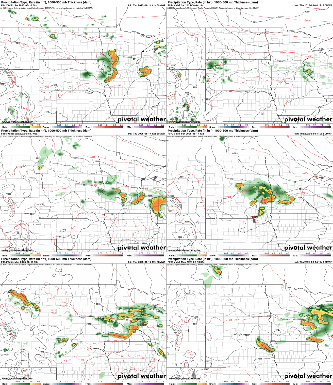
Likely storm movement this weekend seems a little faster than Wednesday. So while local flooding is still possible, it looks like storms may move a littler faster this weekend and dump a a little less rain in many spots.
Turn Up Your Support
MPR News helps you turn down the noise and build shared understanding. Turn up your support for this public resource and keep trusted journalism accessible to all.
But most of our region looks likely to pick up 1 to 3 inches of rainfall through the weekend with some local totals of 4 inches or greater possible.
As always with the localized nature of summer convection, your results may vary. Here’s the European model rainfall output through Monday morning.

The highest severe weather risk Friday (especially evening) favors far eastern Minnesota into Wisconsin.

The biggest flash flood risk covers much of central and southern Minnesota into Wisconsin, including the greater Twin Cities area.

Friday will be steamy across southern Minnesota with dew points rising into the tropical 70s and temperatures into the upper 80s.

Highs this weekend favor the 70s north to 80s south.
Keep an eye out Friday for possible weather watches and local warnings!

