
Stormy Friday night; more occasional storms this weekend
Heavy rainfall potential through the weekend

Go Deeper.
Create an account or log in to save stories.
Like this?
Thanks for liking this story! We have added it to a list of your favorite stories.


Our tropical air mass is already delivering on a model forecast of locally heavy rainfall this weekend. Thunderstorm clusters blew up in the heat of late aternoon around the greater Twin Cities and eastern Minnesota into Wisconsin.
The slowly moving cells dumped a quick couple inches of rain in parts of our area, causing a local flash flood warning to be issued.
The highest wind reports came in from southeast of the Twin Cities around Hastings, Ellsworth, Wis., and Durand, Wis. Trees are reported down in those areas.
Here are some select storms reports form late Friday.
Turn Up Your Support
MPR News helps you turn down the noise and build shared understanding. Turn up your support for this public resource and keep trusted journalism accessible to all.
1 WNW Waconia [Carver Co, MN] NWS Employee reports Hail of penny size (M0.75 Inch) at 4:12 PM CDT --
1 SE Victoria [Carver Co, MN] Trained Spotter reports Hail of half dollar size (M1.25 Inch) at 4:44 PM CDT --
1 S Woodbury [Washington Co, MN] Trained Spotter reports Hail of half dollar size (M1.25 Inch) at 4:53 PM CDT -- Relayed through spotter network.
Rogers [Hennepin Co, MN] Trained Spotter reports Hail of quarter size (M1.00 Inch) at 5:02 PM CDT -- Just northeast of I-94 and Highway 101.
Eden Valley [Meeker Co, MN] Trained Spotter reports Hail of quarter size (M1.00 Inch) at 5:28 PM CDT --
2 N Brooklyn Park [Hennepin Co, MN] Trained Spotter reports Hail of quarter size (M1.00 Inch) at 5:29 PM CDT --
2 SE Burnsville [Dakota Co, MN] Trained Spotter reports Hail of quarter size (M1.00 Inch) at 6:06 PM CDT --
Durand [Pepin Co, WI] Law Enforcement reports Tstm Wnd Dmg at 15 Aug, 5:15 PM CDT -- Few trees down.
Hastings [Washington Co, MN] Law Enforcement reports Tstm Wnd Dmg at 15 Aug, 5:20 PM CDT -- Trees and power lines down. Extent unknown.
Prescott [Pierce Co, WI] Law Enforcement reports Tstm Wnd Dmg at 15 Aug, 5:25 PM CDT -- Trees and power lines down.
More weekend storms
It won’t rain all the time this weekend, but expect a few waves of storms with the potential for high winds, hail and torrential rainfall.
The National Oceanic and Atmospheric Administration’s Rapid Refresh Forecast System model is typical of many that bring another wave of strong storms across Minnesota overnight into early Saturday morning. The forecast model loop below runs between 5 and 10 a.m. Saturday.
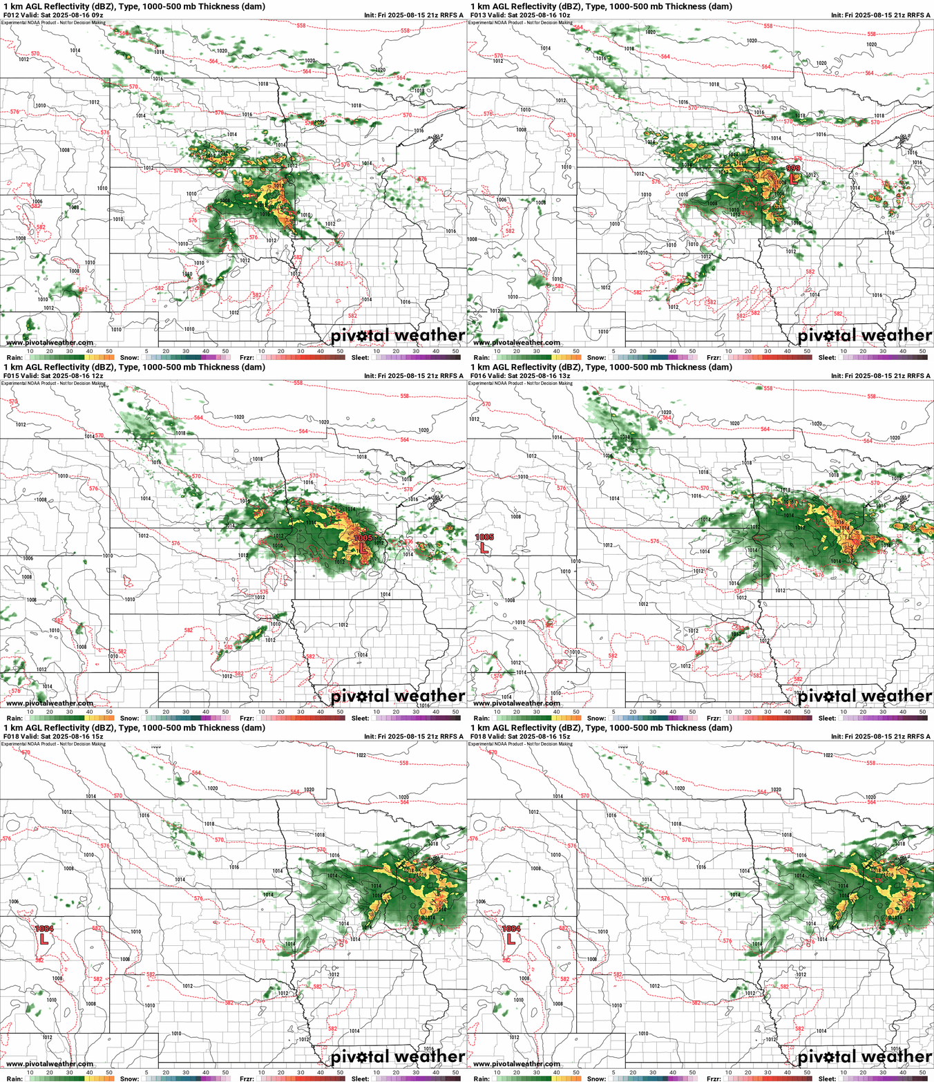
Our tropical air mass means storms are capable of multi-inch rainfall in just a short time. There’s a severe weather and and excessive rainfall risk again Saturday. (See the map at the top.)
Highs will be in the steamy 80s between storm waves. It’s a monsoonal summer weekend in Minnesota.

