
Late summer air mass now; September cold front next week
A summery air mass lingers in Minnesota into the Labor Day weekend.

Go Deeper.
Create an account or log in to save stories.
Like this?
Thanks for liking this story! We have added it to a list of your favorite stories.


It’s a classic late-summer weather pattern across Minnesota.
Temperatures will continue to run mostly in the 70s right into the Labor Day weekend. Most of Minnesota will stay dry for the next several days. But a few scattered showers in the north and thunderstorms in the south will linger into Wednesday night.
NOAA’s FV3 model shows the spotty rain trends between 7 p.m. Wednesday and 7 a.m. Thursday.
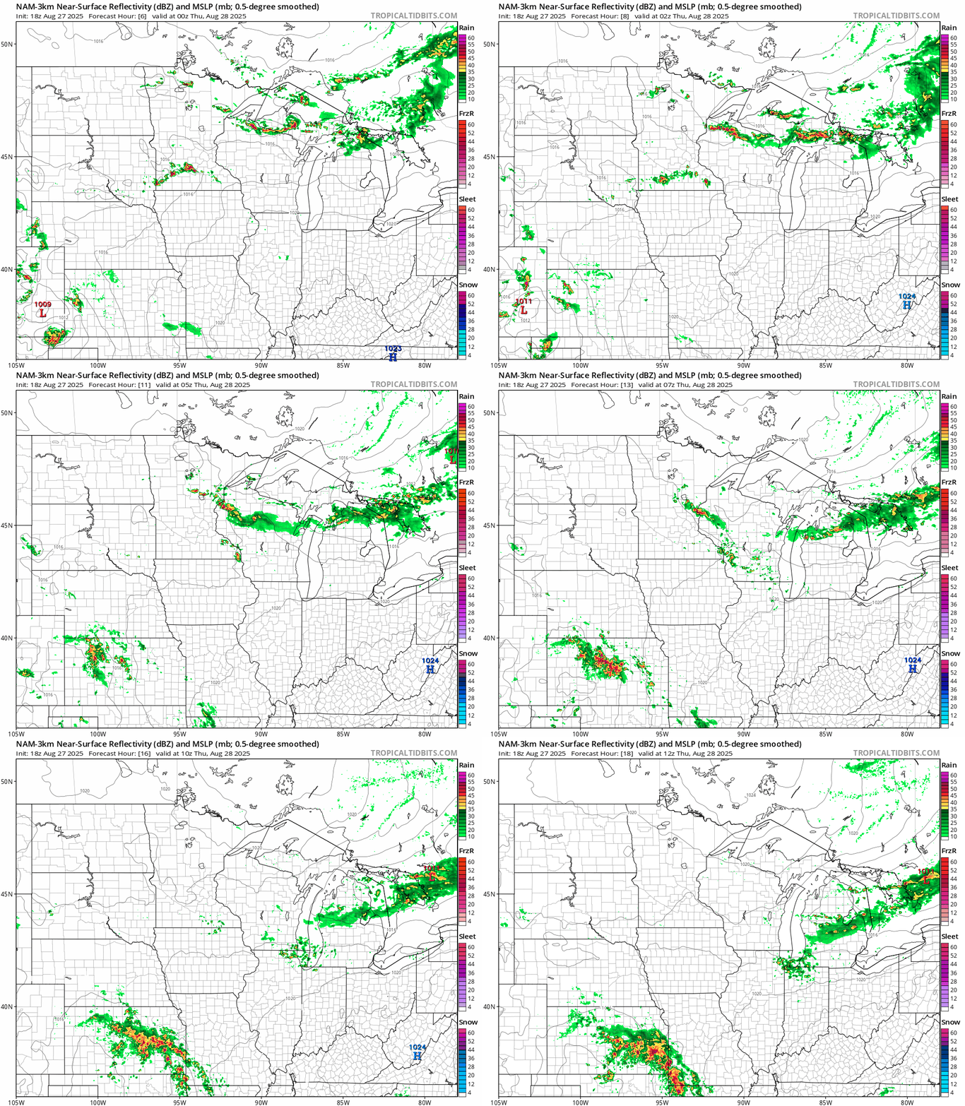
Highs Thursday will continue to run in the 70s for most of Minnesota. It’ll be cooler near your favorite Great Lake.

Look for plenty of sunshine and few rain chances until Labor Day when a few shower chances may arrive. Highs will run in the 70s for most of the upcoming weekend.

Cold front next week
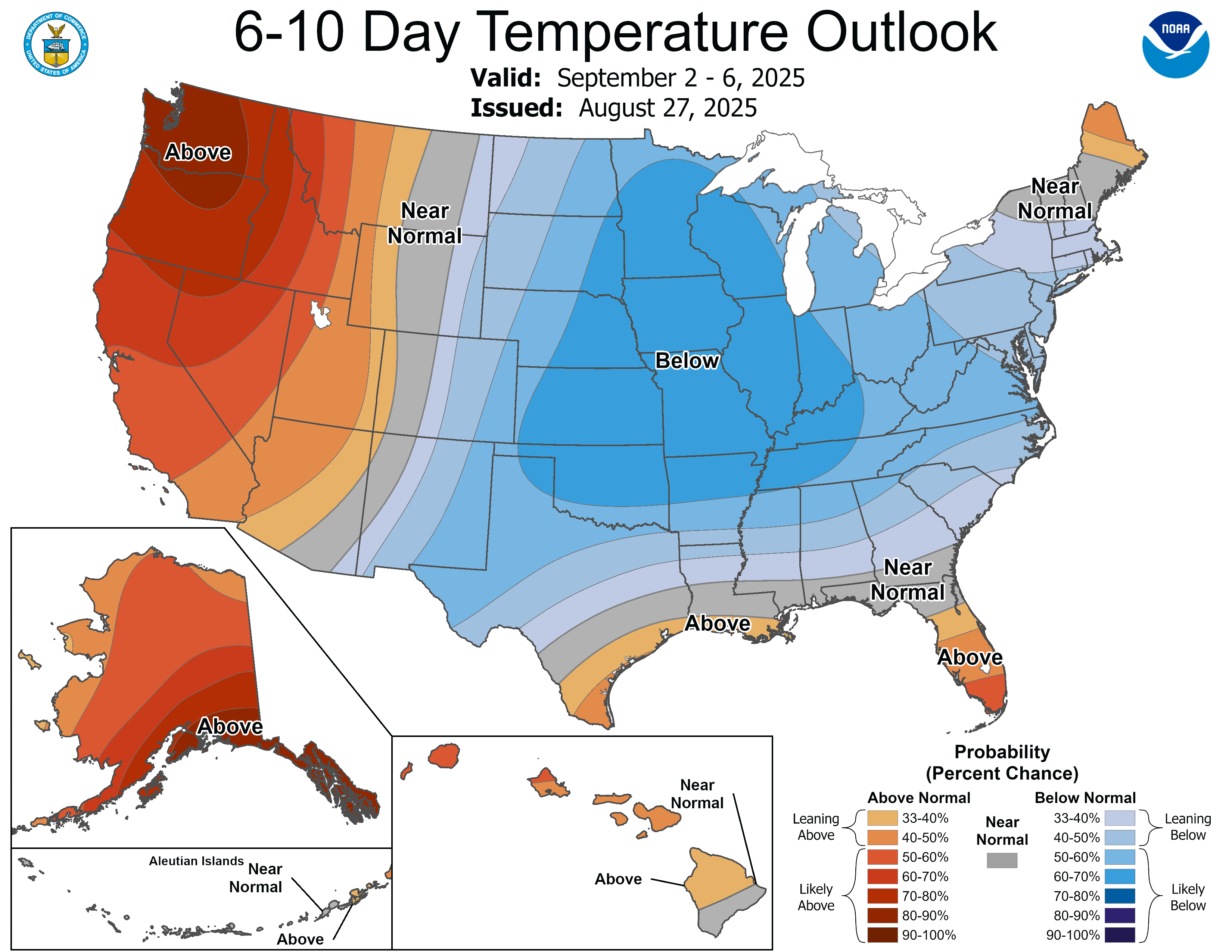
A brisk September cold front looks likely next Tuesday or Wednesday. Highs in the 60s once again, and lows in the 30s north to 40s south look likely by the middle of next week.
Many thanks to the great crowd that came out to the Minnesota State Fair during the noon hour Wednesday to meet the MPR weather team and help us record Climate Cast. Your questions were amazing and your support is appreciated! (I’ll try and have my eyes open next time…)

Turn Up Your Support
MPR News helps you turn down the noise and build shared understanding. Turn up your support for this public resource and keep trusted journalism accessible to all.

