
Showery Tuesday then more summer than September this week
A balmy air mass blows into Minnesota this week.

Go Deeper.
Create an account or log in to save stories.
Like this?
Thanks for liking this story! We have added it to a list of your favorite stories.


It’s a showery Tuesday afternoon across much of southern Minnesota.
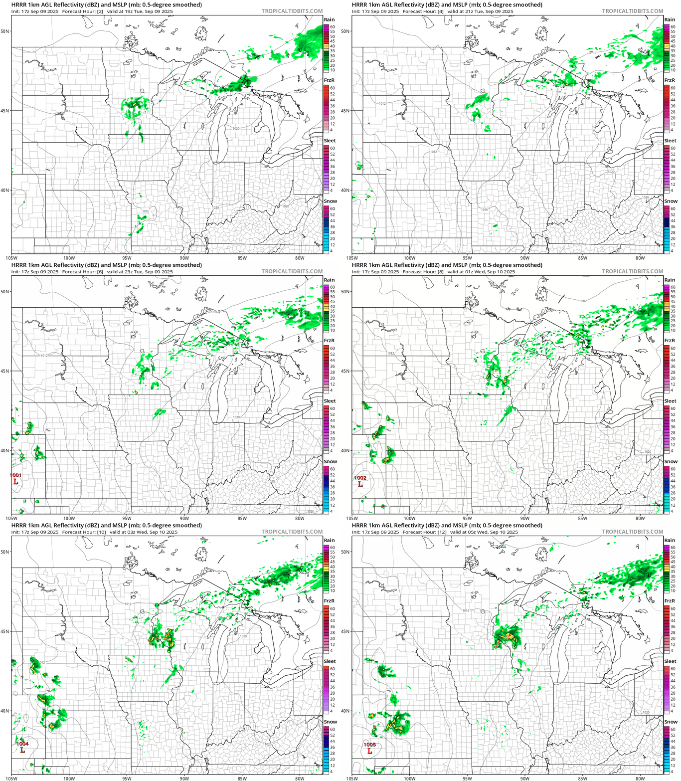
A weak front is sparking scattered showers and a few thunderstorms across the south. NOAA’s HRRR model shows the trend of spotty showers and thundershowers through Tuesday evening. The forecast model loop below runs between 2 p.m. Tuesday and midnight Wednesday.
Wednesday and the rest of the week bring dry skies with more sunshine and warmer temperatures. Highs Wednesday will reach the 70s across most of Minnesota with 60s in the east.

By Friday, temperatures will ramp up back to mid-summer levels. Highs will run well into the 80s in the south and west.

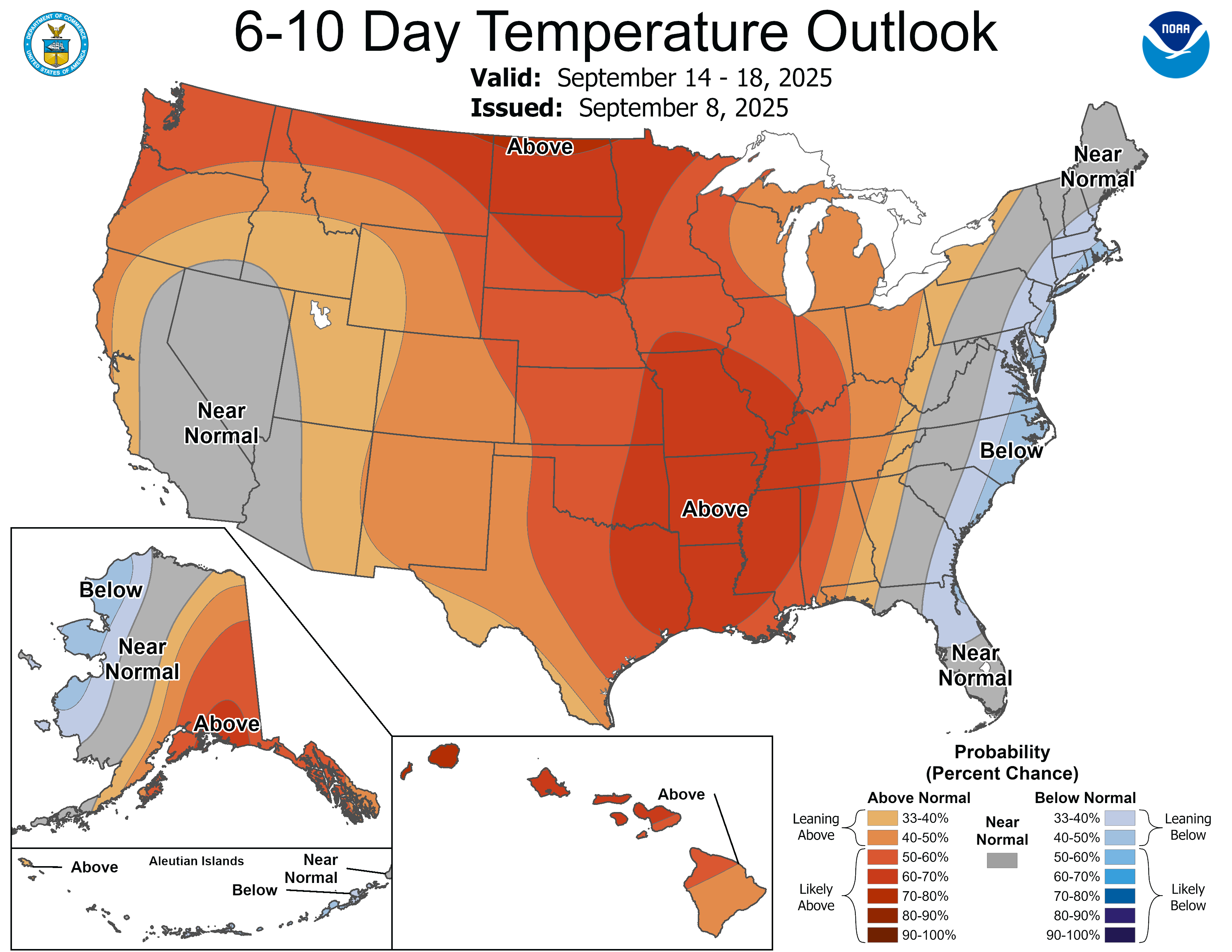
Our warming trend continues through the weekend into next week. NOAA’s temperatures outlooks strongly favor warmer than normal temperatures through most of next week.
Enjoy our summery encore.
Turn Up Your Support
MPR News helps you turn down the noise and build shared understanding. Turn up your support for this public resource and keep trusted journalism accessible to all.

