
Second summer: A string of highs in the 80s ahead
Unseasonably warm weather is ahead for Minnesota into next week.
Go Deeper.
Create an account or log in to save stories.
Like this?
Thanks for liking this story! We have added it to a list of your favorite stories.


We’re entering the middle third of September in Minnesota. The seasons are slowly changing.

This is the time of year when we can see wild temperature swings. Colder air is beginning to pool well to the north in the Arctic regions. Summery air lingers to the south. It’s all about wind direction this time of year when it comes to temperatures in Minnesota. Air masses with wildly different temperature and moisture profiles from different source regions can sweep in at a moment’s notice.

More summer than September
The next week features predominantly southerly winds across our region. That means we’ll milk the remaining balmy and increasingly tropical air masses to our south.
Highs respond into the upper 70s to near 80s by Thursday afternoon across parts of southern and western of Minnesota.
Turn Up Your Support
MPR News helps you turn down the noise and build shared understanding. Turn up your support for this public resource and keep trusted journalism accessible to all.

Right now it looks like 80s will last through the upcoming weekend. This weekend will feel more July than September. Highs will reach the toasty mid to upper 80s across much of southern and western Minnesota this weekend. We could see a few 90-degree temperatures in southwest Minnesota Saturday afternoon.

Rainfall looks spotty the next several days. We may see some foggy mornings. But sunshine will burn off the fog and deliver warmer afternoons.
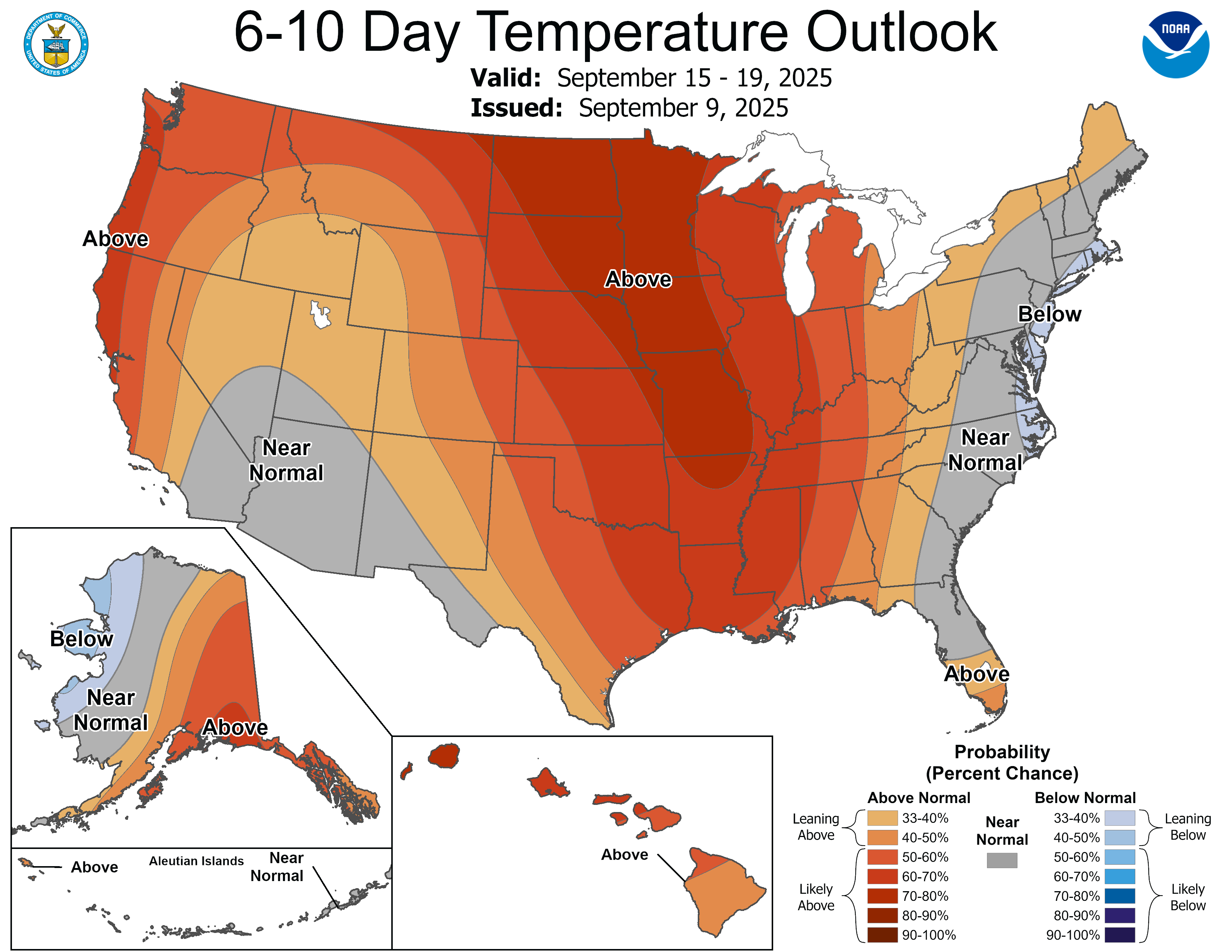
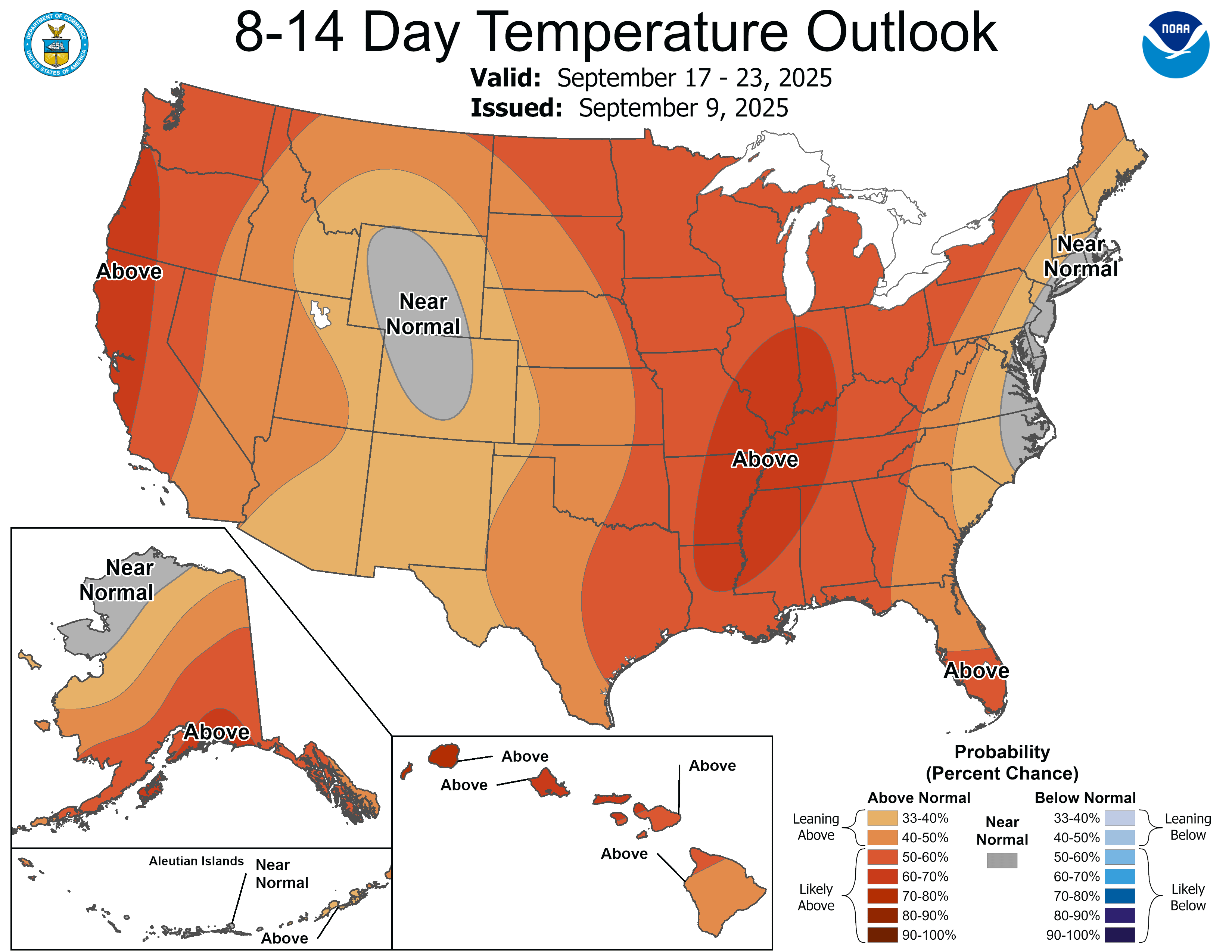
The overall weather pattern still looks warm for most of September. NOAA’s outlooks continue to favor warmer than normal weather through the next 2 weeks.
Enjoy our summer encore. We know it won’t last forever.

