
Aug-tember: Summer sequel this weekend; rainy north overnight into Friday
Temperatures near 90 degrees in southern Minnesota this weekend

Go Deeper.
Create an account or log in to save stories.
Like this?
Thanks for liking this story! We have added it to a list of your favorite stories.


Our well-advertised taste of summer in September is blowing into Minnesota as we approach the upcoming weekend.
Minnesota rides the northern edge of a summery, even tropical air mass to the south. Temperatures reached 80 degrees in much of southwestern Minnesota Thursday afternoon.

This weekend looks unseasonably warm and mainly dry across most of our region. One exception is northern into central Minnesota, where a batch of scattered rain and thunder will cross overnight into Friday.
On the map below, the National Oceanic and Atmospheric Administration’s NAM 3 km model shows the precipitation trend between 10 p.m. Thursday and 10 a.m. Friday.
Turn Up Your Support
MPR News helps you turn down the noise and build shared understanding. Turn up your support for this public resource and keep trusted journalism accessible to all.
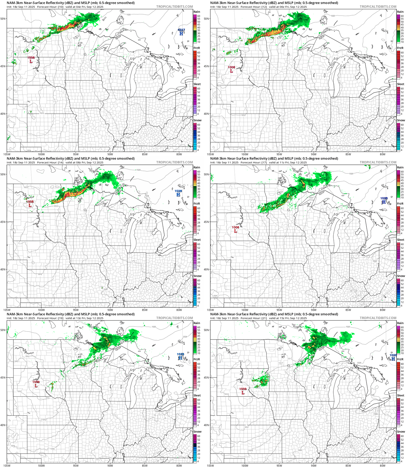
The weekend looks mostly dry with the best chance of a scattered thunderstorm late Sunday night into Monday.
Dense fog northeast
It’s another night of thick fog across northeastern Minnesota and northwestern Wisconsin. A dense fog advisory has been issued once again.

Southern Lake-Southern Cook-Carlton and South St. Louis-Douglas- Including the cities of Grand Marais, Duluth, Two Harbors, Superior, and Silver Bay
126 PM CDT Thu Sep 11 2025
...DENSE FOG ADVISORY IN EFFECT FROM 7 PM THIS EVENING TO 10 AM CDT FRIDAY...
* WHAT...Visibility less around one quarter mile in dense fog.
* WHERE...In Minnesota, Carlton, South St. Louis, Southern Cook and Southern Lake Counties. In Wisconsin, Douglas County. This includes the Tribal Lands of the Grand Portage Reservation and the Fond du Lac Band.
* WHEN...From 7 PM this evening to 10 AM CDT Friday.
* IMPACTS...Low visibility could make driving conditions hazardous.
* ADDITIONAL DETAILS...In Douglas County, the most widespread dense fog is expected in the northern areas of the county.
Another shot at 90 degrees?
The warmest part of our inbound air mass arrives Friday through the upcoming weekend. Friday features temperatures into the 80s once again.

Saturday looks even warmer with highs near 90 in the south.

Sunday looks like another beautiful summery day with highs again well into the upper 80s to near 90 degrees in the south. Cooler near your favorite Great Lake.

The normal high and low temperatures this weekend for the Twin Cities are 74 and 56.
Right now, it looks like the warmth will linger well into next week.
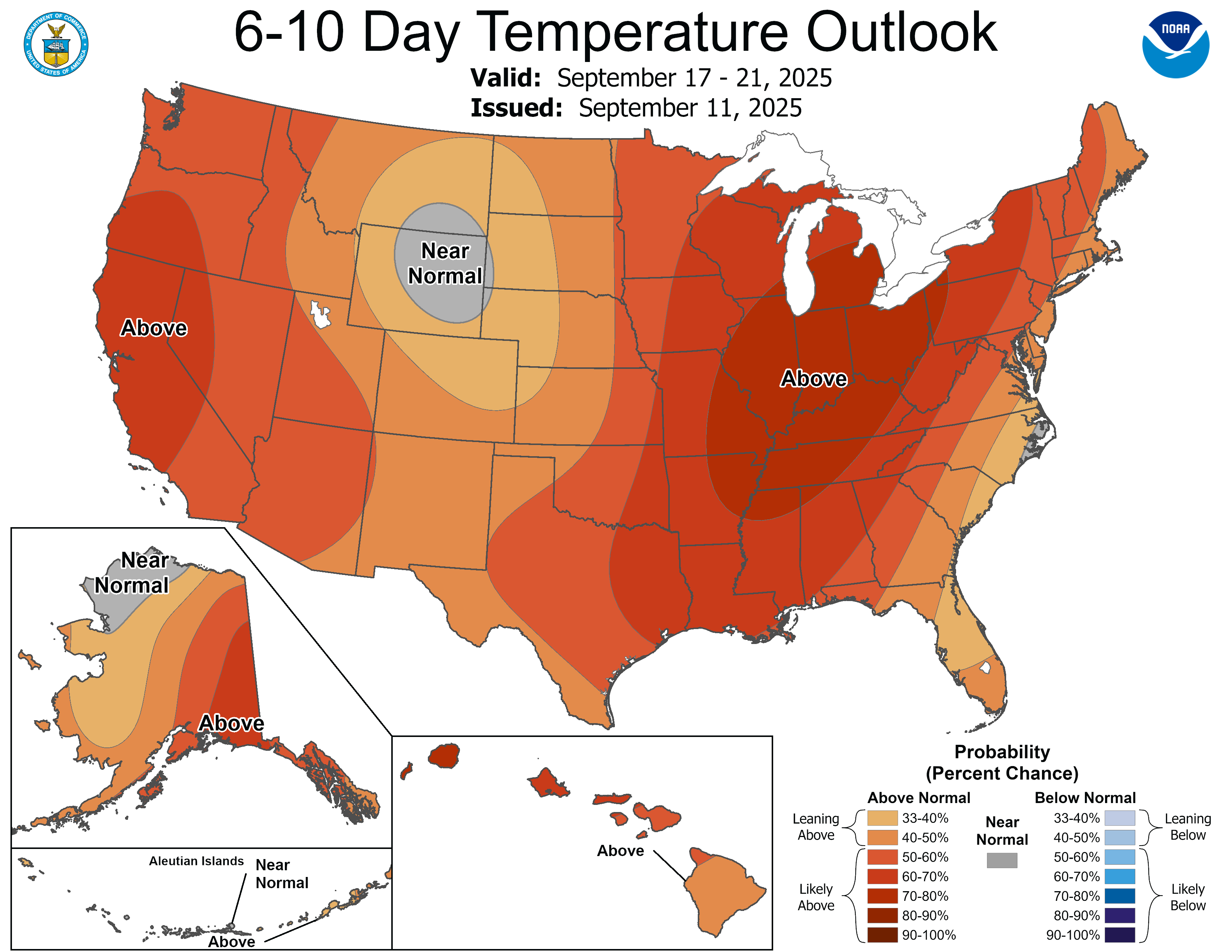
Forecast models suggest a better chance for scattered rain and thunder as next week evolves.
Stay tuned.

