
Lingering summer: Highs in the 80s possible into early October
Temps 10-15 degrees warmer than normal likely into most of next week

Go Deeper.
Create an account or log in to save stories.
Like this?
Thanks for liking this story! We have added it to a list of your favorite stories.


Swimming in October anyone?
Our unseasonably warm weather pattern looks likely to persist into at least the first week of October this year.
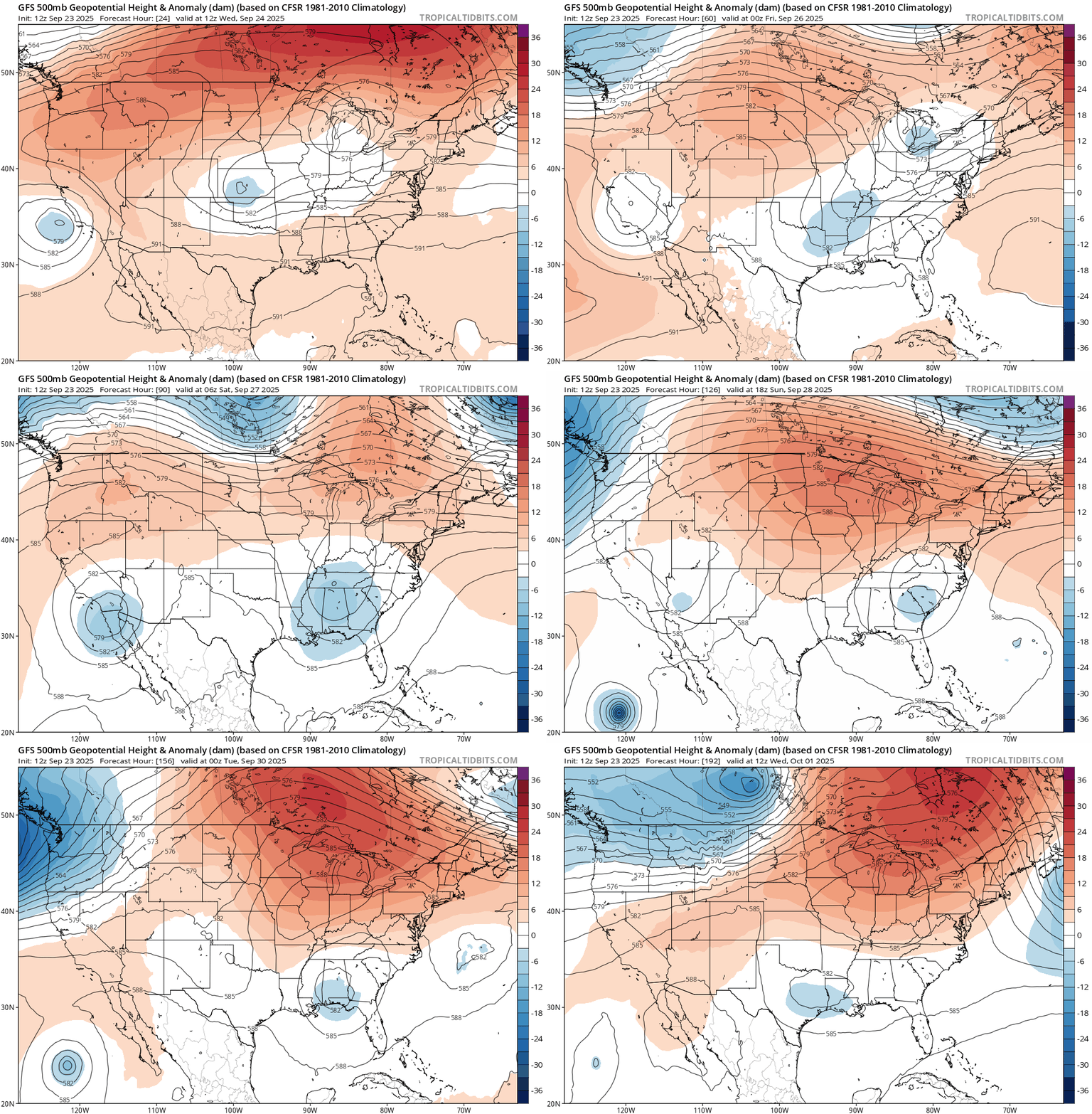
A persistent ridge of warmer-than-normal high pressure is building across the Upper Midwest for the next one to two weeks.
On the map below, the National Oceanic and Atmospheric Administration’s Global Forecast System model shows the trend through the first days of October.
Turn Up Your Support
MPR News helps you turn down the noise and build shared understanding. Turn up your support for this public resource and keep trusted journalism accessible to all.
Wednesday brings another morning of patchy fog to Minnesota with highs in the 70s to around 80 degrees in the west.

Sunshine will be abundant this week. By Friday, highs will pump into the 80s across more of Minnesota.

Early October warmth ahead
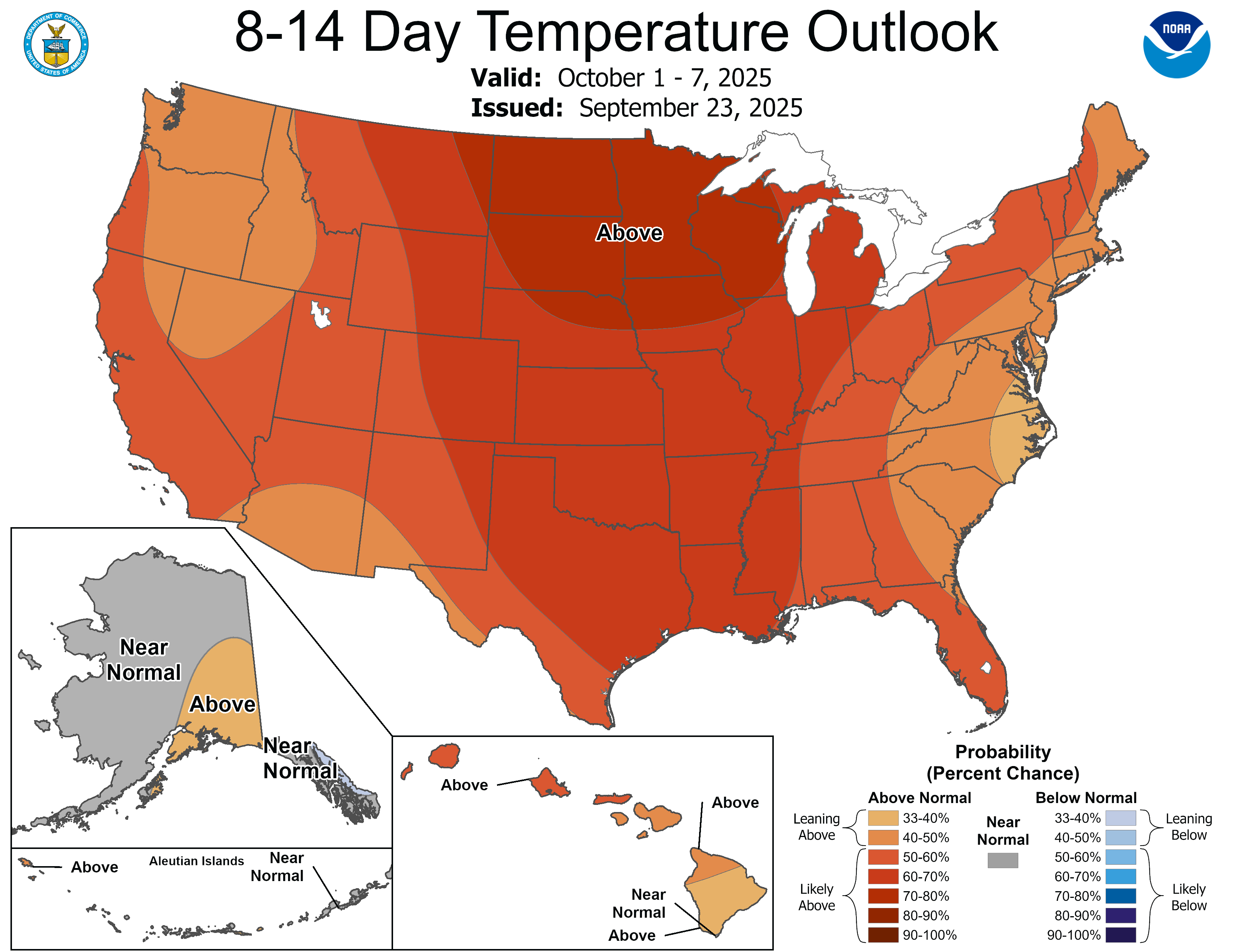
All indications at this point suggest next week could be even warmer than this week in much of Minnesota. Highs in the 80s look persistent around much of Minnesota next week.

Right now the medium-range forecast models don’t show a sharp cold front through the first week of October.
But it’s coming. Eventually.
Stay tuned.

