
Weather winning streak continues into next week
Highs in the 80s for most of southern Minnesota into much of next week

Go Deeper.
Create an account or log in to save stories.
Like this?
Thanks for liking this story! We have added it to a list of your favorite stories.


It’s an extended September summer for Minnesota again for the third straight year.
Last September was the warmest on record for Minnesota. The Twin Cities was about 7 degrees warmer than normal last September. And 2023 was the second warmest on record.
This month it looks like we’ll land in the top 10 and possibly top 5 warmest Septembers on record by the end of the month next Tuesday.
A weak cool front will trim temperatures across northern Minnesota Friday. But highs into the 80s will still linger in the south.
Turn Up Your Support
MPR News helps you turn down the noise and build shared understanding. Turn up your support for this public resource and keep trusted journalism accessible to all.

The next several days will be around 10 to 15 degrees warmer than normal across most of Minnesota. Highs will soar well into the 80s again south by the upcoming weekend.

Next week looks warm again.
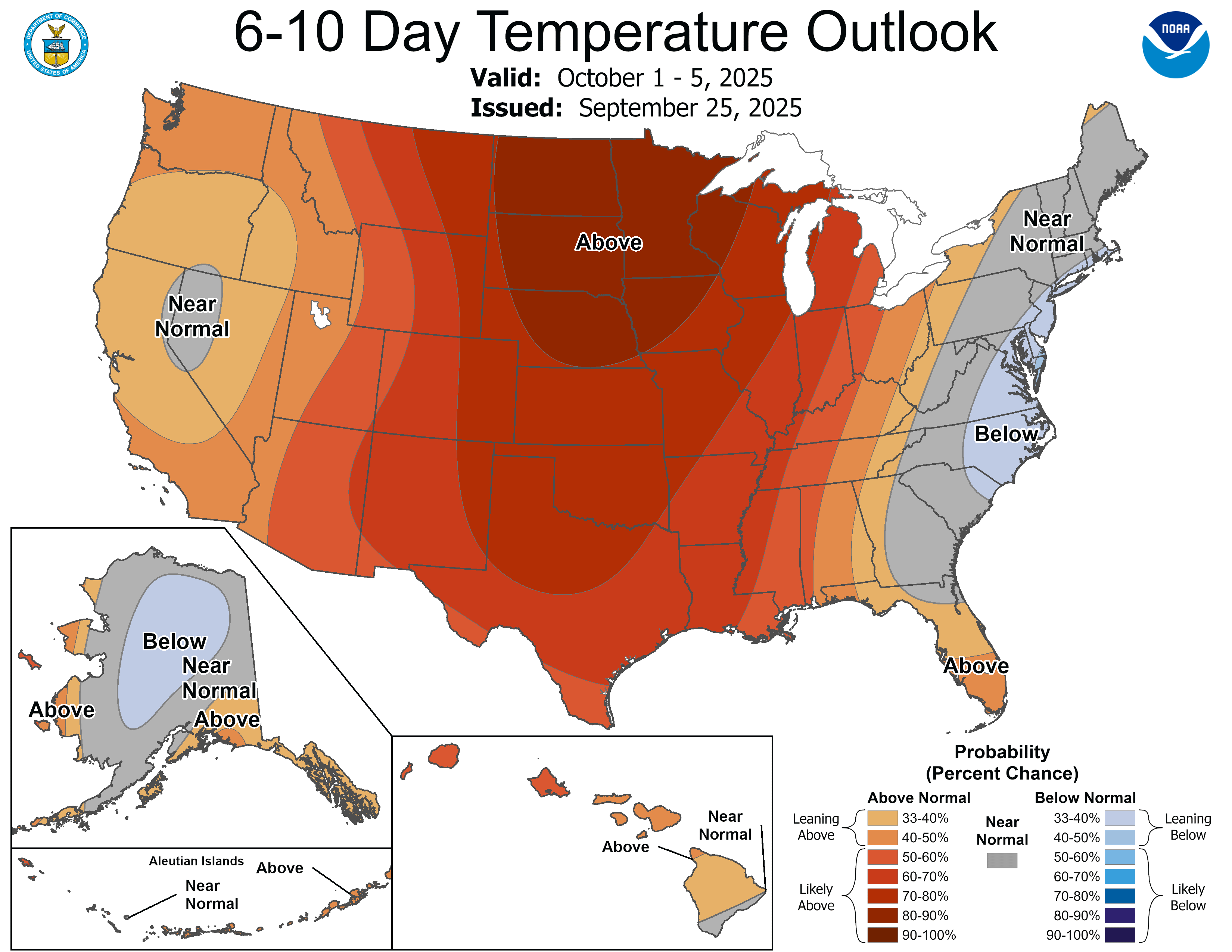
Highs remain in the 80s in the south and west right through next Thursday.

Cold front late next week?
There are finally signs of a fall-like cold front by the first weekend in October.
The National Oceanic and Atmospheric Administration’s Global Forecast System model is in line the the European Centre for Medium-Range Weather Forecasts model bringing rain and colder temperatures the weekend of Oct. 4-5.
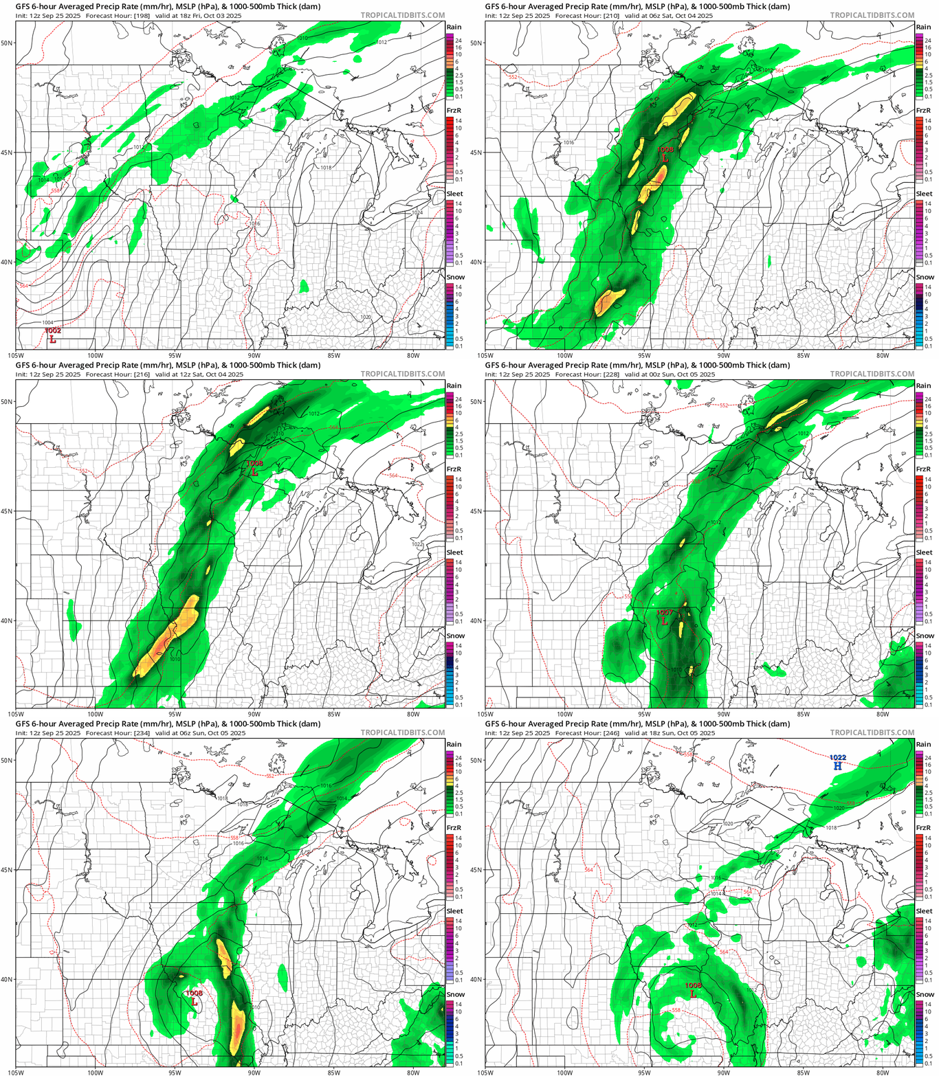
Highs behind the front favor 60s across much of Minnesota with some 50s in the north.
So enjoy our summery run through most of next week!

