
Summery encore lasts into early October
Record level warmth Monday with highs in the 90s in western Minnesota

Go Deeper.
Create an account or log in to save stories.
Like this?
Thanks for liking this story! We have added it to a list of your favorite stories.


Summer lovers are thrilled this week. A July-like air mass lingers over Minnesota for the rest of the week into the first days of October.
Minnesota is riding the edge of a record warm thermal ridge that’s yielded temperatures into the 90s across parts of the Dakotas and western Minnesota Monday afternoon.

Our unseasonably toasty air mass persists this week. Days will feature plenty of sun with a few clouds drifting overhead from time to time. Highs will run well into the 80s once again Tuesday across much of our state.

The warmest days this week will be Thursday and Friday. Highs will hit the 90s once again in the south and west with temperatures approaching the 90-degree mark as far east as the western Twin Cities.
Turn Up Your Support
MPR News helps you turn down the noise and build shared understanding. Turn up your support for this public resource and keep trusted journalism accessible to all.

Weekend rain chances
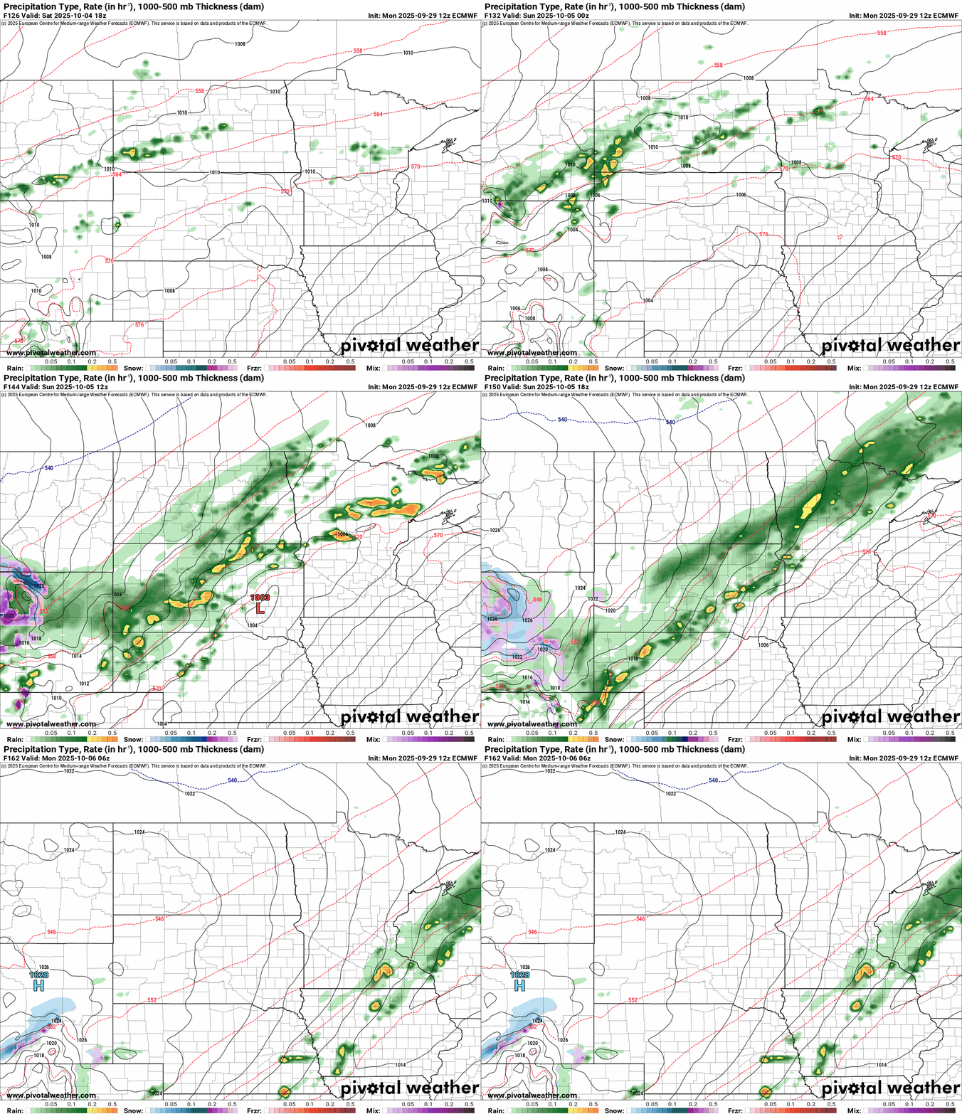
The weekend brings a slowly moving cold front to Minnesota. Right now, forecast models favor the front with scattered showers and thunderstorms in northern and central Minnesota Saturday, drifting south into southern Minnesota Sunday.
On the map below, the European Centre for Medium-Range Weather Forecasts model shows this progression of thundershowers Saturday and Sunday.
Colder next week
Most forecasts models push much colder air into Minnesota next week. Right now highs in the 50s north and 60s south seem most likely next week.

But there are some hints that the colder air may not make as big a push as currently favored by forecast model which tend to keep pushing systems east and south this time of year. In stuck weather patterns like our current scenario, sometimes the cold push can be delayed or weaker then forecast models currently suggest.
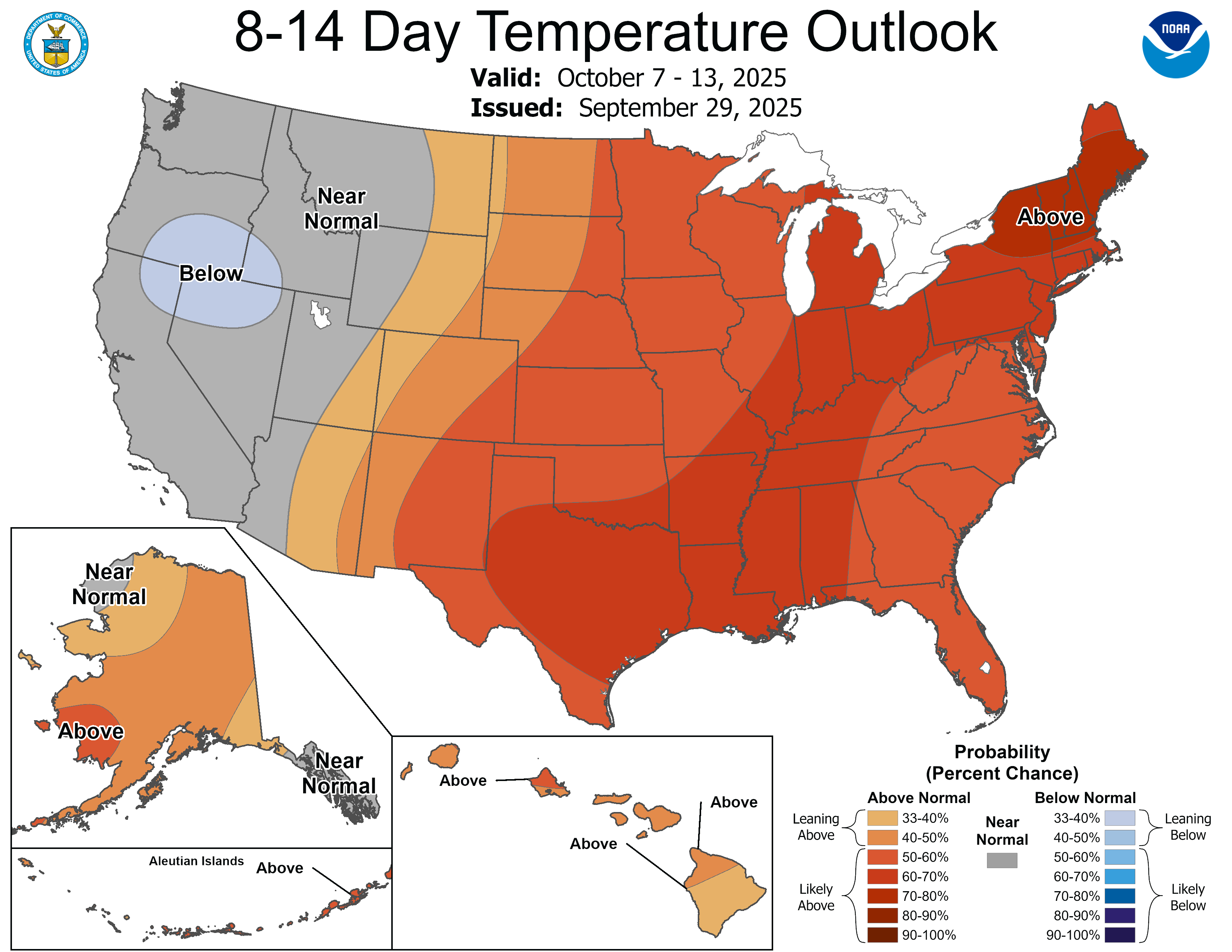
The National Oceanic and Atmospheric Administration’s outlooks while cooler still favor warmer-than-normal temperatures overall in the next couple of weeks.
Stay tuned.

