
Highs in the 70s return Thursday and Friday in the south
A couple milder days ahead then cooler into the upcoming weekend

Go Deeper.
Create an account or log in to save stories.
Like this?
Thanks for liking this story! We have added it to a list of your favorite stories.


We get one more shot at 70 degrees in the Twin Cities and southern Minnesota Thursday and Friday.
The seasonal weather change is clearly evident on the weather maps this week. On the map below, see how Minnesota is perched at the top of a lingering summery warm dome to the south Wednesday afternoon? It’s in the 70s in Iowa with toasty 80s into Nebraska and Kansas.

That warm front will nudge into Minnesota Thursday. The 70s won’t push as far north as in recent weeks, but southwestern Minnesota will rise into the 70s Thursday. (See the map at the top of the post.)
The milder air shifts eastward Friday. The Twin Cities will pass 70 degrees Friday along with much of southeastern Minnesota.
Turn Up Your Support
MPR News helps you turn down the noise and build shared understanding. Turn up your support for this public resource and keep trusted journalism accessible to all.

A few brief rain showers may ride through especially early Friday, but it doesn’t look like we’ll see anything like the soaking rain we got this week in the south.
Cooler weekend ahead
Northwest flow returns to Minnesota this upcoming weekend. Watch on the map below how temperatures hover in the 60s Saturday then crash into the 50s with some 40s north by Sunday.
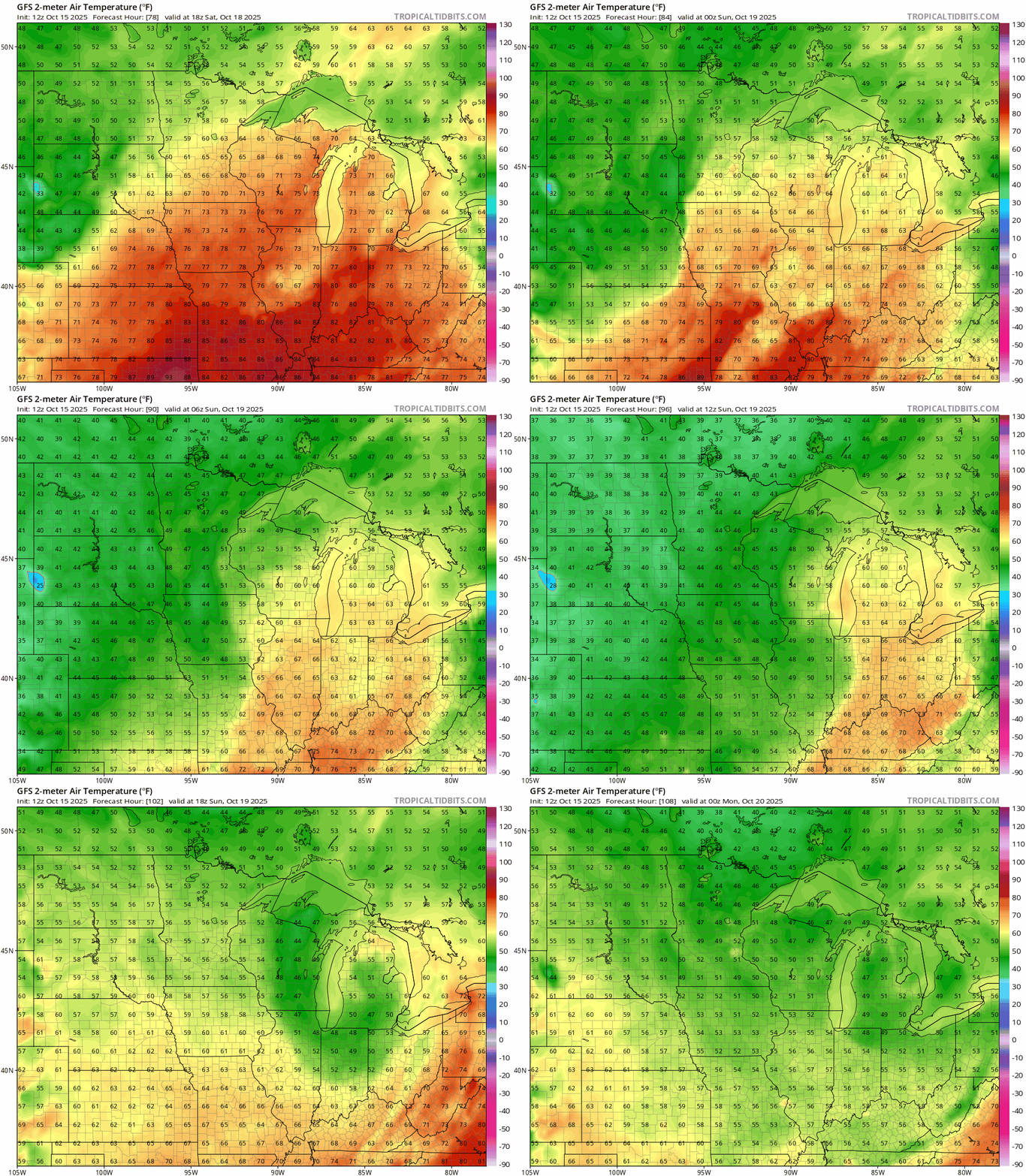
Sunday also looks windy and blustery.
Next week looks seasonably cool, and I’m seeing signs of colder temperatures in the 30s as we head into Halloween week.
Stay tuned.

