
Seasonal outlooks trending colder and snowier heading into winter
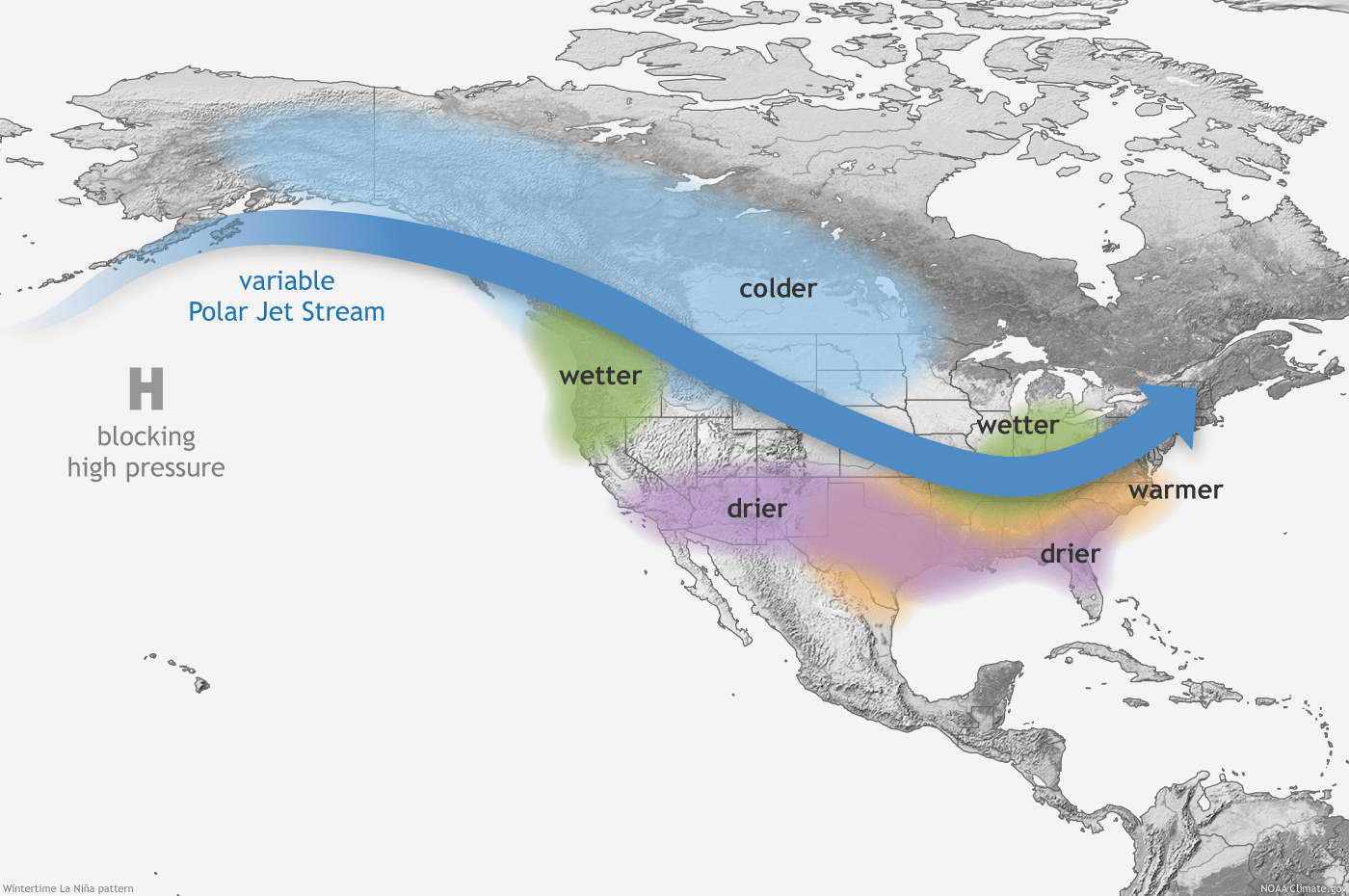
It's beginning to look a lot like a La Niña winter pattern.
Go Deeper.
Create an account or log in to save stories.
Like this?
Thanks for liking this story! We have added it to a list of your favorite stories.


Tuesday’s blustery chill left no doubt that we’re heading into late October in Minnesota. And it could be the start of a La Niña-driven weather pattern that may dominate most of the upcoming winter season.
Water temperatures in the tropical Pacific Ocean are cooling. You can see the start of that trend in this animation of sea surface temperature anomalies (differences from normal) off the coast of South America over the past several weeks.
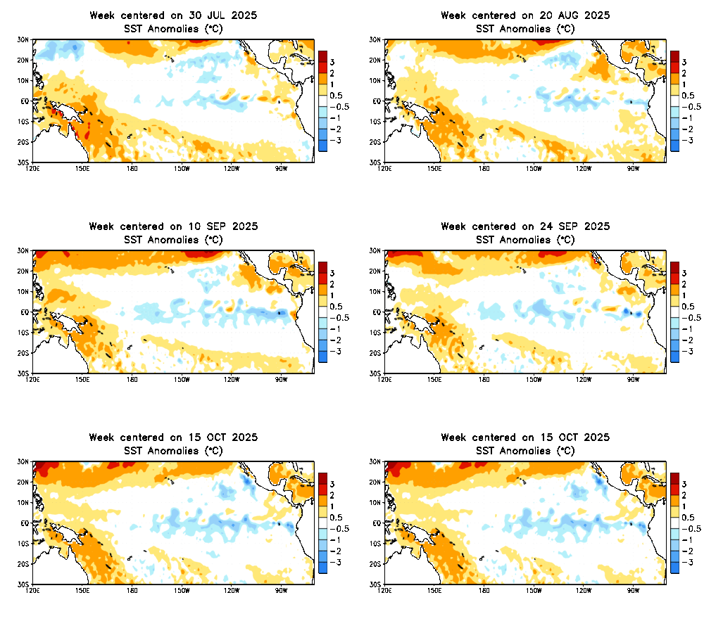
NOAA’s Climate Prediction Center has identified the presence of La Niña conditions and is forecasting La Niña to persist into the upcoming winter season.
For Minnesota and the Upper Midwest, La Niña produces colder than normal temperatures in about 70 percent of winters, historically.
Turn Up Your Support
MPR News helps you turn down the noise and build shared understanding. Turn up your support for this public resource and keep trusted journalism accessible to all.
NOAA’s latest 90-day temperature outlook released Tuesday shows equal chances of above and below normal temperatures from November through January.
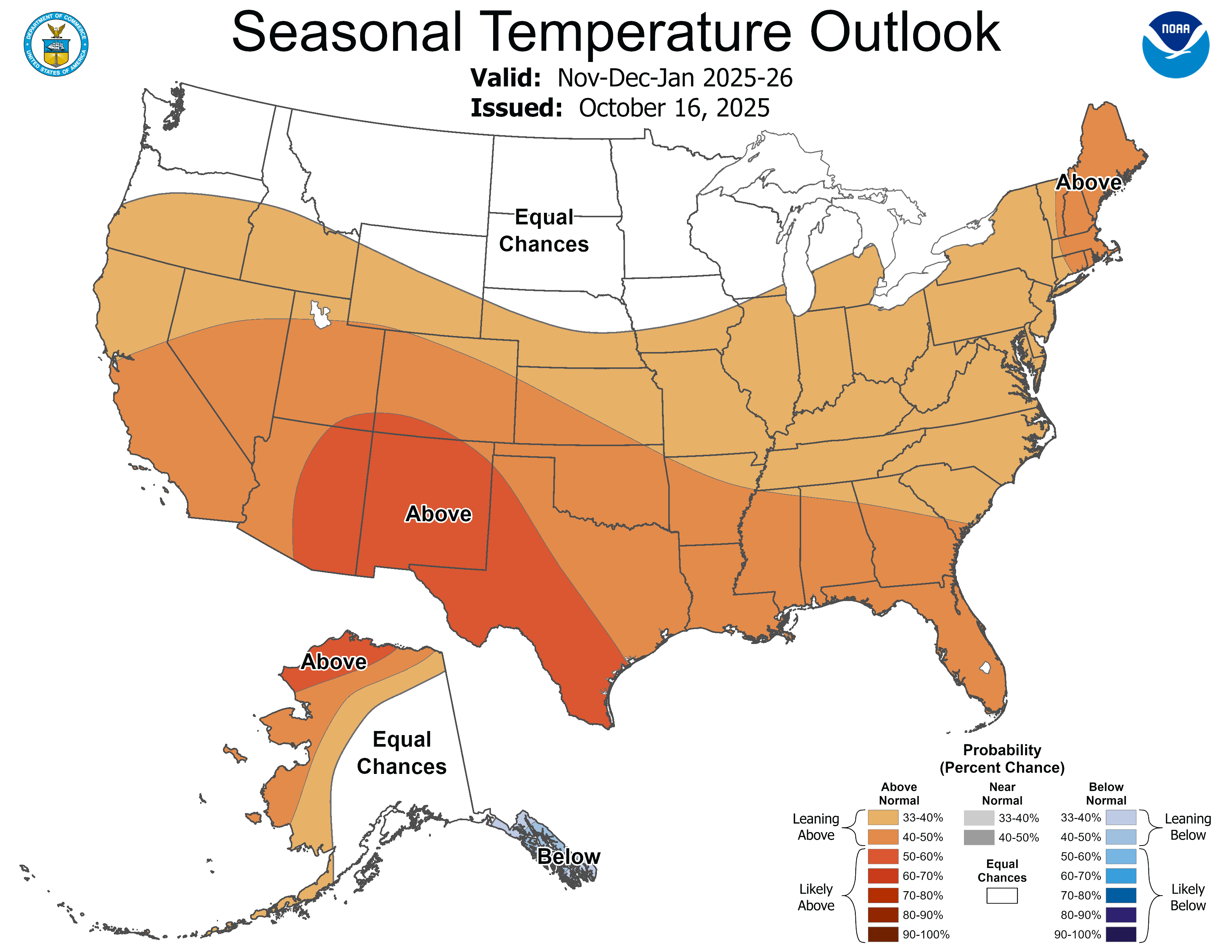
That’s a change from outlooks that have (accurately) predicted warmer than normal temperatures in our region for the past few months.
NOAA’s precipitation outlook now slightly favors wetter than normal conditions from November through January.
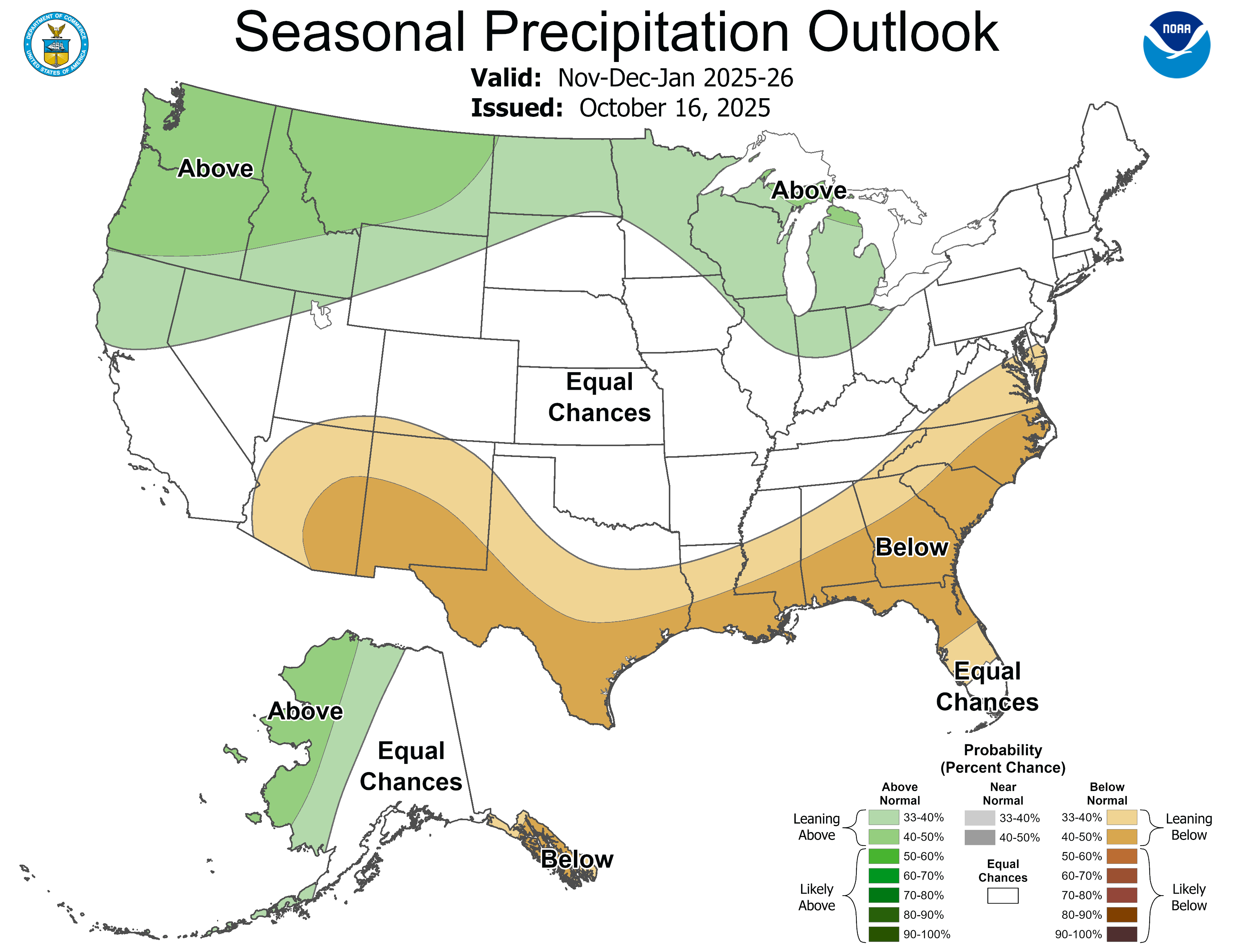
So it’s looking quite possible that our 2025-26 snow season gets off to a good start as we head into the next couple months.

Stay tuned.

