
Mild for now but trending wintry this weekend
Colder weather and snow chances on the way by Saturday

Go Deeper.
Create an account or log in to save stories.
Like this?
Thanks for liking this story! We have added it to a list of your favorite stories.


Fall 2025 has been kind to Minnesota, so far. September and October temperatures ran 4 to 5 degrees warmer than normal across Minnesota. And the past 30 days have continued the warmer than normal trend this fall.

But November is a month of change in Minnesota. Each cold front gets successively colder. And the warmups in between are not quite as balmy as the last.
We’re still basking in temperatures in the 50s in the south and 40s north as we move through midweek.

Weekend clipper ahead
Northwest flow on the weather maps this time of year brings colder temperatures and rain or snow chances. I’m still watching a clipper that is heading for the Upper Midwest Saturday.
Turn Up Your Support
MPR News helps you turn down the noise and build shared understanding. Turn up your support for this public resource and keep trusted journalism accessible to all.
The latest forecast model consensus drives the bulk of the clipper’s precipitation through southwestern Minnesota into Iowa Saturday. There’s a chance of rain or snow showers on the system’s north side near the Twin Cities
The best chance for some lighter accumulating snow favors southwestern Minnesota eastward along the Interstate 90 corridor into Iowa.
The National Oceanic and Atmospheric Administration’s Global Forecast System model run below is similar to the European Centre for Medium-Range Weather Forecasts and other models that drag some snow through southern Minnesota Saturday.
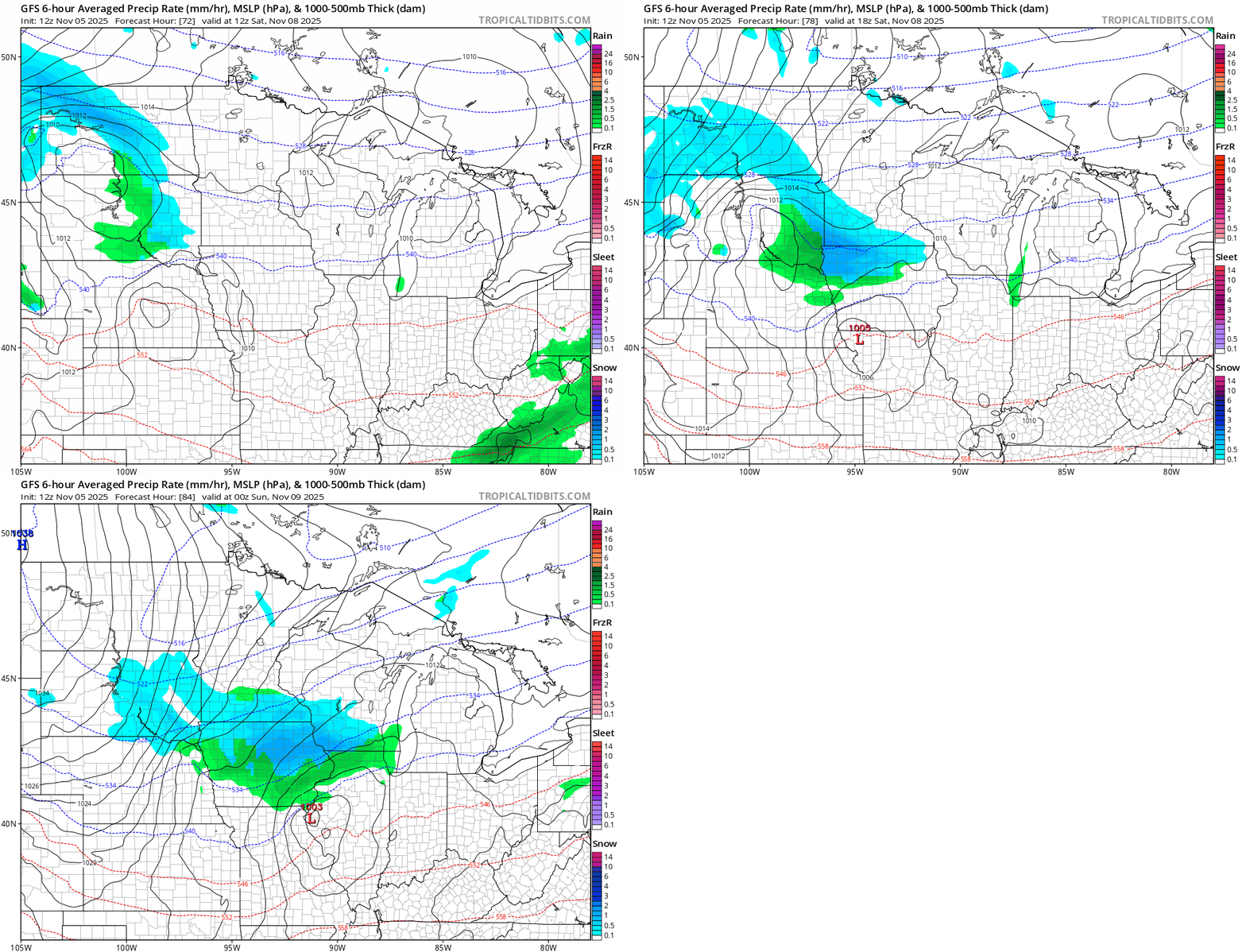
Light snowfall accumulations are possible Saturday in southern Minnesota with some possibly heavier totals in Iowa.

Temperatures this weekend will feel wintry around our region. Lows will dip into the 20s south and teens north. Highs will hover in the 30s!

There are signs we’ll moderate again next week with highs returning to the 50s in southern Minnesota. So this weekend’s wintry temperatures are not here to stay just yet.
Stay tuned.

