Saturday clipper brings rain and snow chances
Rain, snow showers Thursday in northern Minnesota; wintry mix Saturday in southern Minnesota

Go Deeper.
Create an account or log in to save stories.
Like this?
Thanks for liking this story! We have added it to a list of your favorite stories.


It’s that time of year in Minnesota. Our colorful fall leaf show is mostly on the ground now. Sunny days bring cooler breezes and less warmth, and the weather maps are moving faster and trending colder.
A weak system spins through northern Minnesota Thursday. Rain and snow showers will ride along the Canadian border in the far north.
In the south a windy Thursday will feel colder than the thermometer’s advertised afternoon temperatures in the lower 50s.

Then get ready for the coldest weekend of the fall season so far.
Turn Up Your Support
MPR News helps you turn down the noise and build shared understanding. Turn up your support for this public resource and keep trusted journalism accessible to all.
Wintry clipper this weekend
Saturday brings the first real Alberta clipper-type storm to Minnesota. The forecast models continue to favor a southern storm track. That would drive the main precipitation shield across southwestern and southern Minnesota along the Interstate 90 corridor towns.
On the map below, the European Centre for Medium-Range Weather Forecasts model shows Saturday’s southward storm track.
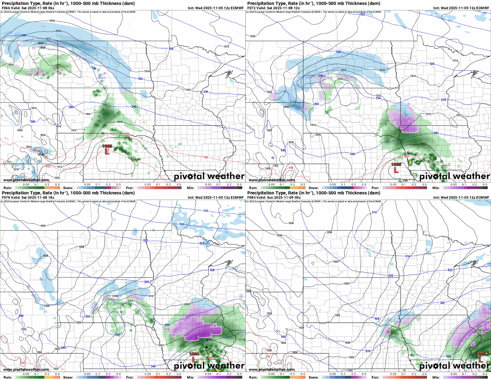
In this scenario snowfall accumulations will be mostly light in southern Minnesota.
On the map below, check out the National Oceanic and Atmospheric Administration’s Global Forecast System model snowfall output through Saturday.
You can see light snow accumulations in far northern Minnesota from Thursday’s system, and Saturday’s potential for some accumulation favoring northwestern Iowa.

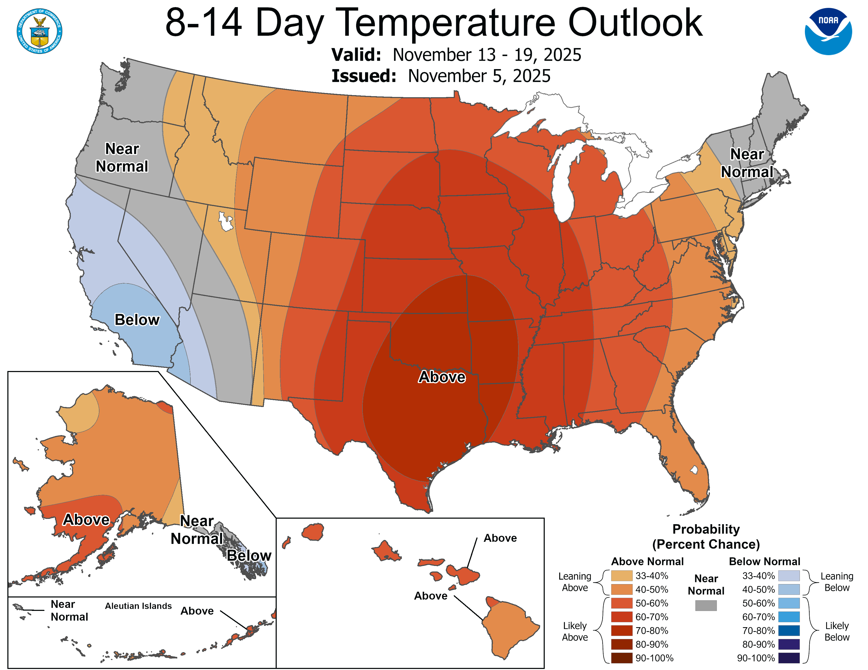
NOAA’s Global Forecast System model tracks the frigid temperature trends this upcoming weekend, but note on the map below how considerably milder temperatures slide northward into Minnesota next week with highs returning to the 50s in the south.
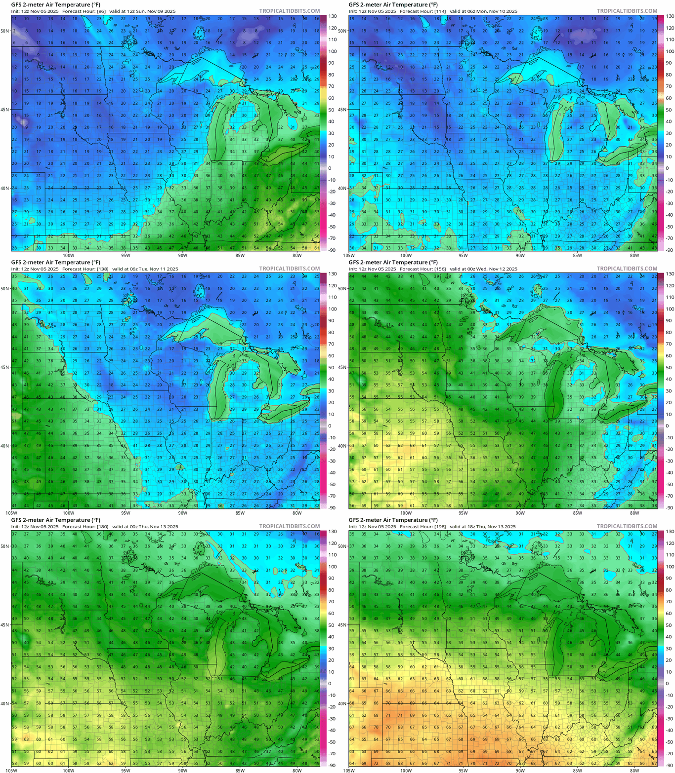
So it looks like we’re not falling off the seasonal temperature cliff for good just yet.