
Clippers taking aim at parts of Minnesota; some snow ahead
Snowflakes to fly near Canadian, Iowa borders in the coming days

Go Deeper.
Create an account or log in to save stories.
Like this?
Thanks for liking this story! We have added it to a list of your favorite stories.


Welcome to Alberta clipper season in Minnesota.
These fast-moving low pressure systems race southeast through the Upper Midwest from the Canadian province of Alberta in the cold season. Typically, they bring a quick shot of snow then wintry winds behind the system.

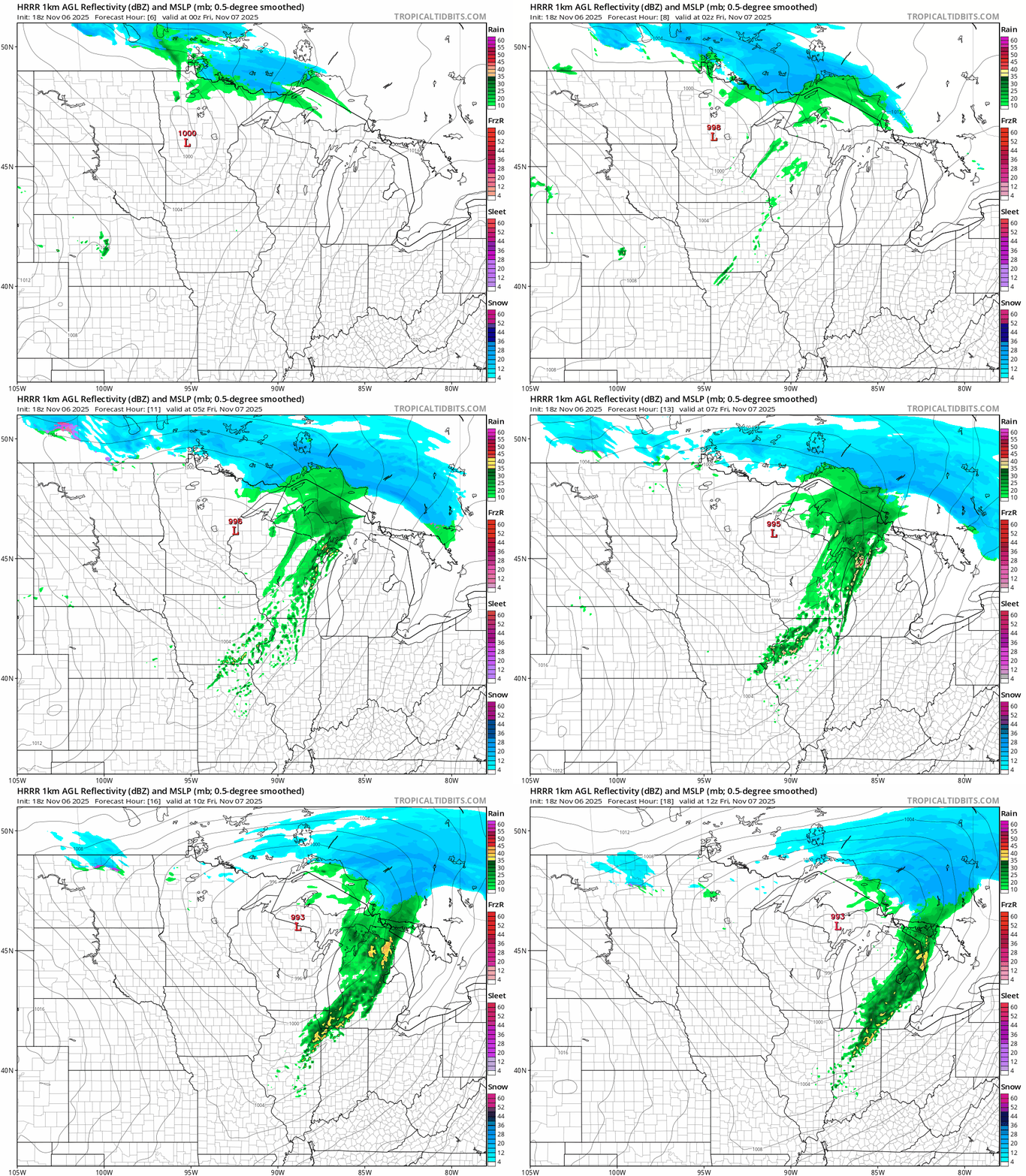
Our first clipper grazes northern Minnesota through Friday. Rain and snow mix overnight and snow will likely leave a light coating especially near the Canadian border.
On the map below, the National Oceanic and Atmospheric Administration’s High-Resolution Rapid Refresh model shows the system with a rain-snow mix in the north overnight into Friday morning.
Turn Up Your Support
MPR News helps you turn down the noise and build shared understanding. Turn up your support for this public resource and keep trusted journalism accessible to all.
Highs Friday will be colder than recent days as a November chill settles in.

Saturday clipper
Forecast models Thursday have slowed down the next clipper that’s aiming for southern Minnesota.
The latest forecast runs bring the system through the south on Saturday. It still looks like we’ll see the most significant snow along the Interstate 90 corridor southward into northern Iowa.
NOAA’s FV3 model shows snow busting out in southwestern Minnesota by 6 a.m. Saturday then spreading east through the day. The forecast model loop below runs between 6 a.m. and 6 p.m. Saturday.

We could see a few inches of slushy accumulations in southern Minnesota into northern Iowa with Saturday’s system. If you are planning travel into northern Iowa Saturday, expect some periods of heavier snow with reduced visibility and possible slick roads.
Here’s NOAA’s Global Forecast System model snowfall output including both the northern and southern systems through Saturday:

Frigid weekend ahead
Saturday’s clipper drags the coldest air mass of the season in tow for Minnesota this weekend.
Highs Saturday and Sunday will run in the 30s.

Sunday morning will bring temperatures in the teens to much of Minnesota. Welcome to unattractive colors on the weather maps we haven’t seen in months.

It looks like temperatures will rebound into the 50s in southern Minnesota by the middle of next week.


