
Saturday clipper south; frigid weekend ahead
Snow Saturday along the Iowa border; season's coldest weekend so far

Go Deeper.
Create an account or log in to save stories.
Like this?
Thanks for liking this story! We have added it to a list of your favorite stories.


Our next Alberta clipper sails through southern Minnesota this weekend.
The system brings snow to the eastern Dakotas and southwestern Minnesota by early Saturday morning. Light snow will spread across the Interstate 90 corridor and parts of southern Minnesota through midday Saturday.
On the map below, the National Oceanic and Atmospheric Administration’s High-Resolution Rapid Refresh model shows the likely (mostly light) snow zone Saturday.
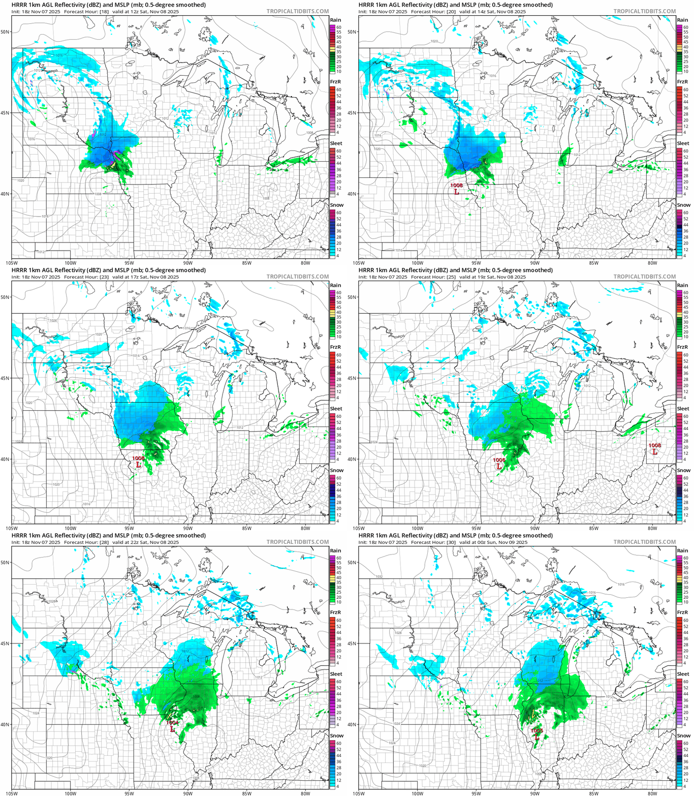
Any snowfall accumulations favor mainly a light coating across southern Minnesota near the Iowa border. A few inches may briefly accumulate in Iowa Saturday.
Turn Up Your Support
MPR News helps you turn down the noise and build shared understanding. Turn up your support for this public resource and keep trusted journalism accessible to all.

This doesn’t look like a significant snowfall event for our region, but it’s a preview of coming winter attractions.
Frigid weekend ahead
This will be the coldest weekend of the fall season so far for Minnesota. Highs Saturday and Sunday will hover in the 30s.

Overnight lows by Sunday morning will plunge into the teens across most of Minnesota with lower 20s in the Twin Cities area.

Next week looks mainly dry and gradually milder. Temperatures will rebound into the low 50s in the south by the middle of next week.

The European Centre for Medium-Range Weather Forecasts model hints at 60 degrees again in southern Minnesota by next Saturday, Nov. 15.

Stay tuned.

