
Warming trend: Temperatures heading for the 50s once again this week
Milder air mass gradually blows into Minnesota this week

Go Deeper.
Create an account or log in to save stories.
Like this?
Thanks for liking this story! We have added it to a list of your favorite stories.


We’ve endured the first significant cold and some snow across parts of Minnesota over the weekend. Saturday’s clipper dropped anywhere from 2 to 5 inches of snow from southwestern Minnesota through eastern South Dakota and northwestern Iowa!

Snowfall also came down in northeastern Minnesota and heavier lake-effect snows hit the south shore of Lake Superior.

Temperatures dropped into the teens this weekend across most of Minnesota. We’ll see a few snow showers overnight especially north of the Twin Cities as a warm front pushes through into Tuesday morning.
Highs Tuesday will recover into the low 50s south with 40s across most of Minnesota.

Temperatures will continue to rise gradually this week. Highs by Friday and Saturday will bubble up into the 60s in the south. We could hit 60 degrees even in the Twin Cities by Friday or Saturday afternoon.

Right now, I don’t see any big November snowstorms on the forecast models for at least the next week or so. Next week also looks likely to be milder than normal across our region. The normal high and low temperatures by next Monday for the Twin Cities are 41 and 27 degrees.
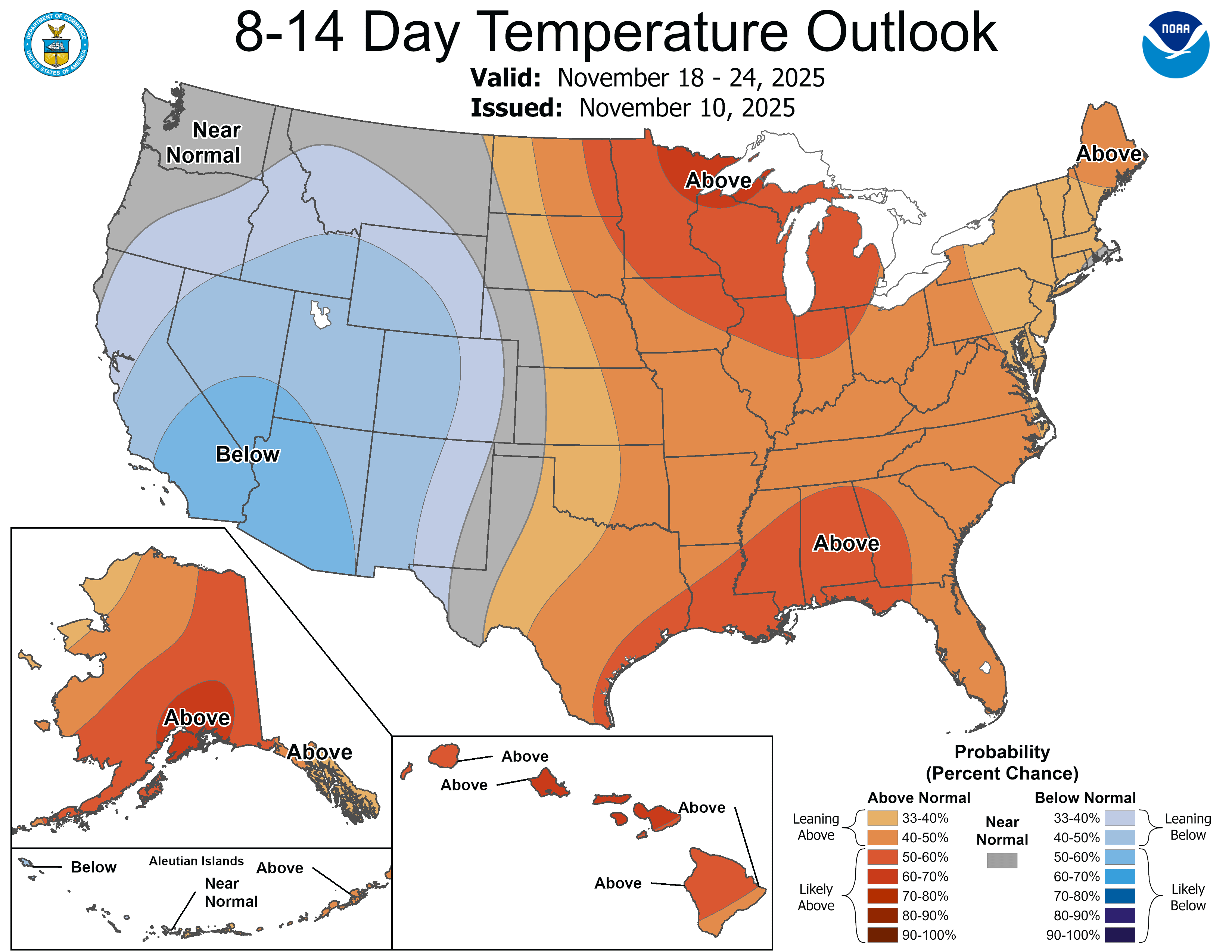
Enjoy our inbound milder air mass and stay tuned.
Turn Up Your Support
MPR News helps you turn down the noise and build shared understanding. Turn up your support for this public resource and keep trusted journalism accessible to all.

