
Record warmth gives way to a cooler weekend
Friday broke Twin Cities, southern Minnesota record for late-season high

Go Deeper.
Create an account or log in to save stories.
Like this?
Thanks for liking this story! We have added it to a list of your favorite stories.


Welcome to arguably the longest and one of the warmest meteorological autumns on record in Minnesota.
Friday’s balmy air mass not only set the record high temperature for Nov. 14, it also set a new record for the warmest temperatures on record so late in the fall season.
We topped out at 72 degrees at Minneapolis-St. Paul International Airport Friday afternoon (see the graphic above). That breaks the previous daily high temperatures record of 71 degrees set in 1990.
It also becomes the latest we’ve been so warm into the fall. Yes, we hit 71 degrees on Nov. 17, 1953, but we’ve never been as warm as 72 degrees this late in the fall season. Records in the Twin Cities date back to 1873.
Turn Up Your Support
MPR News helps you turn down the noise and build shared understanding. Turn up your support for this public resource and keep trusted journalism accessible to all.
On the map below, look how dominant the warm-air plume was across the central United States Friday afternoon. Unusual colors for mid-November.

Weekend temperature correction
A cold front slides through Minnesota overnight into early Saturday.

Highs temperatures Saturday will fall about 20 degrees with 50s in the south to 40s north and some 30s in the far north.

Gusty northwest winds to 25 mph will make it feel much cooler Saturday. Keep in mind the normal high temperature for the Twin Cities Saturday is 42 degrees, so it’s still warmer than normal for Nov. 15.
Sunday brings plenty of sun and less wind with temperatures closer to seasonal norms.
Next week looks seasonably cool with highs mostly in the 40s south to 30s north. A couple of minor rain or snow chances are possible.
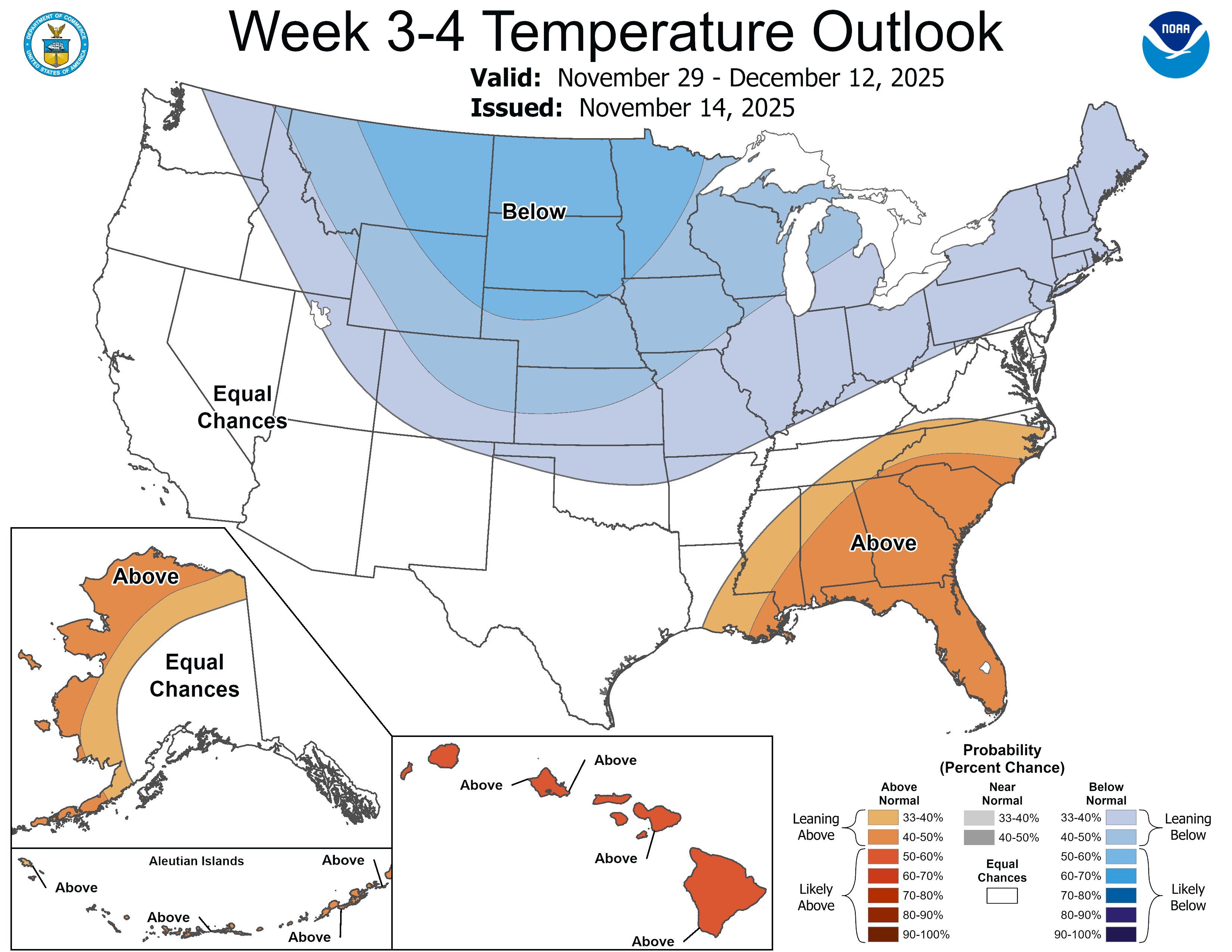
Longer range forecasts hint at potentially colder temperatures with possible snow Thanksgiving week into early December.
Stay tuned.

