
Sloppy snow possible overnight from southern Twin Cities to Iowa
Latest models suggest more rain than snow in many areas

Go Deeper.
Create an account or log in to save stories.
Like this?
Thanks for liking this story! We have added it to a list of your favorite stories.


And so it begins. The first real chance for sloppy November snowfall accumulations rides in overnight into Tuesday morning.

Rain will change to snow overnight and, depending on precise temperatures, it could accumulate, especially from the southern Twin Cities to the Iowa border. A winter weather advisory is posted across a swath of southern Minnesota.
Forecast models vary widely with this system regarding potential snowfall accumulations, so forecast confidence is lower than usual with precisely where and how much snow will fall.
Temperatures right around 32 degrees in the lowest mile of the atmosphere could produce rain, sleet or snow — or possibly all three.
Turn Up Your Support
MPR News helps you turn down the noise and build shared understanding. Turn up your support for this public resource and keep trusted journalism accessible to all.
It should be noted that Monday afternoon’s forecast models are trending toward a slightly warmer temperature profile and favoring more rain than snow in some areas. We’ll see if that trend holds before any possible snow flies after midnight.
Let’s break down the possibilities.
The system
A moderate-strength, low-pressure system will track near the Missouri-Iowa border overnight into Tuesday.
The system will spin up a band of rain Monday evening into southern Minnesota. That zone will try to change to snow around or after midnight and slide toward the southern Twin Cities area and points southward.
The National Oceanic and Atmospheric Administration’s FV3 model shows the rain possibly mixing with snow overnight into Tuesday morning. The forecast model loop below runs between 6 p.m. Monday and noon Tuesday.
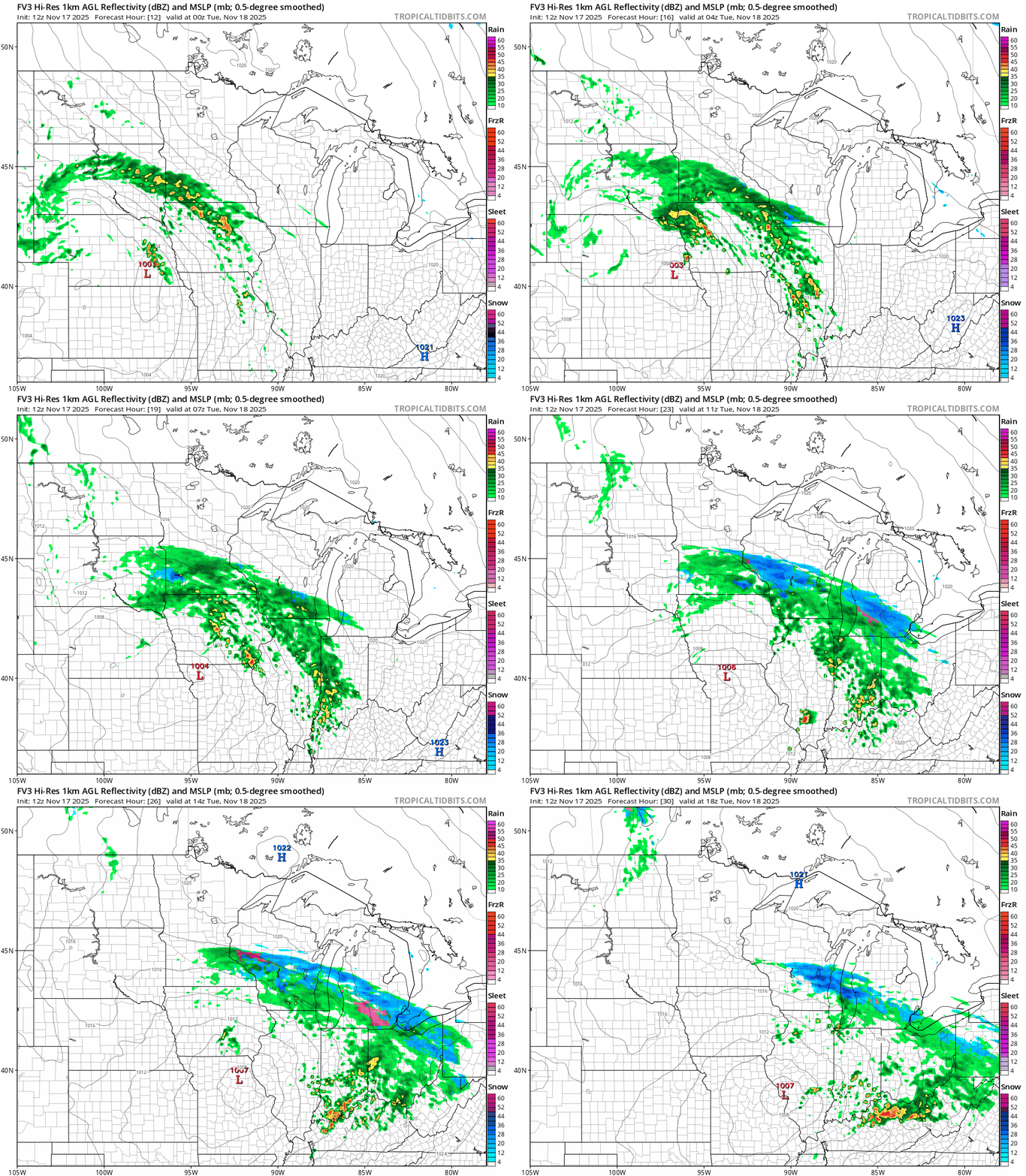
This is what we call a temperature-critical system. With temperatures right around 32 degrees, precipitation could be mostly rain or change to snow and sleet.

Earlier runs projected a widespread 1 to 3-inch sloppy snow zone from the southern Twin Cities south to the Interstate 90 corridor with some locally heaver totals especially in southwestern Minnesota.
Here’s the Monday morning (12Z) European model snowfall output:

Midday forecast model trends have trended slightly warmer, meaning more rain than snow. Here’s NOAA’s High-Resolution Rapid Refresh model snowfall output through Tuesday:

It remains to be seen just how much precipitation will actually fall as snow. I expect some snow, and possible sleet could work its way as far north as the southern Twin Cities. But the latest trends favor more rain and less snow overall.
If temperatures stay at or just below 32 degrees, we could have slushy-to-icy accumulations and some slick roads in the early morning, especially south of the Twin Cities.
Most of anything that falls will melt later Tuesday as temperatures approach 40 degrees.

Stay tuned!

