
Cold Turkey? Frigid air mass likely to arrive by Thanksgiving weekend
Models cranking out highs in the 20s by Thanksgiving Day
Go Deeper.
Create an account or log in to save stories.
Like this?
Thanks for liking this story! We have added it to a list of your favorite stories.


It’s that time of year when the weather maps change quickly.
One important idea I always like to pass on to weather consumers is that when it comes to forecasting a week ahead, there are some trends that are more predictable and actionable than others.
Example?
Model forecasts of overall temperature trends show much higher skill than trying to predict daily storm tracks and precipitation trends. Temperature forecasts a week ahead are much more likely to be accurate than location and magnitude of rain or snow storms.
Turn Up Your Support
MPR News helps you turn down the noise and build shared understanding. Turn up your support for this public resource and keep trusted journalism accessible to all.
Rossby waves
There’s a reason for that. Forecast models are better at identifying bigger atmospheric patterns called Rossby waves in the overall jet stream pattern. These long waves give a good idea of what areas will be warmer or colder than normal a week out.

But individual storm systems are driven by what we call short waves. These smaller waves ride embedded within the jet stream and are much smaller and more difficult to pinpoint a week in advance.
I’m seeing an incredible uptick in intentionally alarming weather clickbait that’s been predicting bitter cold and “snowmageddon” for much of the United States in the past couple of weeks.
But if you understand that temperature patterns are much more reliable than potential snow systems, it’s easier to sort out and ignore the fluff. Alas, monetization has invaded weather social media.
So while we can more reliably say the upper-air pattern is likely to deliver much colder air in the next seven to 10 days, it’s almost impossible to say where there will or will not be any snow.
The state of the science of meteorology is just not there yet, even with forecast models dabbling in artificial intelligence-aided output. Keep that in mind as you consume the expanding weather clickbait.
Thanksgiving weekend pattern shift
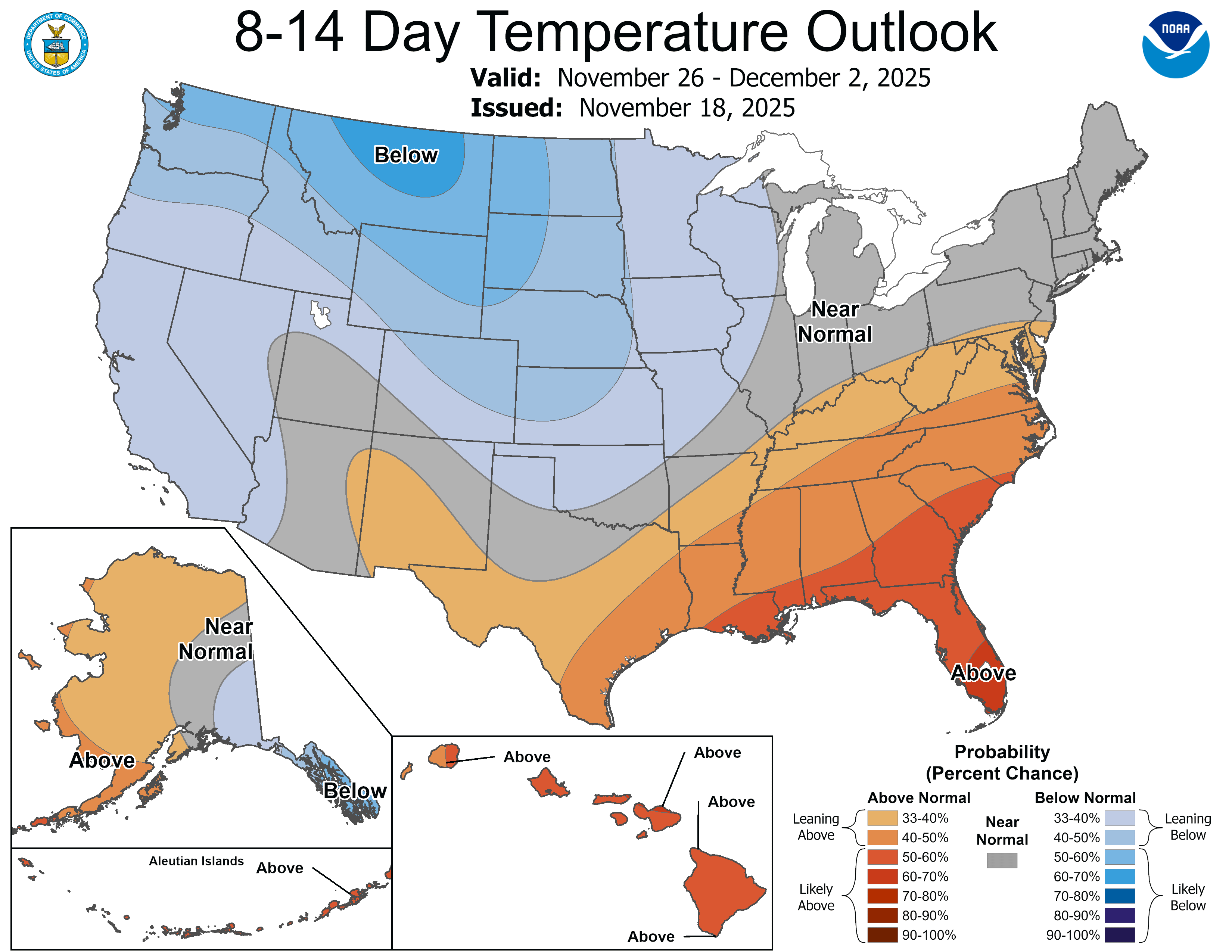
Forecast models are in agreement that a strong northwest flow will develop over the central U.S. by Thanksgiving weekend.
The National Oceanic and Atmospheric Administration’s Global Forecast System model is in line with others that show the transition from a relatively mild pattern next Tuesday to significant cold shot by Thanksgiving weekend.
Highs next Tuesday will likely reach the low 50s in southern Minnesota under the milder pattern early next week.

Now watch that brisk northwest flow kick in with much colder air into Thanksgiving weekend. The upper-air forecast model loop below runs between midday Tuesday and 6 p.m. on Black Friday, the day after Thanksgiving.
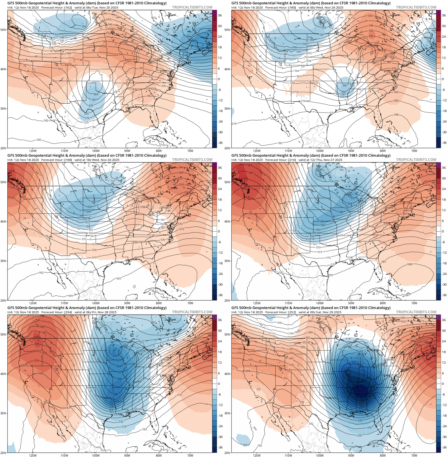
Forecast models are cranking out highs in the 20s by Thanksgiving Day with overnight lows bottoming out in the teens south and single digits north Thanksgiving weekend!

The maps don’t show any big storms for Thanksgiving weekend, so travel looks pretty decent as of now. But maps can change quickly so keep checking each day.
In theory we could see above-normal precipitation, according to NOAA’s eight to 14-day precipitation outlook.
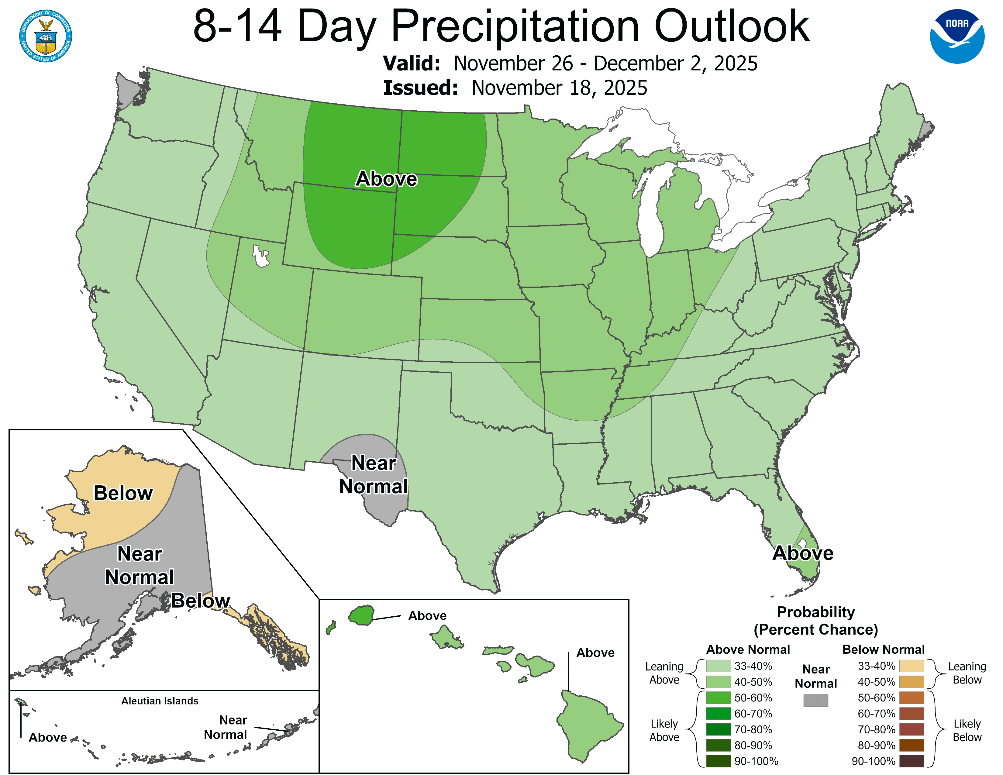
Looks like you can keep the beverages cold on the porch this Thanksgiving. Just make sure they don’t freeze.
Stay tuned.

