
Soaking rains fell south of Twin Cities Tuesday morning; milder days ahead
Highs in the 50s return this week; highs in the 20s likley by Thanksgiving Day

Go Deeper.
Create an account or log in to save stories.
Like this?
Thanks for liking this story! We have added it to a list of your favorite stories.


On Monday, I posted about how forecast models were trending warm enough for mostly rain instead of snow with our overnight system. Those forecast models panned out and handled the system pretty well.
Soaking rains fell across much of southern Minnesota into Tuesday morning. There were few reports of snow. Very little precipitation fell in the southern Twin Cities.
Here are some select rainfall totals into Tuesday morning, measured in hundredths of an inch:
Spring Valley, 0.85
Slayton, 0.83
Pipestone, 0.72
Waseca, 0.71
Austin, 0.70
Sleepy Eye, 0.64
Mankato, Rochester, 0.51

Milder days ahead
Our so relatively tranquil November weather pattern resumes into the upcoming weekend. Highs Wednesday will run mostly in the 40s south to 30s north.
Turn Up Your Support
MPR News helps you turn down the noise and build shared understanding. Turn up your support for this public resource and keep trusted journalism accessible to all.
On Thursday, another milder air mass eases into Minnesota. Sunshine will help push temperatures into the 50s south once again with 40s north.
The weekend also looks relatively mild for November. Keep in mind the normal high and low temperatures for the Twin Cities by this weekend are 39 and 25 degrees.

Thanksgiving week preview
The early part of Thanksgiving week look mild with a chance of lighter showers on Tuesday.
But a strong cold front looks likely by Wednesday into Thanksgiving weekend. Temperatures appear ready to fall into the frozen 20s for highs by Thanksgiving Day into the weekend.
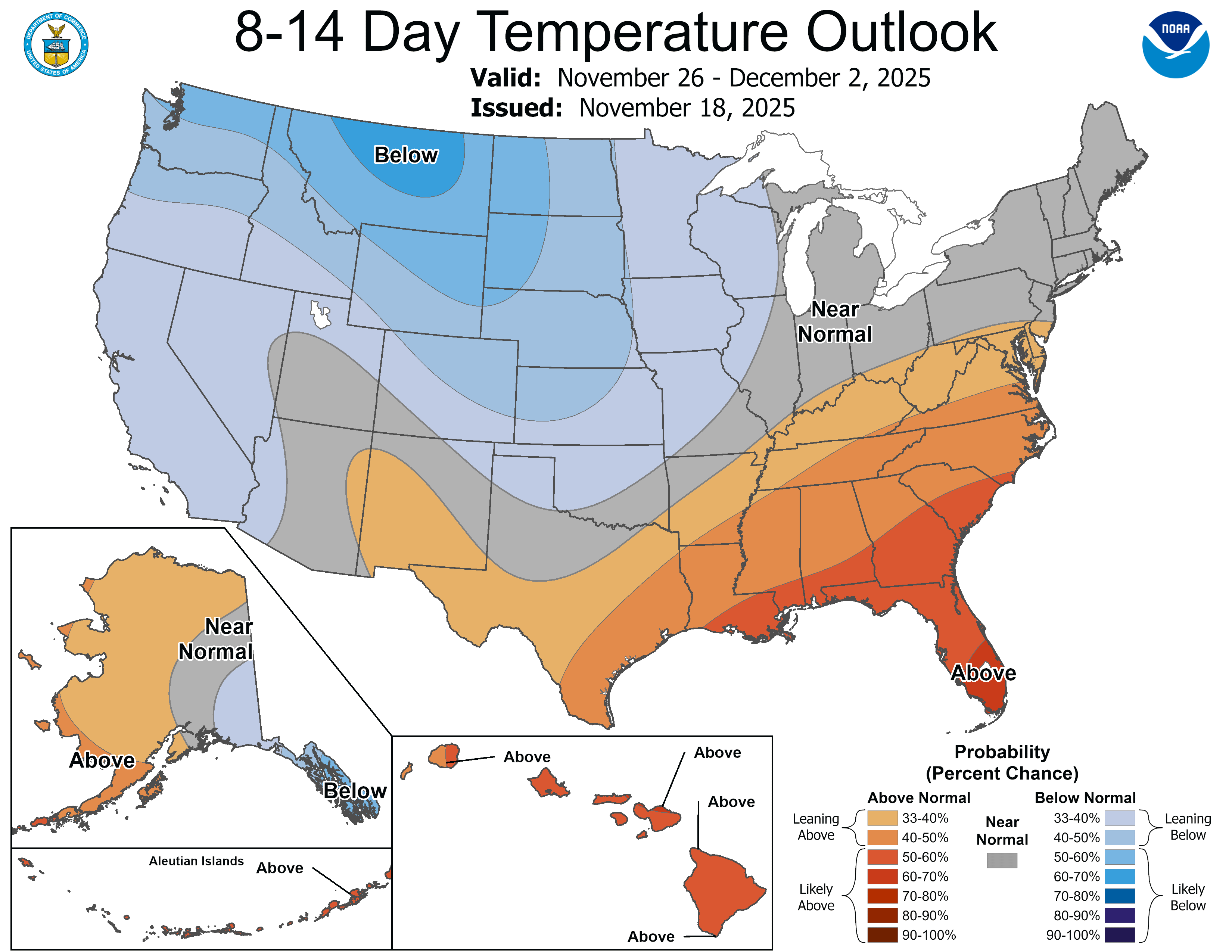
Snow flurries look possible, but right now the maps are free of any big snow events for Thanksgiving weekend.
Stay tuned.

