
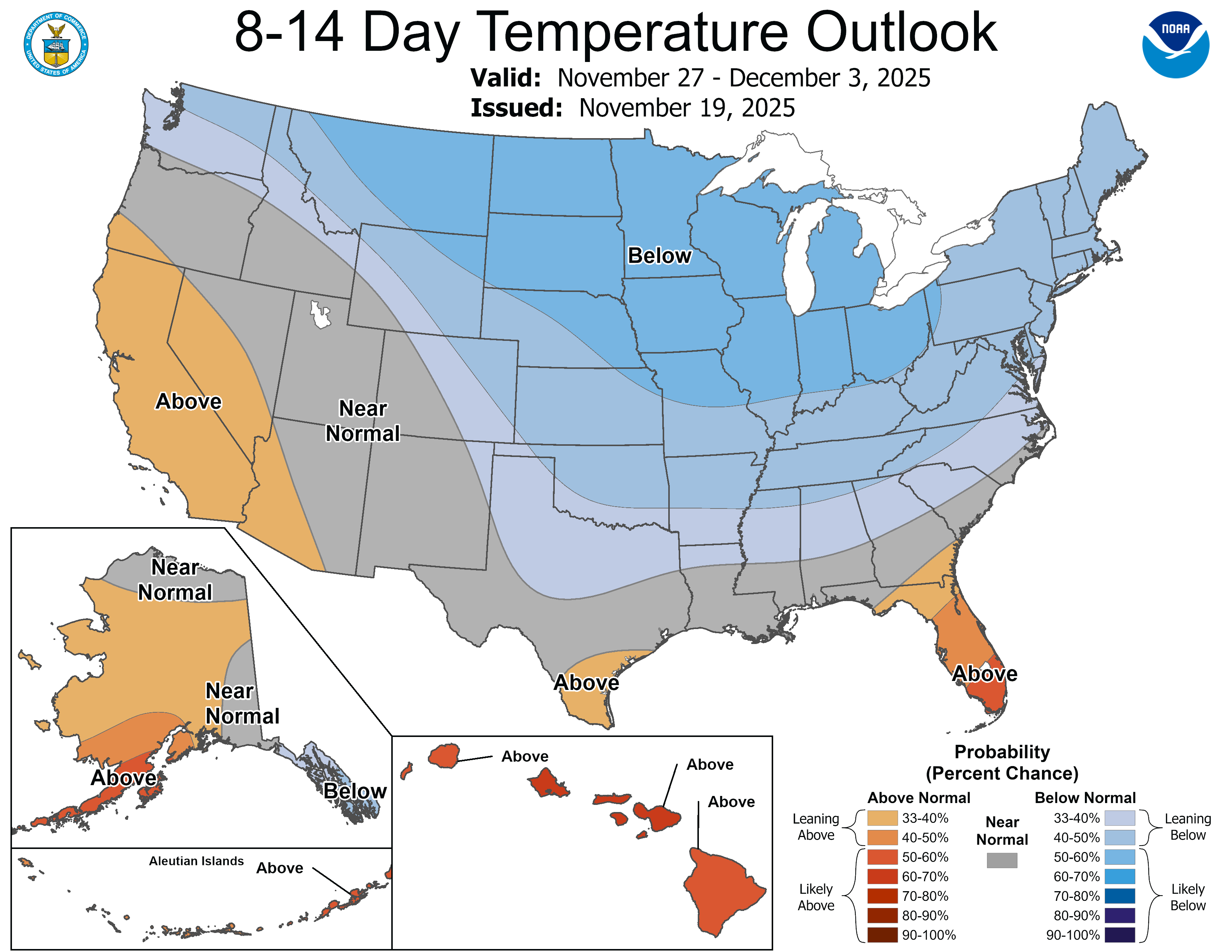
Much colder with snow possible by Thanksgiving weekend
Mild Minnesota November set to shift into winter mode by Thanksgiving Day
Go Deeper.
Create an account or log in to save stories.
Like this?
Thanks for liking this story! We have added it to a list of your favorite stories.


We’re living charmed weather lives this fall around Minnesota.
Our late summerlike weather pattern lasted through September and well into October this year. While November has been cooler, temperatures are still running 4 degrees warmer than average so far this month in the Twin Cities.
Data from the Midwest Regional Climate Center shows temperatures across Minnesota and the Dakotas have run between 3 and 8 degrees warmer than normal over the past 30 days.

Our relatively mild weather pattern lingers into early Thanksgiving week. Highs near 40 degrees north to the 50s south will be common through next Tuesday.
Turn Up Your Support
MPR News helps you turn down the noise and build shared understanding. Turn up your support for this public resource and keep trusted journalism accessible to all.

But a significant pattern change in the jet stream is looking very likely late next week.
On the map below, watch how the National Oceanic and Atmospheric Administration’s Global Forecast System model upper-air animation starts next week on mild notes (warm colors) then takes a frigid swipe at Minnesota by Thanksgiving Day. (Blue hues)
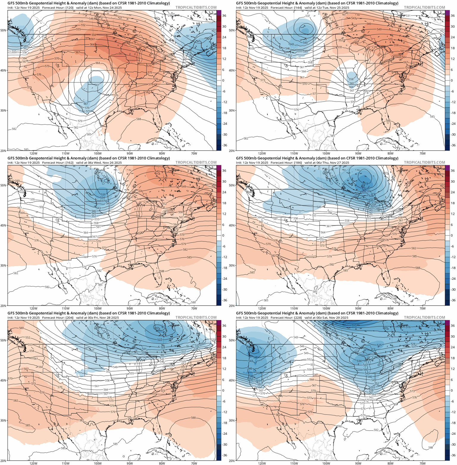
By the time we’re recovering from Thanksgiving dinner late Thursday, temperatures will likely be in the frigid 20s across most of Minnesota with teens in the north.

Potentially stormy pattern emerging
Wednesday’s latest forecast model runs suggest things may get interesting later Thanksgiving weekend. The Canadian, American and European models are starting to develop a possible rain and/or snow system across Minnesota Saturday or Sunday.
Keep in mind that’s still 10 days away, so forecast confidence is low. But the notion of a storm late Thanksgiving weekend is growing on forecast maps.
The Canadian and American models right now suggest heavy snow potential in central Minnesota, possibly including the Twin Cities area. The European model has the system farther north with snow in northern Minnesota and rain in the south.
I’m showing NOAA’s Global Forecast System model loop on the map below not as a specific forecast but to illustrate how forecast models are generating a potentially more active storm and snow pattern in the Upper Midwest as we move through Thanksgiving weekend into early December.
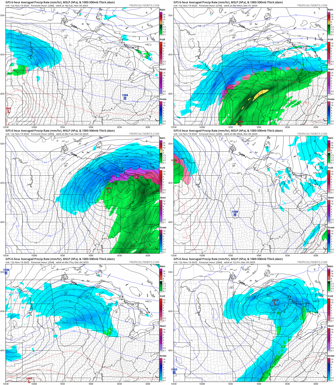
So while it’s far too early to say who might get rain or snow Thanksgiving weekend and into early December, it’s looking more possible that impactful rain or snow systems could affect parts of Minnesota by the Saturday or Sunday of Thanksgiving weekend and beyond.
Forecasts are more confident that travel will be relatively good next week up through Thanksgiving Day at this point.
Forecast model runs for the next three to four days will be critical to watch to see if current trends for possible rain and or snow late Thanksgiving weekend continue.
As we say in the weather biz, stay tuned.

