
Mild weekend ahead; snow chances possible late Thanksgiving weekend
Weekend highs in the 50s; possible rain-to-snow system Thanksgiving weekend

Go Deeper.
Create an account or log in to save stories.
Like this?
Thanks for liking this story! We have added it to a list of your favorite stories.


The weather maps are beginning to look a little more interesting Thanksgiving weekend.
But first we’ll enjoy yet another fine fall weekend as we glide into late November. Our seemingly eternal balmy autumn this year lingers one more weekend.
We’ll enjoy plenty of sunshine this weekend with temperatures a good 10 to 15 degrees warmer than normal. The normal high and low temperatures for the Twin Cities Saturday are 39 and 25 degrees.
Highs this weekend will run into the 50s south with 40s north. Light winds will make it feel nice under the sunshine.
Turn Up Your Support
MPR News helps you turn down the noise and build shared understanding. Turn up your support for this public resource and keep trusted journalism accessible to all.

It will be a great weekend to get those holiday lights up while it’s still relatively mild. One more leisurely stroll around the lakes. One more chance to get those last leaves put away.
Changes ahead Thanksgiving week
The weather maps kick into change mode Thanksgiving week.
Monday starts mild with light rain moving north from southern Minnesota through the day. Rain looks likely to change to snow in the north Monday night through Tuesday.
The map below shows the European Centre for Medium-Range Weather Forecasts model output for Monday and Tuesday.
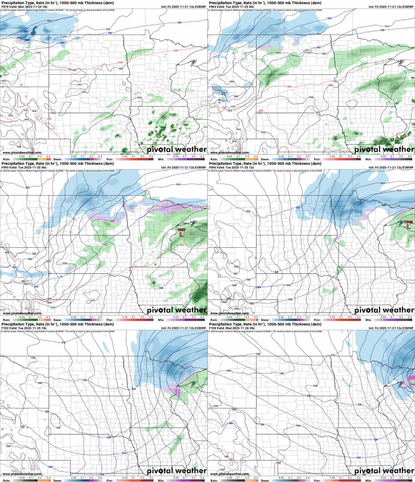
Minor snowfall accumulations are likely in the north Tuesday.
Right now, Wednesday and Thanksgiving Day look blustery and colder with snow flurries but probably no major travel issues. Highs will run in the chilly 20s across most of Minnesota as we roll into the holiday weekend.

Forecast models are wrestling with a possible rain-to-snow system later Thanksgiving weekend.
It’s way too early to talk specific snowfall scenarios, but the notion of accumulating to possibly heavy snow across much for Minnesota is growing next Saturday through the following Monday.
We look at models a week out as pattern trend indicators and not specific forecast maps. With that caveat, here’s Friday’s European model loop looking ahead to Saturday, Nov. 29 through Monday, Dec. 1:
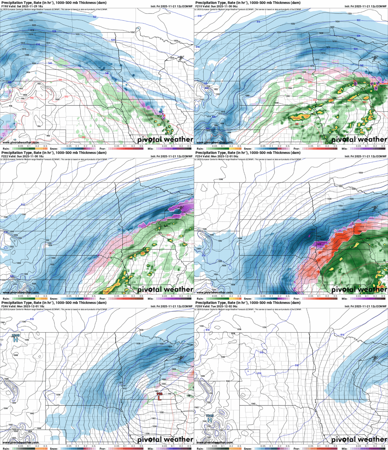
This shows the idea of a sloppy storm across Minnesota. So the potential for a significant rain and or snow event is growing, but specifics will likely crystallize as we move through Thanksgiving week.
Stay tuned!

