
Higher snowfall and winds possible for Twin Cities area Tuesday night
Evening forecast models shift storm south. That may mean more snow for the Twin Cities.

Go Deeper.
Create an account or log in to save stories.
Like this?
Thanks for liking this story! We have added it to a list of your favorite stories.


Here’s a quick late evening update from the Huttner Weather Lab.
Monday evenings late (0Z) forecast model runs continue the trend of shifting our inbound storm to the south. If that trend verifies, that would pump up snowfall totals and winds around the greater Twin Cities area Tuesday night into Wednesday morning.
NOAA’s FV3 model is typical of Monday evening’s model runs. The storm tracks a bit more southward, and that would expose the Twin Cities area to greater snow bands and higher wind gusts as the center of the storm races by Tuesday night. Winds could gust to 50 mph or higher if the storm intensifies.
We might even get some brief thunderstorms in the afternoon hours before rain changes to snow Tuesday evening.
Turn Up Your Support
MPR News helps you turn down the noise and build shared understanding. Turn up your support for this public resource and keep trusted journalism accessible to all.
Then the wind-whipped snow event peaks between about 9 p.m. Tuesday and 6 a.m. Wednesday. The forecast model loop below runs between 6 a.m. Tuesday and 6 a.m. Wednesday.
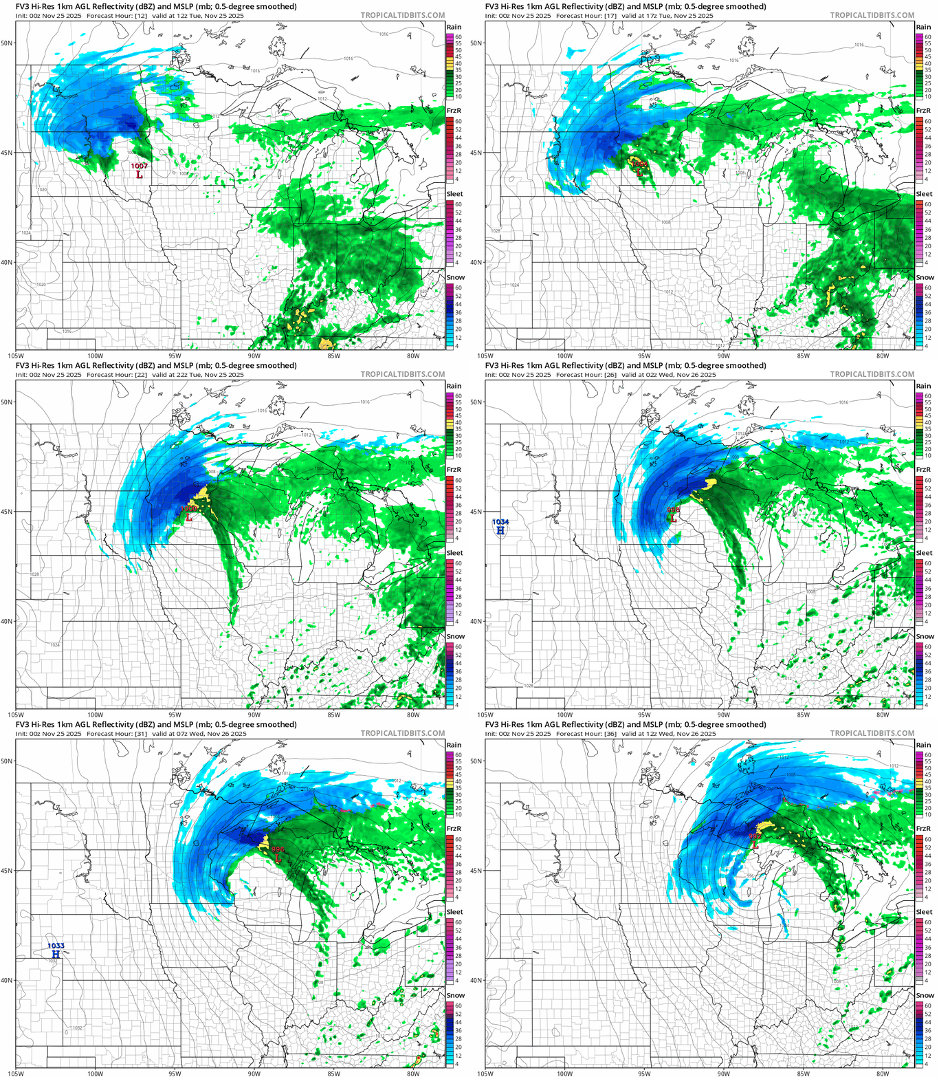
A more intense and longer duration snowfall would increase snowfall totals around the Twin Cities if the more southerly storm track holds.
Previous model runs favored between 1 and 3 inches of snow across the Twin Cities area.
NOAA’s latest HRRR model now cranks out 4 inch plus snowfall totals into the greater Twin Cities by Wednesday morning with higher totals to 6 inches plus in the north metro.

And NOAA’s NAM 3 km model dumps some 6 inch snowfall around the greater Twin Cities area by Wednesday morning with even higher totals in the northern Twin Cities.

If previous more northerly storms tracks hold then the latest available NWS digital snowfall output may be closer to where we end up. (map at top of post)
Travel will deteriorate Tuesday across central and northern Minnesota. The worst travel will be Tuesday night into Wednesday morning. The Wednesday morning commute in the Twin Cities looks bad right now.
So stay tuned as winter storm warnings may creep closer to or possibly include parts of the Twin Cities when the next NWS update arrives early Tuesday morning.
We’ll have more time to asses storms trends Tuesday before the snow flies Tuesday night.

