
Winter storm warning: Travel issues Tuesday into Wednesday morning
Wind-whipped snow heaviest north of Twin Cities; temps plunge through Thanksgiving weekend

Go Deeper.
Create an account or log in to save stories.
Like this?
Thanks for liking this story! We have added it to a list of your favorite stories.


Get the latest weather updates at Updraft.
Here we go, Minnesota.
You knew our lovely lingering autumn of 2025 wouldn’t last forever. The weather switch is about to be flipped quickly into the winter position this week.
The first real wintry storm will impact much of Minnesota Tuesday into Wednesday morning. Travel impacts will be widespread across northern and central Minnesota with lesser impacts south of the Twin Cities.
Turn Up Your Support
MPR News helps you turn down the noise and build shared understanding. Turn up your support for this public resource and keep trusted journalism accessible to all.
Forecast models show a trend to tracking the system a little more south Monday model runs. If that trend continues forecast snowfall totals could climb on the south edge of the storm including the Twin Cities area.
Let’s break down the storm and travel impacts as we head into Tuesday and Wednesday.
The system
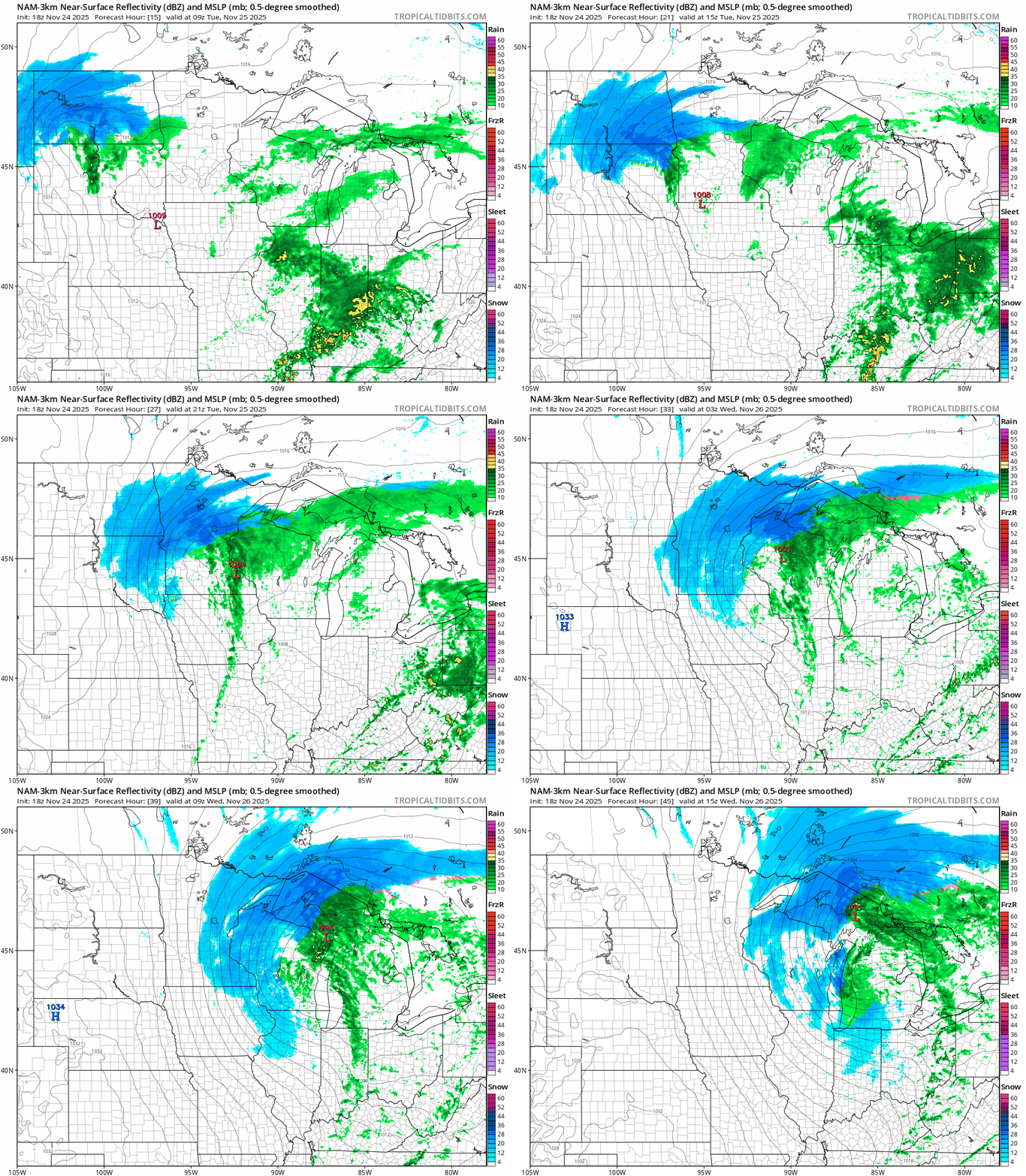
A potent low-pressure system will spin through Minnesota Tuesday. The system will produce moderate to heavy snowfall on the north side, especially across central and northern Minnesota.
Snow will begin in the Red River Valley and northwestern Minnesota mainly after midnight and spread across northern Minnesota through Tuesday. The Twin Cities will see some rain develop Tuesday then likely change to wind-driven snow early Tuesday evening.
On the map below, the National Oceanic and Atmospheric Administration’s latest (18Z) NAM 3 km model shows the system moving through Minnesota between 3 a.m. Tuesday and 9 a.m. Wednesday.
Snowfall totals
The heaviest snowfall with this system favors central and northern Minnesota, especially the North Shore where terrain and lake-effects will enhance snowfall rates.

Model forecasts vary as usual with this system. But overall the National Weather Service digital snowfall output looks like a pretty good average of what the most reliable forecast models put out give or take.
In this scenario, double digit snowfall totals are likely in the north while the Twin Cities is likely to pick up a coating of 1 to 3 wind-whipped inches by Wednesday morning.
Here’s a closer look at likely snowfall totals across central and southern Minnesota:

Gusty winds
Expect a wind whipped snow event with powerful north winds gusting to over 40 mph. There will be near-blizzard conditions across parts of northern and central Minnesota Tuesday night into early Wednesday morning.
Slick roads and poor visibility in blowing snow will be an issue especially Tuesday night into Wednesday morning.
Travel improves by Thanksgiving Day
Roads will gradually improve Wednesday afternoon after the snow as road crews get a chance to clear main highways.
Our weather picture looks dry and sunnier Thanksgiving Day and Black Friday. Highs will be in the wintry 20s with overnight lows in the teens with some single digits north right through Thanksgiving weekend.

Forecast models give Minnesota a chance for light snow Saturday and Sunday. They suggest a bigger storm may head toward Chicago late Thanksgiving weekend.
Stay tuned and please plan to travel safely!

