
Winter storm watch: Heavy snow potential for southern Minnesota Friday into Saturday
Good Thanksgiving travel. A new snow system takes aim at southern Minnesota late Friday and Saturday.

Go Deeper.
Create an account or log in to save stories.
Like this?
Thanks for liking this story! We have added it to a list of your favorite stories.


We’re coming up for air in Minnesota between storm systems.
Thanksgiving Day travel looks good around Minnesota. We’ll see a mix of sun and some clouds with dry skies and high temperatures in the 20s.
But if you’re planning travel to the south Friday or Saturday it looks best to get there early or wait until Sunday. The next late November winter storm is on the way.
Let’s break down the next system and get a jump on travel issues for southern Minnesota, Iowa, Wisconsin, and Illinois Friday and Saturday.
Turn Up Your Support
MPR News helps you turn down the noise and build shared understanding. Turn up your support for this public resource and keep trusted journalism accessible to all.
The system
The next wintry weather system has a lot going for it to produce heavy snowfall. This one will track further south than our last storm. And that will very likely put the heaviest snowfall south of the Twin Cities this time.
Wednesday’s European model run shows the storm tracking from south of Kansas City to south of Chicago Saturday.
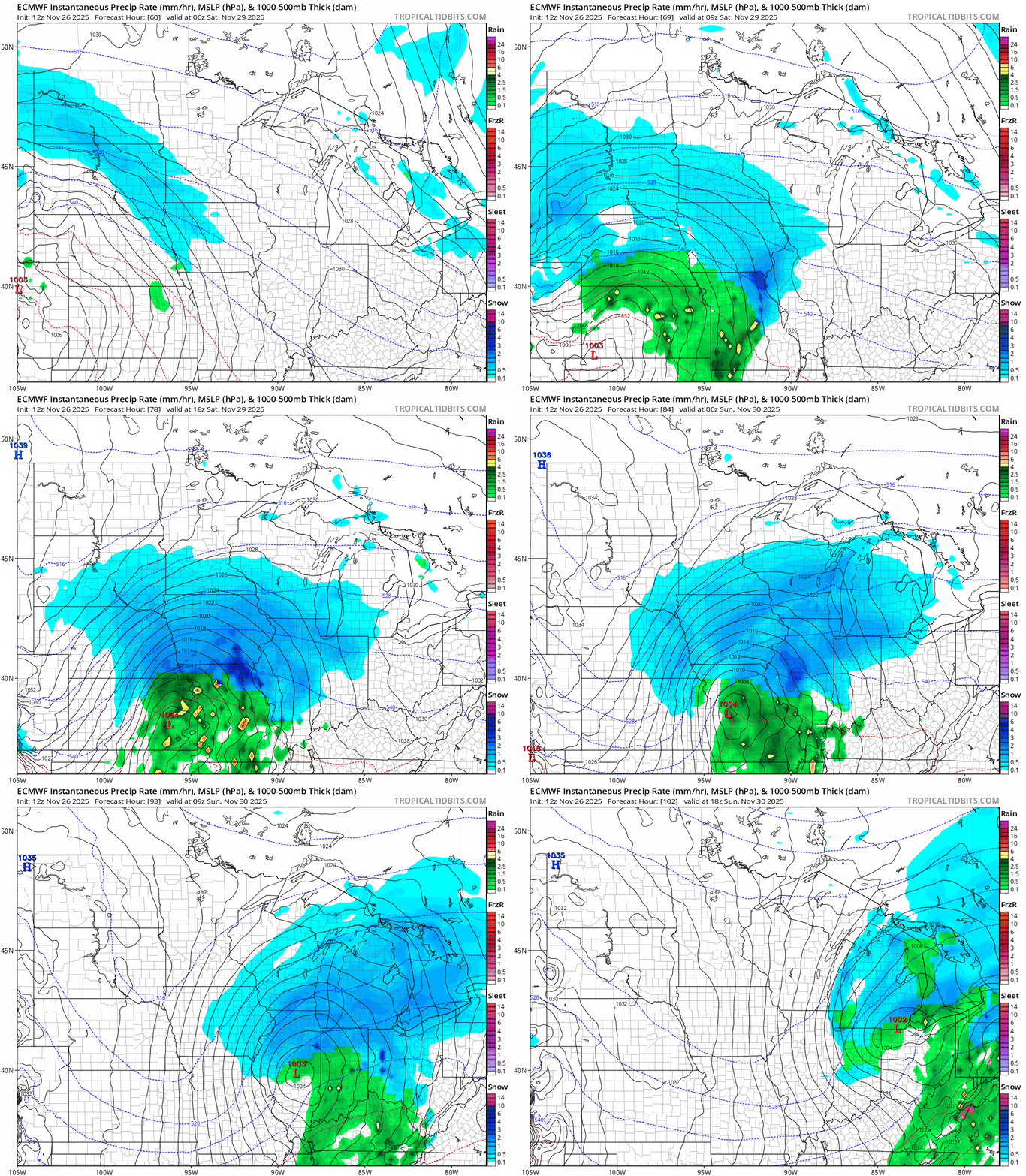
Snowfall potential Friday night through Saturday
That storm track if verified would place the heaviest snowfall bands across parts of Iowa, and Wisconsin to around Chicago.
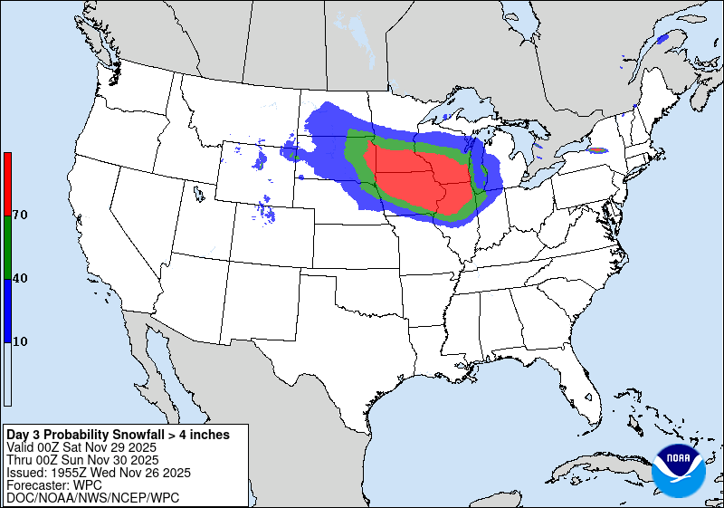
But heavy snow looks likely at this point (still 72 hours ahead of the storm’s peak) in southern Minnesota especially along the I-90 corridor and areas south of the Twin Cities. NOAA’s snowfall outlook gives a 70-percent chance for more than 4 inches from near the Twin Cities southward Saturday.
The Twin Cities will likely see at least some snow Friday night and Saturday. But at this early point in the forecast cycle it’s way too early to say if that would be a light coating or potentially plowable.
For now, winter storm watches have been posted for Friday afternoon through Saturday for southwest Minnesota.

URGENT - WINTER WEATHER MESSAGE National Weather Service Sioux Falls SD
226 PM CST Wed Nov 26 2025
Including the cities of Hendricks, Inwood, Tyler, Ivanhoe, Lake Benton, Fulda, Larchwood, Mountain Lake, Sanborn, Spencer, Rock Valley, Sheldon, Orange City, Spirit Lake, Arnolds Park, Milford, Worthington, Pipestone, Sibley, Hartley, George, Hull, Storm Lake, Windom, Sioux Center, Marshall, Jackson, Lakefield, Rock Rapids, Slayton, Cherokee, Hawarden, and Luverne ...WINTER STORM WATCH IN EFFECT FROM FRIDAY AFTERNOON THROUGH SATURDAY EVENING...
* WHAT...Heavy snow possible. Total snow accumulations between 5 and 10 inches possible.
* WHERE...Portions of northwest Iowa and southwest Minnesota.
* WHEN...From Friday afternoon through Saturday evening.
* IMPACTS...Travel could be very difficult to impossible. The hazardous conditions could impact the post-Thanksgiving travel period.
It remains to be seen how far north watches will be issued in the next 24 hours but I expect the I-90 corridor and southern Minnesota (to probably just south of MSP) will be included.
Travel considerations
For now the most actionable forecast information is to expect snowy travel anywhere south of the Twin Cities Friday night and Saturday, lingering into Sunday morning around Chicago and Milwaukee. The best travel periods will be through Thanksgiving day into early Friday. Then again on Sunday if you are heading south. Travel looks better as you head north from the Twin Cities Saturday.
Have a happy and safe Thanksgiving Minnesota!

