
Textbook clipper dumped heaviest snow north of the Twin Cities
Next colder arctic air pours into Minnesota into the upcoming weekend.

Go Deeper.
Create an account or log in to save stories.
Like this?
Thanks for liking this story! We have added it to a list of your favorite stories.


It’s a winter wonderland out there across much of Minnesota these days.
Our latest Alberta clipper dropped a swath of significant snow from northwestern Minnesota right along and north of Interstate 94 into the greater Twin Cities area. The heaviest snowfall totals fell north of the Twin Cities as expected.

Here are some select snowfall totals from our latest system in inches.
Menahga, Grand Forks 11
Nevis, 10.5
Park Rapids, 9
Jenkins, Pequot Lakes, 8.1
Thief River Falls, Hackensack, 8
Deerwood, Columbus, 7.5
Lake Mille Lacs area, 7
St. Cloud area, 4 to 6
Duluth area, 2 to 5
Rochester area, 1 to 3
Here are some snowfall totals from around the greater Twin Cities area in inches. The heaviest totals favored the northern Twin Cities.
Turn Up Your Support
MPR News helps you turn down the noise and build shared understanding. Turn up your support for this public resource and keep trusted journalism accessible to all.
Blaine, 7.1
Coon Rapids, 6.1
New Hope, Woodbury, 6
Fridley, St. Paul Park, 5.8
Minneapolis, Stillwater, 5.5
Chaska, Farmington, 5.2
Minneapolis-St. Paul International Airport, 4.1
Prior Lake, 3.1
Savage, 2.8
Check the National Weather Service snowfall reports page for your area.
A few light snow showers and flurries will produce a light dusting of snow through Wednesday afternoon.
Wintry week continues
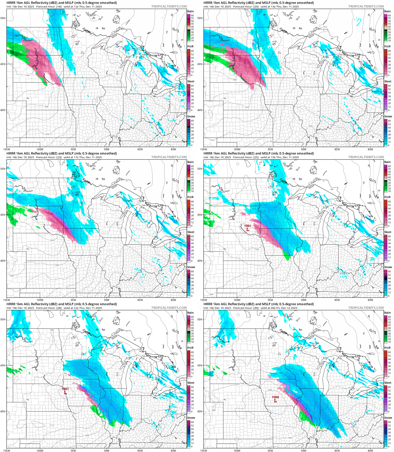
Temperatures will continue to fall over the next few days. Our next clipper brings some light snow to southern Minnesota Thursday. Snowfall totals will not be as heavy as our last system but slick roads could result Thursday especially southwest of the Twin Cities.
On the map below, the National Oceanic and Atmospheric Administration’s High-Resolution Rapid Refresh model shows the system between 6 a.m. and 6 p.m. Thursday.
Temperatures will bottom out in the teens below zero by Sunday morning with minus 20s north.

High temperatures this weekend will hover around zero across most of Minnesota.
Stay warm out there.

