
Snowy dusting possible Friday morning; subzero arctic weekend ahead
Temps -15 to -30 degrees Sunday morning across Minnesota

Go Deeper.
Create an account or log in to save stories.
Like this?
Thanks for liking this story! We have added it to a list of your favorite stories.


It’s a free ride on the Minnesota winter weather roller coaster over the next week.
An arctic front blows into Minnesota Friday. Light snow and flurries accompany the front Friday morning. Most areas will see less than 1 inch of snow accumulation.

Then gusty northwest winds will send temperatures plunging Friday through the upcoming weekend.
Overnight lows Friday night into Saturday morning will plunge below zero.
Turn Up Your Support
MPR News helps you turn down the noise and build shared understanding. Turn up your support for this public resource and keep trusted journalism accessible to all.

Highs Saturday will stay below zero.

Sunday morning will see the coldest temperatures of this arctic outbreak. Lows will hit minus 15 around the Twin Cities and southern Minnesota with minus 25 to minus 30 degrees likely up north.

A cold weather advisory covers most of Minnesota this weekend. Here’s the National Weather Service message:
Including the cities of Red Wing, St. Paul, Le Sueur, Blaine, Durand, Shakopee, Faribault, Chanhassen, Chippewa Falls, Gaylord, Osceola, St. Peter, Victoria, Mankato, Menomonie, River Falls, Owatonna, Stillwater, Eau Claire, Center City, Minneapolis, Albert Lea, Hastings, Waseca, Chaska, Hudson, Rice Lake and Ladysmith
1:30 p.m. CST Thursday, Dec. 11, 2025
...COLD WEATHER ADVISORY IN EFFECT FROM MIDNIGHT FRIDAY NIGHT TO 10 a.m. CST SUNDAY...
* WHAT...Very cold wind chills as low as 32 below expected.
* WHERE...Portions of central, east central, south central and southeast Minnesota and northwest and west central Wisconsin.
* WHEN...From midnight Friday Night to 10 a.m. CST Sunday.
* IMPACTS...The cold wind chills as low as 30 below zero could cause frostbite on exposed skin in as little as 10 minutes.
* ADDITIONAL DETAILS...Wind chills may rise into the teens to 20s below zero during the day Saturday, but frostbite can still occur in as little as 20 minutes.
50 degrees warmer next week
Next week brings a major shift in the upper-air pattern across the United States. A milder flow off the Pacific Ocean will blow in thawing temperatures.
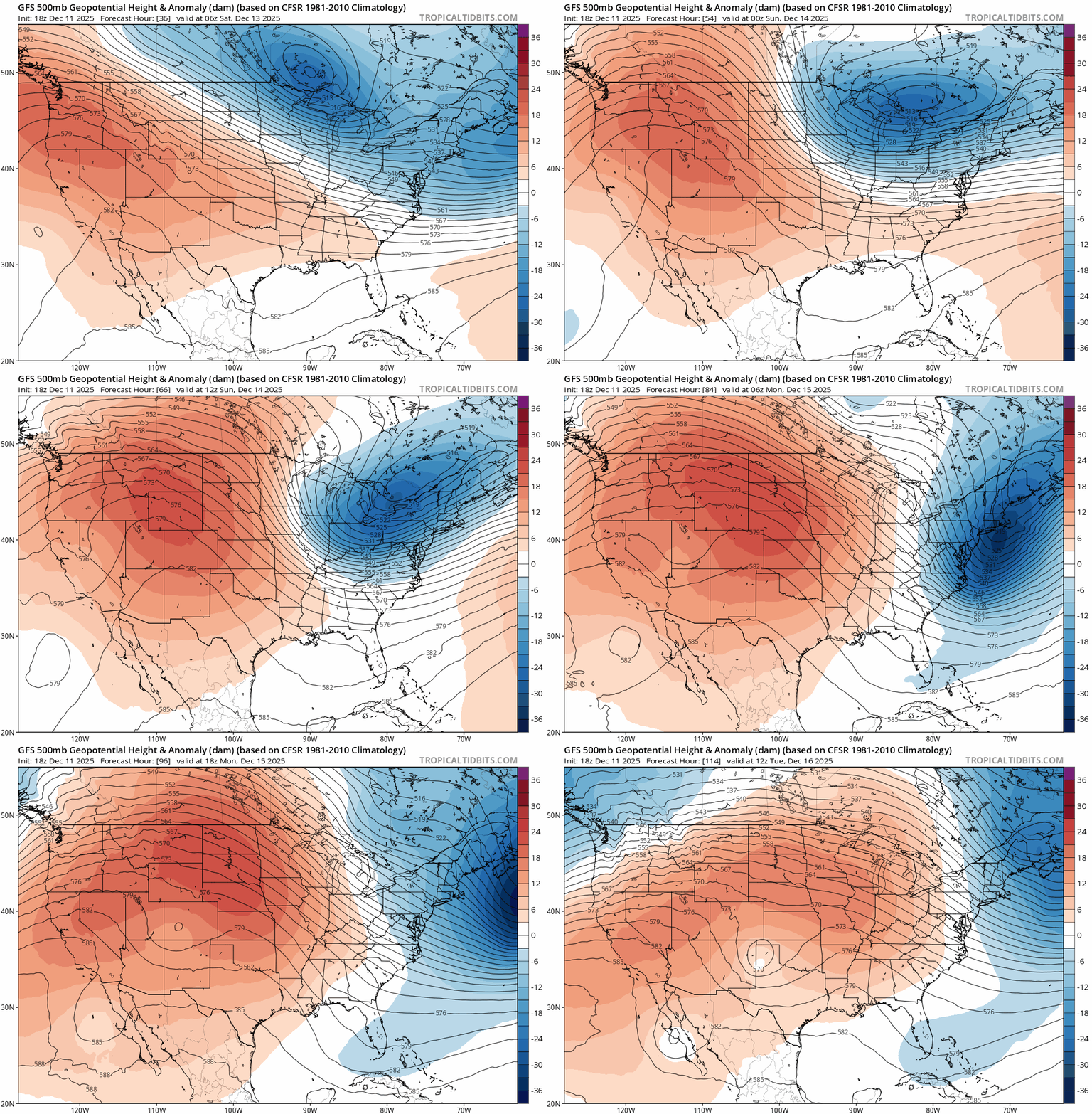
A string of days in the 30s looks likely starting Tuesday.

A few models suggest we could hit 40 degrees in the Twin Cities and southern Minnesota next week.
So take care this weekend in the frigid air mass. And hang in there for much milder temperatures next week.

