
December thaw! 40s likely Tuesday around Minnesota
A much milder Pacific air mass blows into Minnesota Tuesday

Go Deeper.
Create an account or log in to save stories.
Like this?
Thanks for liking this story! We have added it to a list of your favorite stories.


It’s been a wintry December so far for Minnesota. Temperatures are running 11 degrees colder than normal through this first half of December in the Twin Cities.
The coldest air mass so far this season made us bottom out at minus 11 degrees at Minneapolis-St. Paul International Airport Sunday morning. The suburbs hit minus 15 degrees Sunday morning with minus 28 in the north.
So far, we’ve recorded four nights of subzero temperatures in the Twin Cities. The seasonal average is 22 subzero days over the course of a Twin Cities winter.
December thaw Tuesday
A gush of much milder Pacific air blows into Minnesota Tuesday. Temperatures are in the 60s in parts of Nebraska Monday afternoon with our inbound air mass!
Turn Up Your Support
MPR News helps you turn down the noise and build shared understanding. Turn up your support for this public resource and keep trusted journalism accessible to all.

That’s over snow-free ground. It wont get nearly that warm in Minnesota but 40s are likely for most of the state Tuesday afternoon. Check out the map at the top of the post.
Tuesday will be the warmest day this week, although temperatures on Wednesday will still crack the freezing mark across much of Minnesota.

Thursday brings colder air pushing in from the west.

Rain and snow Thursday
Thursday brings a good chance of rain and snow to Minnesota.
The National Oceanic and Atmospheric Administration’s Global Forecast System model is in line with other models that track a low pressure system through northern Minnesota Thursday. Rain is likely in the south with snow in the north.
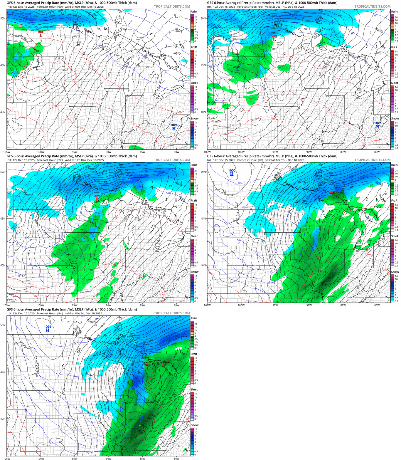
Early indications favor a couple of inches of snow in then north with little accumulation in the south.

Minnesota turns blustery and colder behind the system Thursday into Friday. At this point, the weekend looks quiet with highs in the 20s.
Early indications for Christmas week favor highs in the 20s and 30s. Right now, I don't see any big snowstorms on the map for Christmas week, but it’s still early.
Stay tuned.

