
Blizzard warning in NW Minnesota; winter weather advisories include Twin Cities
Thursday storm brings snow, high winds, flash freeze

Go Deeper.
Create an account or log in to save stories.
Like this?
Thanks for liking this story! We have added it to a list of your favorite stories.


Get ready for another wintry blast through Minnesota. A powerful storm Thursday will bring winds from 50 to as high as 70 mph across Minnesota.
The highest winds and blizzard conditions will be in the Red River Valley through northwestern Minnesota, where a few inches of snow and wind gusts to 70 mph will cause whiteout conditions.

The Red River Valley is one of the most extreme places on earth for blizzard intensity and frequency. Travel will be dangerous in that region Tuesday. Only emergency travel is advised. Here’s the National Weather Service bulletin:
Including the cities of Halstad, Drayton, Grand Forks, Mayville, Fargo, Cooperstown, Moorhead, Valley City, Fosston, Crookston, Hallock, Lankin, Middle River, Newfolden, Ada, Warren, Cavalier, Thief River Falls, Michigan, Hillsboro, East Grand Forks, Finley, Red Lake Falls, Grafton, and Roseau
111 PM CST Wed Dec 17 2025
...BLIZZARD WARNING REMAINS IN EFFECT FROM 3 AM TO 6 PM CST THURSDAY...
* WHAT...Blizzard conditions expected. Total snow accumulations between 1 and 4 inches and ice accumulations around a light glaze. Winds gusting up to 70 mph.
* WHERE...Portions of northwest and west central Minnesota and northeast and southeast North Dakota.
* WHEN...From 3 AM to 6 PM CST Thursday.
* IMPACTS...Whiteout conditions will make travel extremely dangerous or impossible. The hazardous conditions will impact the Thursday morning and evening commutes. Very strong winds will cause extensive tree damage.
PRECAUTIONARY/PREPAREDNESS ACTIONS... Travel should be restricted to emergencies only. If you must travel, have a winter survival kit with you. If you get stranded, stay with your vehicle. The latest road conditions for the state you are calling from can be obtained by calling 5 1 1.
The heaviest snowfall Thursday favors far northern Minnesota. Several inches of snow will accumulate with the highest totals near the Canadian border.
Turn Up Your Support
MPR News helps you turn down the noise and build shared understanding. Turn up your support for this public resource and keep trusted journalism accessible to all.

Winter weather advisories for light glaze ice and snow cover most of northeastern Minnesota. From the National Weather Service:
Northern Cook and Lake-Southern Cook- Including the cities of Isabella and Grand Marais
320 PM CST Wed Dec 17 2025
...WINTER WEATHER ADVISORY REMAINS IN EFFECT FROM MIDNIGHT TONIGHT TO 4 AM CST FRIDAY...
* WHAT...Mixed precipitation expected. Total snow accumulations between 2 and 6 inches and a light glaze of ice accumulations. Winds gusting as high as 55 mph.
* WHERE...North Lake and Cook Counties. This includes the Tribal Lands of the Grand Portage Reservation. This also includes the Boundary Waters eastern and central area.
* WHEN...From midnight tonight to 4 AM CST Friday.
* IMPACTS...Plan on slippery road conditions. The hazardous conditions could impact the Thursday morning and evening commutes. Strong winds could cause tree damage.
In the south, we’ll see less than an inch of snow in most areas. But high winds gusting to 50 mph will make travel difficult, especially Thursday afternoon and evening.

Winter weather advisories include the Interstate 94 corridor from Fergus Falls all the way through the Twin Cities.
URGENT - WINTER WEATHER MESSAGE National Weather Service Twin Cities/Chanhassen MN 216 PM CST Wed Dec 17 2025 ...GUSTY WINDS, BLOWNG SNOW, AND ICY FLASH FREEZE CONDITIONS TOMORROW... .Light snow, gusty northwest winds of 40 to 50 mph, & plummeting temperatures develop tomorrow behind an Arctic front. While snow accumulations will likely only be an inch or less, low visibility is expected as the gusty winds blow around the falling snow. Localized & brief bursts of heavier snow & whiteout conditions are also possible with sporadic snow squalls during the afternoon. Temperatures plummet behind the front into the single digits & below zero through the afternoon & evening. This may lead to flash freeze conditions, where any snow & residual moisture quickly freezes onto untreated roads & surfaces. these icy flash freeze conditions will be most impactful during the evening commute.
Including the cities of Blaine, Elk River, Mora, St Paul, Stillwater, Victoria, Little Falls, Center City, Sauk Rapids, Chanhassen, Shakopee, Hastings, Princeton, Minneapolis, Cambridge, Monticello, and Chaska
216 PM CST Wed Dec 17 2025
...WINTER WEATHER ADVISORY IN EFFECT FROM 9 AM TO 9 PM CST THURSDAY...
* WHAT...A combination of winds gusting 40 to 50 mph, low visibility in falling snow, and flash freeze conditions leading to icy roads and surfaces.
* WHERE...Benton, Morrison, Sherburne, Wright, Anoka, Carver, Chisago, Dakota, Hennepin, Isanti, Kanabec, Mille Lacs, Ramsey, Scott, and Washington Counties.
* WHEN...From 9 AM to 9 PM CST Thursday.
* IMPACTS...Plan on slippery road conditions. The hazardous conditions will impact the Thursday morning and evening commutes. Gusty winds could bring down tree branches.
Flash freeze
The onset of freezing temperatures will be sudden as winds shift into the northwest with this storm. Temperatures will quickly plunge Thursday into the single digits north and teens south. Any water standing around on roads and walkways will ice up quickly.

Wind and snow will make for a challenging rush hour Thursday afternoon. Forecast models suggest light snow chances again Friday and Sunday night.
Christmas week looks likely to bring another thaw.
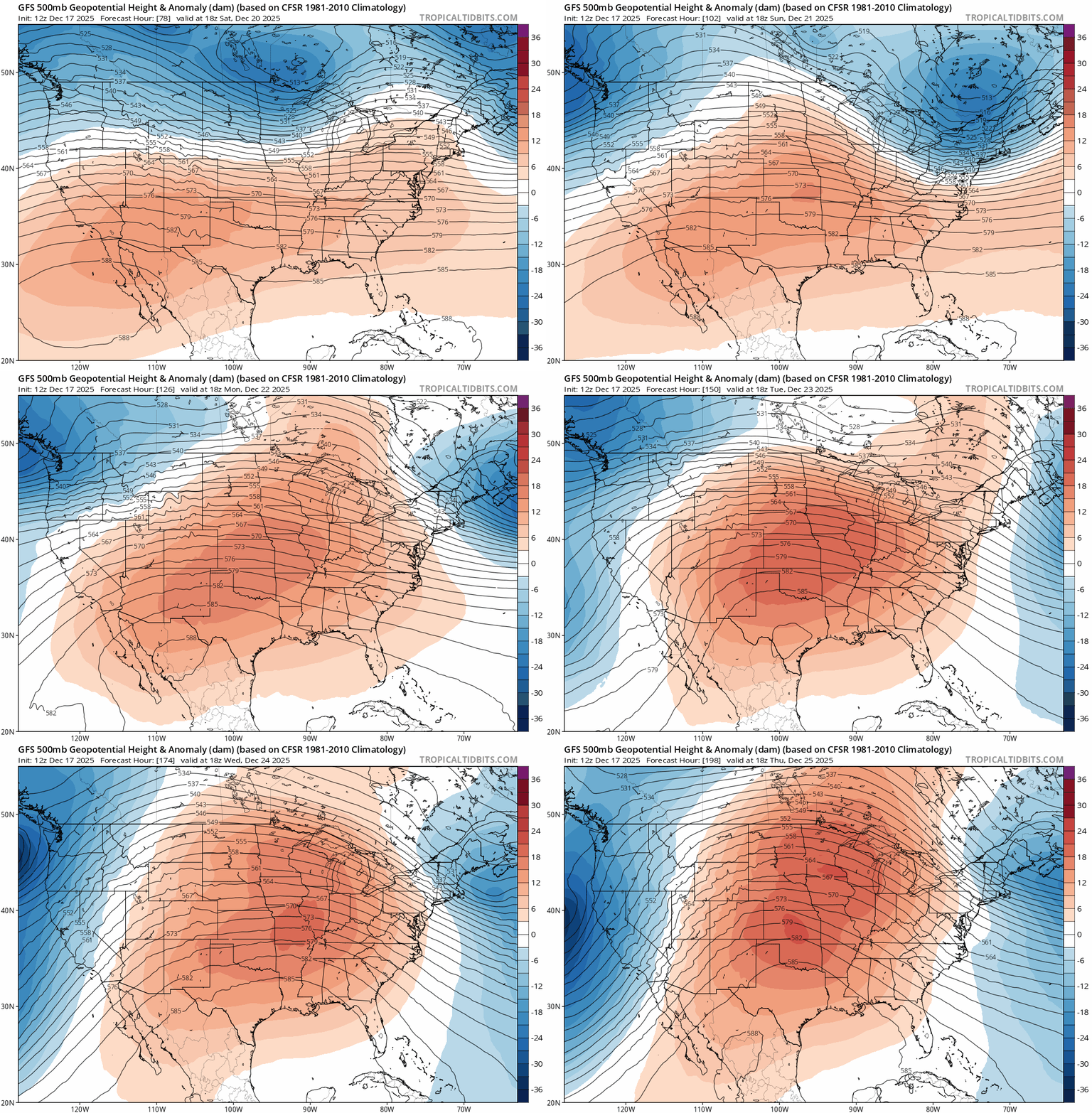
We may be melting more snow by Christmas Day 2025!
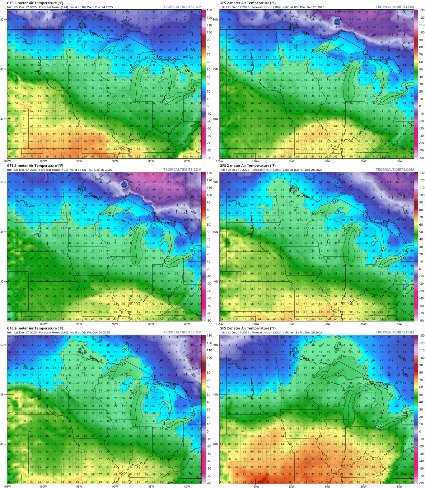
Stay tuned.

