
Blizzard fades overnight, wintry weekend ahead; 40 degrees possible by Christmas
Mild Christmas likely for much of Minnesota

Go Deeper.
Create an account or log in to save stories.
Like this?
Thanks for liking this story! We have added it to a list of your favorite stories.


A raging whiteout blizzard developed as forecast Thursday across much of western Minnesota. Sideways snow and 60 mph winds made travel near impassable on many highways.
Here are some National Weather Service reports:
1 S Hallock [Kittson Co, MN] AWOS reports Blizzard at 2:50 PM CST -- First reduction of a quarter mile or less in visibility occurred at 455a and persisted until 1235p with a peak gust of 51mph.
3 S Thief River Falls [Pennington Co, MN] AWOS reports Blizzard at 2:54 PM CST -- First visibility reduction of a quarter mile or less occurred at 855a and persisted until 145p with a peak wind gust up to 41mph.
3 S Brooks [Red Lake Co, MN] Mesonet reports Blizzard at 3:31 PM CST -- Blizzard conditions persisted from 850a until 1200p with a peak wind gust of 42mph.
Numerous roads are closed in northwestern Minnesota. Wind gusts over 60 mph are common at many locations.
Here are some more select wind gust reports as of late Thursday afternoon:
Turn Up Your Support
MPR News helps you turn down the noise and build shared understanding. Turn up your support for this public resource and keep trusted journalism accessible to all.
Herman, 64 mph
Morris, Redwood Falls, 61 mph
Willmar, 60 mph
Blizzard conditions shifted into southern Minnesota late Thursday. The National Oceanic and Atmospheric Administration’s Storm Prediction Center issued a special mesoscale statement for areas southwest of the Twin Cities.
Including the cities of Austin, Dodge Center, New Hampton,
Rochester, Charles City, Preston, Osage, Cresco, and Decorah
359 PM CST Thu Dec 18 2025
...BLIZZARD WARNING IN EFFECT UNTIL 9 PM CST THIS EVENING...
* WHAT...Whiteout conditions. Additional snow accumulations up to
one inch. Winds gusting as high as 50 mph.
* WHERE...Portions of north central and northeast Iowa and southeast
Minnesota.
* WHEN...Until 9 PM CST this evening.
* IMPACTS...Plan on hazardous road conditions. Gusty winds could
bring down tree branches.
Wintry weekend temperatures
Our flash freeze happened quickly Thursday as arctic air poured south. Temperatures will bottom out week below zero across most of Minnesota Friday morning.

Highs Friday and through the weekend will fall in the teens to 20s in most areas.

There are chances for light snow Friday night and again Sunday night.
Christmas week thaw?
Forecast models continue to show another surge of mild Pacific air pouring into Minnesota next week. On the map below, NOAA’s Global Forecast System and other models suggest highs on the 30s and even 40s in the south next week.
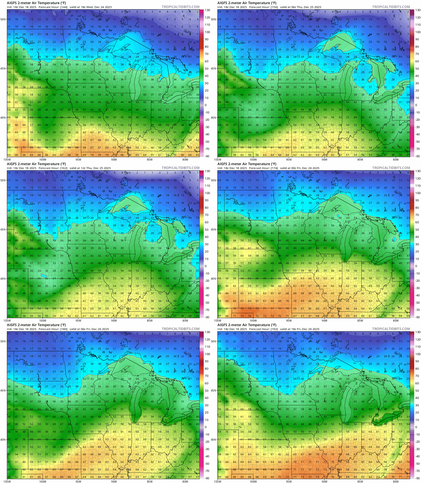
Right now, I still don’t see any big storms on the maps Christmas week so hoping travel will be good. These melty patterns can favor fog and hoarfrost late at night and early in the mornings.

It looks like a mild Christmas 2025 for much of Minnesota!
Stay tuned.

